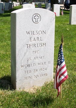
PFC Wilson Earl “Woodie” Thrush
| Birth | : | 28 Feb 1924 Hanna City, Peoria County, Illinois, USA |
| Death | : | 20 Jun 1985 Columbia, Boone County, Missouri, USA |
| Burial | : | Saint Marys Cemetery, Rose Bud, White County, USA |
| Coordinate | : | 35.3329710, -92.1074770 |
| Plot | : | F-0031 |
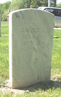
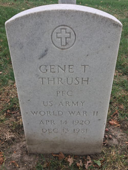
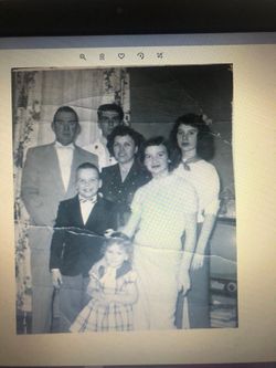
| Description | : | World War II Army Veteran. Son of Thomas and Mamie Bollinger Thrush. Survived by his wife, Roberta; and two sons: Ronald and Rick, both of Hamilton; the following stepchildren: Robert and Terry Stutes, both of Des Moines, Ia., Patricia Stutes of Keokuk, Ia., Stacy Stutes with the U.S. Navy, and Tracy Mibbs of the state of Virginia; six granddaughters and one grandson; five step-grandchildren; one sister: Almeda Horner of Keokuk and Gary Piction of Keokuk.; Preceded in death by two brothers. |
frequently asked questions (FAQ):
-
Where is PFC Wilson Earl “Woodie” Thrush's memorial?
PFC Wilson Earl “Woodie” Thrush's memorial is located at: Saint Marys Cemetery, Rose Bud, White County, USA.
-
When did PFC Wilson Earl “Woodie” Thrush death?
PFC Wilson Earl “Woodie” Thrush death on 20 Jun 1985 in Columbia, Boone County, Missouri, USA
-
Where are the coordinates of the PFC Wilson Earl “Woodie” Thrush's memorial?
Latitude: 35.3329710
Longitude: -92.1074770
Family Members:
Parent
Spouse
Siblings
Flowers:
Nearby Cemetories:
1. Saint Marys Cemetery
Rose Bud, White County, USA
Coordinate: 35.3329710, -92.1074770
2. Moon Cemetery
Rose Bud, White County, USA
Coordinate: 35.3408012, -92.1006012
3. Rose Bud Cemetery
Rose Bud, White County, USA
Coordinate: 35.3328018, -92.0922012
4. Bethesda Cemetery
Rose Bud, White County, USA
Coordinate: 35.3029000, -92.0957000
5. Martin Cemetery
Cleburne County, USA
Coordinate: 35.3642006, -92.0755997
6. Starkey Cemetery
White County, USA
Coordinate: 35.2817001, -92.0753021
7. Aldridge Cemetery
Cleburne County, USA
Coordinate: 35.3913994, -92.1303024
8. New Hart Cemetery
Rose Bud, White County, USA
Coordinate: 35.2951200, -92.0468300
9. Friendship South Cemetery
Hopewell, Cleburne County, USA
Coordinate: 35.3839920, -92.0622580
10. Old Hopewell Cemetery
Rose Bud, White County, USA
Coordinate: 35.3261900, -92.0296810
11. Center Point Baptist Church Cemetery
Quitman, Cleburne County, USA
Coordinate: 35.3733230, -92.1695470
12. Dupriest Cemetery
Rose Bud, White County, USA
Coordinate: 35.2628000, -92.1008000
13. Norman Cemetery
Joy, White County, USA
Coordinate: 35.3280200, -92.0076700
14. Mount Olive Bedford Chapel Cemetery
Rose Bud, White County, USA
Coordinate: 35.2516470, -92.0982170
15. Crossroads Cemetery
Hopewell, Cleburne County, USA
Coordinate: 35.4043500, -92.0476300
16. Mount Bethel Cemetery
Rose Bud, White County, USA
Coordinate: 35.3177440, -92.0018060
17. Mortar Creek Cemetery
Faulkner County, USA
Coordinate: 35.3474998, -92.2149963
18. Holleman Cemetery
Joy, White County, USA
Coordinate: 35.3265930, -91.9959230
19. Cleburne County Farm Cemetery
Heber Springs, Cleburne County, USA
Coordinate: 35.2728520, -92.0206640
20. Brown Cemetery
Enola, Faulkner County, USA
Coordinate: 35.2635994, -92.1996994
21. Quitman Cemetery
Quitman, Cleburne County, USA
Coordinate: 35.3860800, -92.2167900
22. Mount Vernon Cemetery
Mount Vernon, Faulkner County, USA
Coordinate: 35.2305984, -92.1299973
23. Romance Cemetery
Romance, White County, USA
Coordinate: 35.2400093, -92.0486069
24. Pearson Cemetery
Pearson, Cleburne County, USA
Coordinate: 35.4371986, -92.1241989

