Phillip Arthur Barr
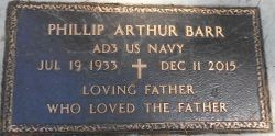
| Birth | : | 19 Jul 1933 Libby, Lincoln County, Montana, USA |
| Death | : | 11 Dec 2015 Libby, Lincoln County, Montana, USA |
| Burial | : | Milnor Lake Cemetery, Troy, Lincoln County, USA |
| Coordinate | : | 48.4181150, -115.8259500 |
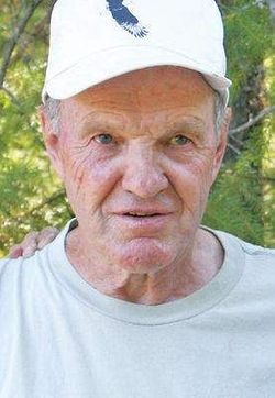
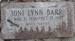
| Description | : | Phillip Barr December 15, 2015 at 6:01 am Phillip A. Barr 82, of Libby, went to be with the Lord Friday, Dec. 11, 2015. Phil was born July 19, 1933 to Arthur and Grace (Van Dyke) Barr in Libby. He graduated from Libby High School and enlisted in the Navy in 1951. Phil met and married Lucretia Kennedy in 1953. They had a son James and a daughter Joni. He later met Frances “Frankie” Bauer in Kalispell while working for Equity Supply delivering milk. They were married in August 1960. They had three sons, Bill, Doug... Read More |
frequently asked questions (FAQ):
-
Where is Phillip Arthur Barr's memorial?
Phillip Arthur Barr's memorial is located at: Milnor Lake Cemetery, Troy, Lincoln County, USA.
-
When did Phillip Arthur Barr death?
Phillip Arthur Barr death on 11 Dec 2015 in Libby, Lincoln County, Montana, USA
-
Where are the coordinates of the Phillip Arthur Barr's memorial?
Latitude: 48.4181150
Longitude: -115.8259500
Family Members:
Parent
Siblings
Children
Flowers:
Nearby Cemetories:
1. Milnor Lake Cemetery
Troy, Lincoln County, USA
Coordinate: 48.4181150, -115.8259500
2. Larchwood Cemetery
Lincoln County, USA
Coordinate: 48.4178009, -115.8257980
3. Troy Cemetery
Troy, Lincoln County, USA
Coordinate: 48.4752330, -115.8992710
4. Winn Family Cemetery
Lincoln County, USA
Coordinate: 48.5488590, -115.9644710
5. Bull Lake Guest Ranch Cemetery
Troy, Lincoln County, USA
Coordinate: 48.2424940, -115.8275090
6. Libby Cemetery
Libby, Lincoln County, USA
Coordinate: 48.3893540, -115.5646380
7. Leonia Cemetery
Leonia, Boundary County, USA
Coordinate: 48.6161720, -116.0497860
8. Boulder Creek Cemetery
Boundary County, USA
Coordinate: 48.6194000, -116.0571976
9. Sylvanite Cemetery
Lincoln County, USA
Coordinate: 48.7210000, -115.8745000
10. Clark Fork Cemetery
Clark Fork, Bonner County, USA
Coordinate: 48.1610000, -116.1690000
11. Cloudledge Cemetery
East Hope, Bonner County, USA
Coordinate: 48.2345670, -116.2772340
12. Hope Cemetery
East Hope, Bonner County, USA
Coordinate: 48.2449989, -116.2966995
13. Owen Family Cemetery
East Hope, Bonner County, USA
Coordinate: 48.2160100, -116.2790200
14. Old Hope Cemetery
Hope, Bonner County, USA
Coordinate: 48.2530500, -116.3157300
15. Heron Cemetery
Heron, Sanders County, USA
Coordinate: 48.0613000, -115.9621000
16. Cabinet Cemetery
Bonner County, USA
Coordinate: 48.0826000, -116.0681000
17. Parker Family Cemetery
Boundary County, USA
Coordinate: 48.6665200, -116.2619200
18. Paradise Valley Cemetery
Bonners Ferry, Boundary County, USA
Coordinate: 48.6453018, -116.3080978
19. Gold Creek Cemetery
Bonner County, USA
Coordinate: 48.4000015, -116.4160995
20. Holy Myrrhbearers Orthodox Church Parish Cemetery
Bonners Ferry, Boundary County, USA
Coordinate: 48.6190260, -116.3598830
21. Grandview Cemetery
Bonners Ferry, Boundary County, USA
Coordinate: 48.6851300, -116.2932700
22. Pack River Cemetery
Bonner County, USA
Coordinate: 48.3675620, -116.4404120
23. McArthur Cemetery
Boundary County, USA
Coordinate: 48.5246000, -116.4350000
24. Noxon Cemetery
Noxon, Sanders County, USA
Coordinate: 47.9908295, -115.7822189

