
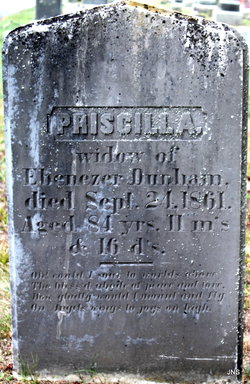
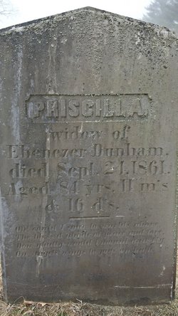

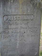
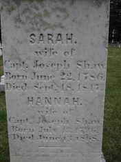
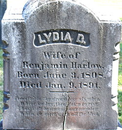
Priscilla Morton Dunham
| Birth | : | 1777 |
| Death | : | 24 Sep 1861 Carver, Plymouth County, Massachusetts, USA |
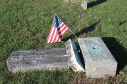
| Burial | : | Pine Level Cemetery, Pine Level, Coffee County, USA |
| Coordinate | : | 31.4727993, -86.1828003 |
| Plot | : | Section C Lot 14 |
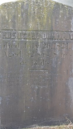
| Description | : | Priscilla married Ebenezer Dunham JR 26 Dec 1794 |
frequently asked questions (FAQ):
-
Where is Priscilla Morton Dunham's memorial?
Priscilla Morton Dunham's memorial is located at: Pine Level Cemetery, Pine Level, Coffee County, USA.
-
When did Priscilla Morton Dunham death?
Priscilla Morton Dunham death on 24 Sep 1861 in Carver, Plymouth County, Massachusetts, USA
-
Where are the coordinates of the Priscilla Morton Dunham's memorial?
Latitude: 31.4727993
Longitude: -86.1828003
Family Members:
Spouse
Children
Flowers:


Nearby Cemetories:
1. Pine Level Cemetery
Pine Level, Coffee County, USA
Coordinate: 31.4727993, -86.1828003
2. Liberty Cemetery
Coffee County, USA
Coordinate: 31.4300003, -86.1810989
3. Beaver Dam Cemetery
Elba, Coffee County, USA
Coordinate: 31.5025005, -86.1414032
4. Prescott Cemetery
Coffee County, USA
Coordinate: 31.4556007, -86.1306000
5. Mount Vernon Assembly of God Church Cemetery
Shady Grove, Coffee County, USA
Coordinate: 31.4998700, -86.1354680
6. Hudson Cemetery
Elba, Coffee County, USA
Coordinate: 31.4950008, -86.1316986
7. Driskell Family Cemetery
Coffee County, USA
Coordinate: 31.5182991, -86.1549988
8. Bethany Primitive Baptist Church Cemetery
Danleys Crossroads, Coffee County, USA
Coordinate: 31.4250100, -86.1509500
9. Danleys Cross Roads Cemetery
Danleys Crossroads, Coffee County, USA
Coordinate: 31.4200001, -86.1647034
10. Bethany Cemetery
Coffee County, USA
Coordinate: 31.4249992, -86.1502991
11. Brannen Cemetery
Elba, Coffee County, USA
Coordinate: 31.4808220, -86.1165800
12. Weed Baptist Church Cemetery
Weed Crossroad, Crenshaw County, USA
Coordinate: 31.5091991, -86.2358017
13. Mitchell Cemetery
Crenshaw County, USA
Coordinate: 31.4552994, -86.2481003
14. Taylor Hill Community Baptist Church Cemetery
Coffee County, USA
Coordinate: 31.4281006, -86.1343994
15. Old Union Primitive Baptist Cemetery
Weed Crossroad, Crenshaw County, USA
Coordinate: 31.5064700, -86.2434380
16. Oak Grove Cemetery
Coffee County, USA
Coordinate: 31.4106007, -86.1643982
17. Bethlehem Baptist Church Cemetery
Curtis, Coffee County, USA
Coordinate: 31.4062490, -86.1871430
18. Bethlehem Missionary Baptist Church Cemetery
Elba, Coffee County, USA
Coordinate: 31.4062270, -86.1870610
19. Taylor Cemetery
Coffee County, USA
Coordinate: 31.4316998, -86.1160965
20. Friendship United Methodist Church Cemetery
Opp, Covington County, USA
Coordinate: 31.4046993, -86.2055969
21. Bullock Community Cemetery
Bullock, Crenshaw County, USA
Coordinate: 31.5454070, -86.1787940
22. Shady Grove AME Church Cemetery
Coffee County, USA
Coordinate: 31.5067005, -86.1018982
23. Williams Cemetery
Covington County, USA
Coordinate: 31.5100689, -86.2715149
24. New Ebenezer Cemetery
Curtis, Coffee County, USA
Coordinate: 31.3894005, -86.1541977