
| Birth | : | 23 Jan 1910 Macon County, North Carolina, USA |
| Death | : | 26 May 2006 Macon County, North Carolina, USA |
| Burial | : | Charters Towers Monumental & Lawn Cemetery, Charters Towers, Charters Towers Region, Australia |
| Coordinate | : | -20.0441050, 146.2456630 |
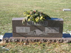
| Inscription | : | Beyond The Sunset |
| Description | : | Queenie Ledford Shope, 96, of Franklin, passed away on Friday, May 26, 2006. A native of Macon County, she was the daughter of the late Miller Ledford and Lula Stanfield Ledford. She was preceded in death by her husband, Prioleau Shope, who died in 1989; a son, Billy Shope, who died in 1997; three infant children; three brothers, Ellsworth, Lake and Claude; and three sisters, Edna McConnell, Vernie Sanders and Lillian Cowart. She was a faithful member of Prentiss Baptist Church. She is survived by five children, Don Shope of Hixson, Tenn., Charles Robert Shope, Wayne Shope and Betty Dalton, all of Franklin,... Read More |
frequently asked questions (FAQ):
-
Where is Queenie Elizabeth Ledford Shope's memorial?
Queenie Elizabeth Ledford Shope's memorial is located at: Charters Towers Monumental & Lawn Cemetery, Charters Towers, Charters Towers Region, Australia.
-
When did Queenie Elizabeth Ledford Shope death?
Queenie Elizabeth Ledford Shope death on 26 May 2006 in Macon County, North Carolina, USA
-
Where are the coordinates of the Queenie Elizabeth Ledford Shope's memorial?
Latitude: -20.0441050
Longitude: 146.2456630
Family Members:
Parent

Spouse
Siblings
Children
Flowers:


Nearby Cemetories:
1. Charters Towers Monumental & Lawn Cemetery
Charters Towers, Charters Towers Region, Australia
Coordinate: -20.0441050, 146.2456630
2. Charters Towers Pioneer Cemetery
Charters Towers, Charters Towers Region, Australia
Coordinate: -20.0855180, 146.2695370
3. Sellheim Cemetery
Sellheim, Charters Towers Region, Australia
Coordinate: -20.0096093, 146.4013893
4. Macrossan Cemetery
Macrossan, Charters Towers Region, Australia
Coordinate: -20.0021640, 146.4439990
5. Ravenswood Cemetery
Ravenswood, Charters Towers Region, Australia
Coordinate: -20.1116040, 146.8872210
6. Manton Cemetery
Manton, Townsville City, Australia
Coordinate: -19.6511300, 146.8335700
7. Range Hotel
Townsville City, Australia
Coordinate: -19.3514510, 146.4871560
8. Stewart's Creek Penal Establishment Cemetery
Stuart, Townsville City, Australia
Coordinate: -19.3524684, 146.8498339
9. Woongarra Crematorium
Townsville, Townsville City, Australia
Coordinate: -19.3580935, 146.8756311
10. Giru-Woodstock Road Homestead Cemetery
Giru, Burdekin Shire, Australia
Coordinate: -19.5477500, 147.0598300
11. Pentland Cemetery
Pentland, Charters Towers Region, Australia
Coordinate: -20.5237240, 145.3916070
12. West End Cemetery
West End, Townsville City, Australia
Coordinate: -19.2657130, 146.8011430
13. Belgian Gardens Cemetery
Belgian Gardens, Townsville City, Australia
Coordinate: -19.2431100, 146.7826400
14. Sacred Heart Cathedral
Townsville, Townsville City, Australia
Coordinate: -19.2589000, 146.8118000
15. North Queensland Garden of Remembrance
Townsville, Townsville City, Australia
Coordinate: -19.2554030, 146.8240260
16. West Point Cemetery
Magnetic Island, Townsville City, Australia
Coordinate: -19.1334561, 146.7864305
17. Magnetic Island Memorial Gardens
Townsville, Townsville City, Australia
Coordinate: -19.1562722, 146.8551167
18. Florence Bay Scout Chapel Cemetery
Magnetic Island, Townsville City, Australia
Coordinate: -19.1239643, 146.8765564
19. St Helens Anglican Church Columbarium Wall
Home Hill, Burdekin Shire, Australia
Coordinate: -19.6572720, 147.4130880
20. Home Hill General Cemetery
Home Hill, Burdekin Shire, Australia
Coordinate: -19.6630800, 147.4259200
21. Ayr Cemetery
Ayr, Burdekin Shire, Australia
Coordinate: -19.5641000, 147.3909940
22. Palm Island
Palm Island, Palm Island Shire, Australia
Coordinate: -18.7354000, 146.5778575
23. Torrens Creek Cemetery
Torrens Creek, Flinders Shire, Australia
Coordinate: -20.7641800, 145.0247870
24. New Ingham Cemetery
Ingham, Hinchinbrook Shire, Australia
Coordinate: -18.6707560, 146.1927830