
| Birth | : | 23 Feb 1816 |
| Death | : | 9 Jun 1894 Clay County, Nebraska, USA |
| Burial | : | Fairfield Cemetery, Fairfield, Clay County, USA |
| Coordinate | : | 40.4094009, -98.0982971 |
| Inscription | : | Rachel A. Flowers died June 9, 1894 78 years 3 mos 14 days |
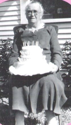
| Description | : | Rachel Amanda Bower Flower married Samuel H. Bower on October 2,1849. Rachel had 3 daughter's by Samuel H. Bower, Sarah E. who is listed as 4 months old in the 1850 census but must have died before 1851 as that census doesn't include her just Julia Minerva born in March 25,1851 even though her FAG memorial #12916933 and tombstone say 1852 all of the census documents say 1851. I am sure 1851 is correct because my great Grandmother was her sister and was born in May of 1852 and they weren't twins, my great Grandmother's was name Alice... Read More |
frequently asked questions (FAQ):
-
Where is Rachel Amanda Pumphrey Bower Flower's memorial?
Rachel Amanda Pumphrey Bower Flower's memorial is located at: Fairfield Cemetery, Fairfield, Clay County, USA.
-
When did Rachel Amanda Pumphrey Bower Flower death?
Rachel Amanda Pumphrey Bower Flower death on 9 Jun 1894 in Clay County, Nebraska, USA
-
Where are the coordinates of the Rachel Amanda Pumphrey Bower Flower's memorial?
Latitude: 40.4094009
Longitude: -98.0982971
Family Members:
Parent

Siblings
Children
Flowers:


Nearby Cemetories:
1. Fairfield Cemetery
Fairfield, Clay County, USA
Coordinate: 40.4094009, -98.0982971
2. Saint Aloysius Cemetery
Deweese, Clay County, USA
Coordinate: 40.3932991, -98.1278000
3. Assumption Church Cemetery
Deweese, Clay County, USA
Coordinate: 40.3507000, -98.1324000
4. Saint Martin-Loucky Cemetery
Deweese, Clay County, USA
Coordinate: 40.3652496, -98.1948624
5. Hannum Graves
Lawrence, Nuckolls County, USA
Coordinate: 40.3456500, -98.1766800
6. Anandale Cemetery
Glenvil, Clay County, USA
Coordinate: 40.4661900, -98.1935300
7. Union Cemetery
Nuckolls County, USA
Coordinate: 40.3146706, -98.1236877
8. Smith Cemetery
Nelson, Nuckolls County, USA
Coordinate: 40.3078003, -98.0567017
9. Eller Cemetery
Clay Center, Clay County, USA
Coordinate: 40.4956700, -98.0145700
10. Liberty Creek Cemetery
Nuckolls County, USA
Coordinate: 40.3361015, -98.2035980
11. Edgar Cemetery
Edgar, Clay County, USA
Coordinate: 40.3587200, -97.9700200
12. Spring Ranch Cemetery
Clay County, USA
Coordinate: 40.4065100, -98.2484100
13. Clay Center Cemetery
Clay Center, Clay County, USA
Coordinate: 40.5325012, -98.0500031
14. Marshall Union Evergreen Cemetery
Clay Center, Clay County, USA
Coordinate: 40.4880300, -97.9573000
15. Zion Cemetery
Clay County, USA
Coordinate: 40.5382996, -98.1643982
16. Prairieview Cemetery
Ong, Clay County, USA
Coordinate: 40.4235100, -97.9093400
17. Glenville Union Cemetery
Glenvil, Clay County, USA
Coordinate: 40.5308980, -98.2052220
18. Sacred Heart Cemetery
Lawrence, Nuckolls County, USA
Coordinate: 40.2921982, -98.2268982
19. Glenvil Cemetery
Glenvil, Clay County, USA
Coordinate: 40.5088400, -98.2604700
20. Oxbow Cemetery
Nelson, Nuckolls County, USA
Coordinate: 40.2560997, -98.0280991
21. Chapel Grove Cemetery
Clay County, USA
Coordinate: 40.4660988, -97.8816986
22. Saint Pauls Lutheran Cemetery
Adams County, USA
Coordinate: 40.5104530, -98.2872960
23. Phil R Landon Gravesite
Angus, Nuckolls County, USA
Coordinate: 40.2703200, -97.9553200
24. Evergreen Cemetery
Lawrence, Nuckolls County, USA
Coordinate: 40.2922401, -98.2723236