
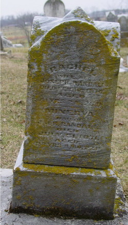
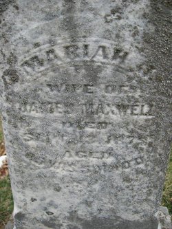
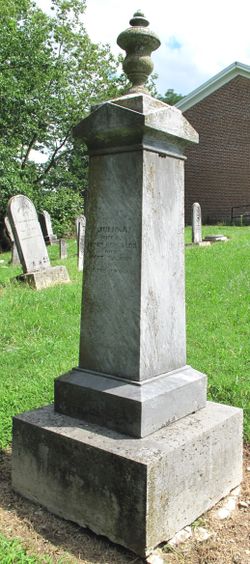
Rachel McKinney Randall
| Birth | : | 1828 Ohio, USA |
| Death | : | 15 Feb 1870 Greene County, Ohio, USA |
| Burial | : | Fort Steele Cemetery, Fort Steele, East Kootenay Regional District, Canada |
| Coordinate | : | 49.6260109, -115.6225662 |
| Inscription | : | aged 41y |
| Description | : | "Ohio, Deaths and Burials, 1854-1997": Rachel Randell, d 15 Feb 1870 Cedarville, Greene Co, OH, age 42, bd 1828, white, married. Wife of Joseph Randall, married 12 Mar 1845 Clark Co, OH. |
frequently asked questions (FAQ):
-
Where is Rachel McKinney Randall's memorial?
Rachel McKinney Randall's memorial is located at: Fort Steele Cemetery, Fort Steele, East Kootenay Regional District, Canada.
-
When did Rachel McKinney Randall death?
Rachel McKinney Randall death on 15 Feb 1870 in Greene County, Ohio, USA
-
Where are the coordinates of the Rachel McKinney Randall's memorial?
Latitude: 49.6260109
Longitude: -115.6225662
Family Members:
Parent

Siblings
Children

Flowers:


Nearby Cemetories:
1. Fort Steele Cemetery
Fort Steele, East Kootenay Regional District, Canada
Coordinate: 49.6260109, -115.6225662
2. Aqam Cemetery
Cranbrook, East Kootenay Regional District, Canada
Coordinate: 49.5833840, -115.7574800
3. Cranbrook Catholic Cemetery
Cranbrook, East Kootenay Regional District, Canada
Coordinate: 49.5114080, -115.7813930
4. Cranbrook Old General Cemetery
Cranbrook, East Kootenay Regional District, Canada
Coordinate: 49.5116630, -115.7826420
5. Westlawn Cemetery
Cranbrook, East Kootenay Regional District, Canada
Coordinate: 49.5112220, -115.7821910
6. Cranbrook New General Cemetery
Cranbrook, East Kootenay Regional District, Canada
Coordinate: 49.5118890, -115.7837250
7. Marysville Cemetery
Marysville, East Kootenay Regional District, Canada
Coordinate: 49.6386900, -115.9513300
8. Kimberley Cemetery
Kimberley, East Kootenay Regional District, Canada
Coordinate: 49.6766700, -115.9746000
9. Sand Creek Cemetery
Jaffray, East Kootenay Regional District, Canada
Coordinate: 49.3362250, -115.2909390
10. Moyie Cemetery
Moyie, East Kootenay Regional District, Canada
Coordinate: 49.2743920, -115.8350350
11. Fernie Cemetery
Fernie, East Kootenay Regional District, Canada
Coordinate: 49.5002240, -115.0579050
12. East Fernie Cemetery
Fernie, East Kootenay Regional District, Canada
Coordinate: 49.5018590, -115.0566640
13. Saint Margaret's Cemetery
Fernie, East Kootenay Regional District, Canada
Coordinate: 49.4989900, -115.0550900
14. Hosmer Cemetery
Hosmer, East Kootenay Regional District, Canada
Coordinate: 49.5863580, -114.9565980
15. Elko Cemetery
Elko, East Kootenay Regional District, Canada
Coordinate: 49.2978200, -115.1353500
16. Baynes Lake Cemetery
Baynes Lake, East Kootenay Regional District, Canada
Coordinate: 49.2369900, -115.2106000
17. Morrissey Cemetery
Morrissey, East Kootenay Regional District, Canada
Coordinate: 49.3751030, -114.9941990
18. Hannah Robinson Gravesite
Morrissey, East Kootenay Regional District, Canada
Coordinate: 49.3725000, -114.9913800
19. Rivercrest Cemetery
Sparwood, East Kootenay Regional District, Canada
Coordinate: 49.7617300, -114.8862200
20. Elk Valley Cemetery
Sparwood, East Kootenay Regional District, Canada
Coordinate: 49.7403800, -114.8685100
21. Canal Flats Cemetery
Canal Flats, East Kootenay Regional District, Canada
Coordinate: 50.1617820, -115.8049420
22. Yahk Cemetery
Yahk, Central Kootenay Regional District, Canada
Coordinate: 49.0885510, -116.0776230
23. Corbin Cemetery
Corbin, East Kootenay Regional District, Canada
Coordinate: 49.5217700, -114.6785500
24. Mountview Cemetery
Elkford, East Kootenay Regional District, Canada
Coordinate: 50.0583600, -114.9222300