
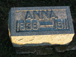
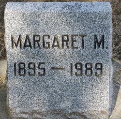
| Birth | : | 4 Feb 1862 Fountain County, Indiana, USA |
| Death | : | 14 Nov 1938 Spokane, Spokane County, Washington, USA |
| Burial | : | Greenwood Memorial Terrace, Spokane, Spokane County, USA |
| Coordinate | : | 47.6568985, -117.4708023 |
| Plot | : | Lawn 10, lot10, SH, space N3 |
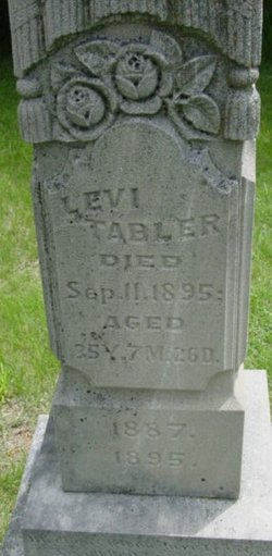
| Description | : | Rachel was the 5th child born to Abraham & Annie (Lee) Tabler. Her father was an "eclectic" physician according to the 1860 census. The family traveled around northern Indiana until he enlisted in the Civil War soon after her birth. Abraham was killed in the battle of Chickamauga (GA) 2 September 1863. Another girl was born into the family in 1865. Then the family moved to Clarke County, Iowa where Rachel's maternal grandparents lived. Her mother remarried in 1870 and 4 more girls were born. Rachel married John F. Blake 29 September 1881 and they lived in Wapello... Read More |
frequently asked questions (FAQ):
-
Where is Rachel Tabler Blake's memorial?
Rachel Tabler Blake's memorial is located at: Greenwood Memorial Terrace, Spokane, Spokane County, USA.
-
When did Rachel Tabler Blake death?
Rachel Tabler Blake death on 14 Nov 1938 in Spokane, Spokane County, Washington, USA
-
Where are the coordinates of the Rachel Tabler Blake's memorial?
Latitude: 47.6568985
Longitude: -117.4708023
Family Members:
Parent
Spouse

Siblings
Children
Flowers:


Nearby Cemetories:
1. Greenwood Memorial Terrace
Spokane, Spokane County, USA
Coordinate: 47.6568985, -117.4708023
2. Mount Nebo Cemetery
Spokane, Spokane County, USA
Coordinate: 47.6624985, -117.4689026
3. Riverside Memorial Park
Spokane, Spokane County, USA
Coordinate: 47.6599998, -117.4606018
4. Fort George Wright Cemetery
Spokane, Spokane County, USA
Coordinate: 47.6821290, -117.4802020
5. Saint John The Evangelist Columbarium
Spokane, Spokane County, USA
Coordinate: 47.6450000, -117.4105000
6. Fairmount Memorial Park
Spokane, Spokane County, USA
Coordinate: 47.7075005, -117.4869003
7. Spokane Memorial Gardens
Spokane, Spokane County, USA
Coordinate: 47.5988998, -117.4393997
8. Saint Davids Episcopal Church Columbarium
Spokane, Spokane County, USA
Coordinate: 47.7244630, -117.4224170
9. Holy Cross Cemetery
Spokane, Spokane County, USA
Coordinate: 47.7242012, -117.4160995
10. Saint Stephens Episcopal Church Columbarium
Spokane, Spokane County, USA
Coordinate: 47.6017230, -117.3911700
11. Moran Cemetery
Spokane, Spokane County, USA
Coordinate: 47.5957985, -117.3685989
12. Marshall Cemetery
Spokane, Spokane County, USA
Coordinate: 47.5724983, -117.5302963
13. Woodlawn Cemetery
Spokane, Spokane County, USA
Coordinate: 47.6492004, -117.3135986
14. Queen of Peace Cemetery
Spokane, Spokane County, USA
Coordinate: 47.5893200, -117.3409370
15. Resthaven Cemetery
Mead, Spokane County, USA
Coordinate: 47.7483300, -117.3611100
16. Holy Rosary Cemetery
Spokane, Spokane County, USA
Coordinate: 47.7360039, -117.3408051
17. Jesuit Cemetery of the Oregon Province
Spokane, Spokane County, USA
Coordinate: 47.7364006, -117.3394012
18. Evergreen Cemetery
Mead, Spokane County, USA
Coordinate: 47.7505989, -117.3606033
19. Saint Michael Mission Cemetery
Spokane County, USA
Coordinate: 47.7308300, -117.3258400
20. Orchard Prairie Cemetery
Hillyard, Spokane County, USA
Coordinate: 47.7392700, -117.3261700
21. Dartford Cemetery
Dartford, Spokane County, USA
Coordinate: 47.7842178, -117.4206238
22. Saint John Vianney Catholic Church Columbarium
Spokane, Spokane County, USA
Coordinate: 47.6619000, -117.2715000
23. Finlay Burial Site
Spokane, Spokane County, USA
Coordinate: 47.7845000, -117.5353500
24. Pleasant Prairie Cemetery
Spokane, Spokane County, USA
Coordinate: 47.7305984, -117.2752991