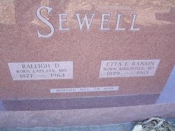
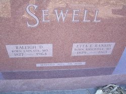
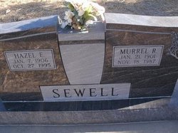
Raleigh Dell Sewell
| Birth | : | 18 Nov 1877 Missouri, USA |
| Death | : | 25 May 1964 Dresden, Decatur County, Kansas, USA |
| Burial | : | Cottonwood Cemetery, Whiteside County, USA |
| Coordinate | : | 41.8532982, -90.0643997 |
| Plot | : | Block 1 Lot 52 |
frequently asked questions (FAQ):
-
Where is Raleigh Dell Sewell's memorial?
Raleigh Dell Sewell's memorial is located at: Cottonwood Cemetery, Whiteside County, USA.
-
When did Raleigh Dell Sewell death?
Raleigh Dell Sewell death on 25 May 1964 in Dresden, Decatur County, Kansas, USA
-
Where are the coordinates of the Raleigh Dell Sewell's memorial?
Latitude: 41.8532982
Longitude: -90.0643997
Family Members:
Flowers:
Nearby Cemetories:
1. Cottonwood Cemetery
Whiteside County, USA
Coordinate: 41.8532982, -90.0643997
2. Baker Cemetery
Whiteside County, USA
Coordinate: 41.8883018, -90.0828018
3. Hollinshead Cemetery
Ustick, Whiteside County, USA
Coordinate: 41.9053001, -90.0689011
4. Spring Valley Methodist Cemetery
Fulton, Whiteside County, USA
Coordinate: 41.9055755, -90.0365056
5. Union Grove Cemetery
Whiteside County, USA
Coordinate: 41.8260994, -89.9978027
6. Morrison Mennonite Cemetery
Morrison, Whiteside County, USA
Coordinate: 41.8650510, -89.9881850
7. Spring Valley Presbyterian Cemetery
Ustick, Whiteside County, USA
Coordinate: 41.9023650, -90.0167050
8. Garden Plain Cemetery
Garden Plain, Whiteside County, USA
Coordinate: 41.8014070, -90.1204100
9. Fulton Township Cemetery
Fulton, Whiteside County, USA
Coordinate: 41.8725014, -90.1603012
10. Calvary Cemetery
Fulton, Whiteside County, USA
Coordinate: 41.8758011, -90.1641998
11. Clyde Cemetery
Whiteside County, USA
Coordinate: 41.8772011, -89.9543991
12. Grove Hill Cemetery
Morrison, Whiteside County, USA
Coordinate: 41.8153114, -89.9617767
13. Church of Saint Anne Memorial Garden
Morrison, Whiteside County, USA
Coordinate: 41.8102610, -89.9649340
14. North Clyde Methodist Cemetery
Whiteside County, USA
Coordinate: 41.9162760, -89.9675410
15. Calvary Cemetery
Clinton, Clinton County, USA
Coordinate: 41.8944016, -90.1808014
16. Oakland Cemetery
Clinton, Clinton County, USA
Coordinate: 41.8964005, -90.1800003
17. Mount Saint Clare Cemetery
Clinton County, USA
Coordinate: 41.8514179, -90.1973494
18. Saint Boniface Cemetery
Clinton, Clinton County, USA
Coordinate: 41.8960991, -90.1844025
19. Heaton Cemetery
Morrison, Whiteside County, USA
Coordinate: 41.8372002, -89.9306030
20. Lower York Cemetery
Thomson, Carroll County, USA
Coordinate: 41.9588890, -90.0555573
21. Springdale Cemetery
Clinton, Clinton County, USA
Coordinate: 41.8530998, -90.2067032
22. Minta Cemetery
Garden Plain, Whiteside County, USA
Coordinate: 41.7639008, -90.1502991
23. Hess Cemetery
Clinton County, USA
Coordinate: 41.8586006, -90.2225037
24. Pine Grove Cemetery
Clinton, Clinton County, USA
Coordinate: 41.8442001, -90.2253036


