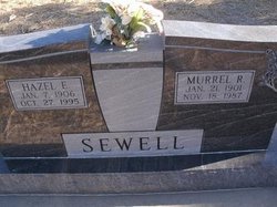
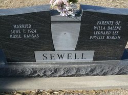
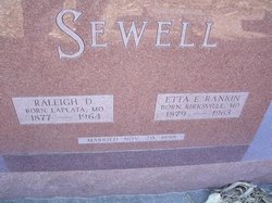
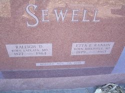
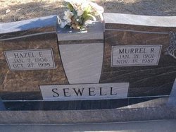
Murrel Rankin Sewell
| Birth | : | 21 Jan 1901 Green Castle, Sullivan County, Missouri, USA |
| Death | : | 18 Nov 1987 Dresden, Decatur County, Kansas, USA |
| Burial | : | Lanark City Cemetery, Lanark, Carroll County, USA |
| Coordinate | : | 42.0966682, -89.8261108 |
| Plot | : | Block 1 Lot 52 |
frequently asked questions (FAQ):
-
Where is Murrel Rankin Sewell's memorial?
Murrel Rankin Sewell's memorial is located at: Lanark City Cemetery, Lanark, Carroll County, USA.
-
When did Murrel Rankin Sewell death?
Murrel Rankin Sewell death on 18 Nov 1987 in Dresden, Decatur County, Kansas, USA
-
Where are the coordinates of the Murrel Rankin Sewell's memorial?
Latitude: 42.0966682
Longitude: -89.8261108
Family Members:
Parent
Spouse
Flowers:
Nearby Cemetories:
1. Lanark City Cemetery
Lanark, Carroll County, USA
Coordinate: 42.0966682, -89.8261108
2. Cherry Grove Brethren Cemetery
Lanark, Carroll County, USA
Coordinate: 42.1450005, -89.8261108
3. Wolfe Cemetery
Georgetown, Carroll County, USA
Coordinate: 42.1357994, -89.8711014
4. Shannon Brethren Cemetery
Shannon, Carroll County, USA
Coordinate: 42.1458282, -89.7433319
5. Saint Wendelin Cemetery
Shannon, Carroll County, USA
Coordinate: 42.1549988, -89.7506027
6. Schriner Cemetery
Lanark, Carroll County, USA
Coordinate: 42.0374985, -89.7427826
7. Oakville Cemetery
Mount Carroll, Carroll County, USA
Coordinate: 42.0501862, -89.9262314
8. Spring Valley Cemetery
Carroll County, USA
Coordinate: 42.1850014, -89.8099976
9. Chadwick Cemetery
Chadwick, Carroll County, USA
Coordinate: 42.0097198, -89.8680573
10. Arnolds Grove Cemetery
Carroll County, USA
Coordinate: 42.1283302, -89.9436111
11. Arnolds Grove Dunkard Cemetery
Mount Carroll, Carroll County, USA
Coordinate: 42.1338610, -89.9436900
12. Shelly Cemetery
Shannon, Carroll County, USA
Coordinate: 42.1553001, -89.7164001
13. Chambers Grove Cemetery
Forreston, Ogle County, USA
Coordinate: 42.0899811, -89.6841812
14. Hope Brethren Cemetery
Chadwick, Carroll County, USA
Coordinate: 42.0116855, -89.9176153
15. Trinity Lutheran Church Cemetery
Mount Carroll, Carroll County, USA
Coordinate: 42.0505600, -89.9588928
16. Union Cemetery
Milledgeville, Carroll County, USA
Coordinate: 42.0019417, -89.7533264
17. Brookville Lutheran Cemetery
Carroll County, USA
Coordinate: 42.0550003, -89.6872177
18. Renner Family Cemetery
Carroll County, USA
Coordinate: 42.1891708, -89.9102783
19. Daggert Cemetery
Mount Carroll, Carroll County, USA
Coordinate: 42.0377808, -89.9583282
20. Black Oak Cemetery
Chadwick, Carroll County, USA
Coordinate: 42.0122185, -89.9372177
21. Oak Hill Cemetery
Mount Carroll, Carroll County, USA
Coordinate: 42.1033287, -89.9861069
22. Carroll County Farm Cemetery
Mount Carroll, Carroll County, USA
Coordinate: 42.0722050, -89.9848680
23. Brookville United Methodist Cemetery
Brookville, Ogle County, USA
Coordinate: 42.0455589, -89.6761322
24. Dutchtown Church of the Brethren Cemetery
Milledgeville, Carroll County, USA
Coordinate: 41.9741130, -89.8174290

