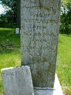
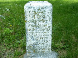
| Birth | : | 11 Feb 1875 Audubon County, Iowa, USA |
| Death | : | 20 May 1920 Chicago, Cook County, Illinois, USA |
| Burial | : | Holy Trinity Anglican Cemetery, Cressy, Northern Midlands Council, Australia |
| Coordinate | : | -41.6896474, 147.0786681 |
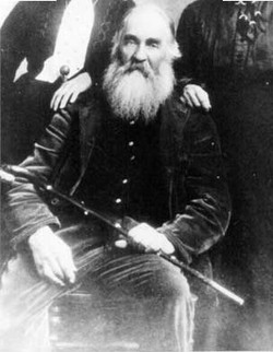
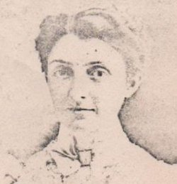
| Description | : | Audubon County Journal (IA) May 27, 1920 page 1 DIED SUDDENLY OF HEART TROUBLE Ralph Akers was born February 11, 1875, near Brayton where he lived the greater part of his life, until last year when he moved to Exira. He had been ailing for sometime which resulted in his sudden death which was pronounced heart failure, in the Union Depot at Chicago, Thursday, May 20th. He was forty-five years, four months and nine days of age at the time of his death. He was united in marriage to Miss Ethel Parrott, December 23, 1895. To this union eight children... Read More |
frequently asked questions (FAQ):
-
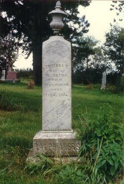
Where is Ralph Akers Jr.'s memorial?
Ralph Akers Jr.'s memorial is located at: Holy Trinity Anglican Cemetery, Cressy, Northern Midlands Council, Australia.
-
When did Ralph Akers Jr. death?
Ralph Akers Jr. death on 20 May 1920 in Chicago, Cook County, Illinois, USA
-
Where are the coordinates of the Ralph Akers Jr.'s memorial?
Latitude: -41.6896474
Longitude: 147.0786681
Family Members:
Parent
Spouse
Siblings
Children
Nearby Cemetories:
1. Holy Trinity Anglican Cemetery
Cressy, Northern Midlands Council, Australia
Coordinate: -41.6896474, 147.0786681
2. Cressy Methodist Cemetery
Cressy, Northern Midlands Council, Australia
Coordinate: -41.6893220, 147.0779440
3. Longford General Cemetery
Longford, Northern Midlands Council, Australia
Coordinate: -41.6223790, 147.1055480
4. Longford Uniting Church Cemetery
Longford, Northern Midlands Council, Australia
Coordinate: -41.6096150, 147.1162410
5. Holy Nativity Anglican Cemetery
Bishopsbourne, Northern Midlands Council, Australia
Coordinate: -41.6173490, 146.9869290
6. St Augustine Catholic Church Cemetery
Longford, Northern Midlands Council, Australia
Coordinate: -41.5932650, 147.1140900
7. Longford Christ Church Pioneer Cemetery
Longford, Northern Midlands Council, Australia
Coordinate: -41.5943270, 147.1194860
8. Bracknell Presbyterian Cemetery
Bracknell, Meander Valley Council, Australia
Coordinate: -41.6518889, 146.9420278
9. Bracknell General Cemetery
Bracknell, Meander Valley Council, Australia
Coordinate: -41.6436630, 146.9398520
10. Perth General Cemetery
Perth, Northern Midlands Council, Australia
Coordinate: -41.5775800, 147.1612200
11. St. Andrew's Anglican Cemetery
Perth, Northern Midlands Council, Australia
Coordinate: -41.5727500, 147.1777170
12. Illawarra Christ Church Cemetery
Carrick, Meander Valley Council, Australia
Coordinate: -41.5502380, 147.0651810
13. Mountain Vale Methodist Cemetery
Liffey, Northern Midlands Council, Australia
Coordinate: -41.6728910, 146.8919670
14. Blackwood Creek Community Church Cemetery
Blackwood Creek, Northern Midlands Council, Australia
Coordinate: -41.7400164, 146.8934466
15. Whitemore Methodist-Uniting Cemetery
Whitemore, Meander Valley Council, Australia
Coordinate: -41.5810490, 146.9325240
16. Carrick Anglican Churchyard
Carrick, Meander Valley Council, Australia
Coordinate: -41.5306800, 147.0075400
17. St. Andrew's Uniting Church Cemetery
Evandale, Northern Midlands Council, Australia
Coordinate: -41.5713670, 147.2452090
18. Saint Andrews Anglican Cemetery
Evandale, Northern Midlands Council, Australia
Coordinate: -41.5694500, 147.2478100
19. Evandale Rose Garden
Evandale, Northern Midlands Council, Australia
Coordinate: -41.5698800, 147.2489770
20. Evandale Catholic Cemetery
Evandale, Northern Midlands Council, Australia
Coordinate: -41.5685580, 147.2530820
21. Church Of The Good Shepherd
Hadspen, Meander Valley Council, Australia
Coordinate: -41.5076150, 147.0618590
22. Hadspen Uniting Church Cemetery
Hadspen, Meander Valley Council, Australia
Coordinate: -41.5064200, 147.0637300
23. St. Peter's Anglican Church and Cemetery
Nile, Northern Midlands Council, Australia
Coordinate: -41.6462800, 147.3314240
24. St. Mary's Anglican Church Cemetery
Hagley, Meander Valley Council, Australia
Coordinate: -41.5217840, 146.9104460

