

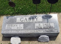
Ralph Dale Gabby
| Birth | : | 29 Jul 1906 Osage, Mitchell County, Iowa, USA |
| Death | : | 2 Feb 1984 Osage, Mitchell County, Iowa, USA |
| Burial | : | Sacred Heart Cemetery, Osage, Mitchell County, USA |
| Coordinate | : | 43.2742004, -92.7917023 |
| Description | : | Dale Gabby Funeral services for Dale Gabby, 77, of Osage were held at 10:30 a.m. Friday, February 10, 1984 at Sacred Heart Catholic Church in Osage. He died Tuesday, February 7 at the Mitchell County Memorial Hospital. The Reverend Jacob Roth officiated at the service with burial in the Sacred Heart Cemetery where military rites were performed by the American Legion Post 276. Dale spent most of his life in Osage. At one time he had a portable roller rink and the Orchard Pavilion. He was employed from 1950 to 1972 in Mitchell County as a surveyor and as assistant... Read More |
frequently asked questions (FAQ):
-
Where is Ralph Dale Gabby's memorial?
Ralph Dale Gabby's memorial is located at: Sacred Heart Cemetery, Osage, Mitchell County, USA.
-
When did Ralph Dale Gabby death?
Ralph Dale Gabby death on 2 Feb 1984 in Osage, Mitchell County, Iowa, USA
-
Where are the coordinates of the Ralph Dale Gabby's memorial?
Latitude: 43.2742004
Longitude: -92.7917023
Family Members:
Spouse

Flowers:


Nearby Cemetories:
1. Sacred Heart Cemetery
Osage, Mitchell County, USA
Coordinate: 43.2742004, -92.7917023
2. South Osage Mennonite Church Cemetery
Osage, Mitchell County, USA
Coordinate: 43.2544556, -92.7915573
3. Osage Cemetery
Osage, Mitchell County, USA
Coordinate: 43.2916700, -92.8201700
4. Tucker Cemetery
Osage, Mitchell County, USA
Coordinate: 43.2494011, -92.8319016
5. Orchard Cemetery
Orchard, Mitchell County, USA
Coordinate: 43.2249985, -92.7838898
6. Calvary Cemetery
Osage, Mitchell County, USA
Coordinate: 43.2238998, -92.8300018
7. Oak Grove Cemetery
Mitchell, Mitchell County, USA
Coordinate: 43.3156013, -92.8707962
8. Dudley Cemetery
Dudley (historical), Mitchell County, USA
Coordinate: 43.2252998, -92.8743973
9. Rock Creek Cemetery
Meroa, Mitchell County, USA
Coordinate: 43.2352791, -92.9225006
10. Stillwater Cemetery
Orchard, Mitchell County, USA
Coordinate: 43.2130585, -92.6780624
11. Eden Presbyterian Cemetery
Meroa, Mitchell County, USA
Coordinate: 43.2131004, -92.9103012
12. Beaver Creek Cemetery
Brownville, Mitchell County, USA
Coordinate: 43.3397217, -92.6727829
13. Saint Peters Cemetery
New Haven, Mitchell County, USA
Coordinate: 43.2858315, -92.6427765
14. Howardville Cemetery
Floyd, Floyd County, USA
Coordinate: 43.1866989, -92.7016983
15. West End Cemetery
Meroa, Mitchell County, USA
Coordinate: 43.2216682, -92.9250031
16. Riverview Cemetery
Saint Ansgar, Mitchell County, USA
Coordinate: 43.3430328, -92.9220200
17. Liberty Cemetery
Little Cedar, Mitchell County, USA
Coordinate: 43.3856010, -92.7230988
18. Saint Ansgar Cemetery
Saint Ansgar, Mitchell County, USA
Coordinate: 43.3777809, -92.9094391
19. Immanuel Lutheran Cemetery
Saint Ansgar, Mitchell County, USA
Coordinate: 43.3717003, -92.9257965
20. First Lutheran Cemetery
Saint Ansgar, Mitchell County, USA
Coordinate: 43.3841705, -92.9194412
21. Blakestad Cemetery
Saint Ansgar, Mitchell County, USA
Coordinate: 43.3711014, -92.9400024
22. Saint Johns Lutheran Cemetery
Rock Creek, Mitchell County, USA
Coordinate: 43.3295560, -92.9849770
23. Saint Johns Lutheran Old Cemetery
Rock Creek, Mitchell County, USA
Coordinate: 43.3313904, -92.9897232
24. Stacyville Cemetery
Stacyville, Mitchell County, USA
Coordinate: 43.4294014, -92.7908020