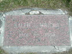
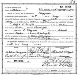
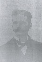
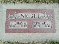
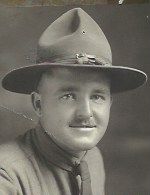
Ralph E Wright
| Birth | : | 3 Sep 1901 Chelan, Chelan County, Washington, USA |
| Death | : | 18 Feb 1989 Okanogan, Okanogan County, Washington, USA |
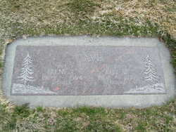
| Burial | : | Lakeview Cemetery, Kenmare, Ward County, USA |
| Coordinate | : | 48.6627998, -102.1016998 |
| Plot | : | South Fraternal Row58 STBLK59 L1A |
frequently asked questions (FAQ):
-
Where is Ralph E Wright's memorial?
Ralph E Wright's memorial is located at: Lakeview Cemetery, Kenmare, Ward County, USA.
-
When did Ralph E Wright death?
Ralph E Wright death on 18 Feb 1989 in Okanogan, Okanogan County, Washington, USA
-
Where are the coordinates of the Ralph E Wright's memorial?
Latitude: 48.6627998
Longitude: -102.1016998
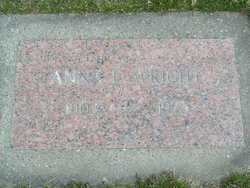
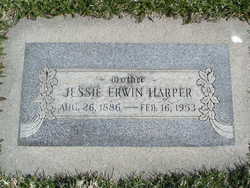
Family Members:
Parent
Spouse
Siblings
Flowers:
Nearby Cemetories:
1. Lakeview Cemetery
Kenmare, Ward County, USA
Coordinate: 48.6627998, -102.1016998
2. Saint Agnes Catholic Cemetery
Kenmare, Ward County, USA
Coordinate: 48.6804500, -102.0737200
3. Rose Hill Cemetery
Kenmare, Ward County, USA
Coordinate: 48.6804600, -102.0723200
4. Spring Valley Mennonite Cemetery
Kenaston, Ward County, USA
Coordinate: 48.5904617, -102.0805817
5. Trinity Lutheran Cemetery
Kenmare, Ward County, USA
Coordinate: 48.7335590, -102.0646290
6. Elmdale Lutheran Cemetery
Niobe, Ward County, USA
Coordinate: 48.6988983, -102.2127991
7. Bethany Lutheran Cemetery
Burke County, USA
Coordinate: 48.7349080, -102.1683880
8. Baden Cemetery
Baden, Ward County, USA
Coordinate: 48.5610700, -102.0823000
9. Our Saviors Lutheran Cemetery
Kenaston, Ward County, USA
Coordinate: 48.5604477, -102.1352158
10. Little Butte Cemetery
Bowbells, Burke County, USA
Coordinate: 48.7197310, -102.2769000
11. Coulee Cemetery
Coulee, Mountrail County, USA
Coordinate: 48.5462723, -102.0065536
12. Bethlehem Lutheran Cemetery
Coulee, Mountrail County, USA
Coordinate: 48.5301895, -102.1457291
13. Saint Joseph Cemetery
Bowbells, Burke County, USA
Coordinate: 48.8069000, -102.2266998
14. Bowbells Cemetery
Bowbells, Burke County, USA
Coordinate: 48.8068000, -102.2278100
15. Greenfield Cemetery
Ward County, USA
Coordinate: 48.5974998, -101.8653030
16. Trinity Cemetery
Tolley, Renville County, USA
Coordinate: 48.7261009, -101.8341980
17. Saint Charles Cemetery
Tolley, Renville County, USA
Coordinate: 48.7340012, -101.8345108
18. Zion Lutheran Cemetery
Coulee, Mountrail County, USA
Coordinate: 48.4882300, -102.2240500
19. Nasareth Cemetery
Vanville, Burke County, USA
Coordinate: 48.6180992, -102.3861008
20. Bethlehem Lutheran Cemetery
Bowbells, Burke County, USA
Coordinate: 48.7963982, -102.3236008
21. Zion Lutheran Cemetery
Norma, Renville County, USA
Coordinate: 48.8499184, -101.9987030
22. Hide and Stone Cemetery
Vanville, Burke County, USA
Coordinate: 48.5788000, -102.3792600
23. Donnybrook Community Cemetery
Donnybrook, Ward County, USA
Coordinate: 48.5171165, -101.8895264
24. Holbrook Cemetery
Donnybrook, Ward County, USA
Coordinate: 48.5119019, -101.8944016

