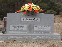
Ralph Edward Simmons
| Birth | : | 14 Jul 1953 Portageville, New Madrid County, Missouri, USA |
| Death | : | 21 Jul 2002 USA |
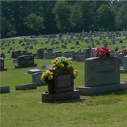
| Burial | : | Spindale Cemetery, Spindale, Rutherford County, USA |
| Coordinate | : | 35.3507996, -81.9218979 |
| Inscription | : | This came out in the Portageville Missourian News Paper on July 25th 2002 |
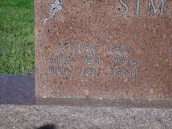
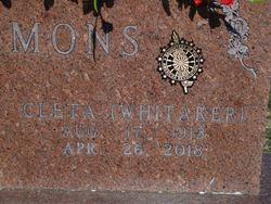
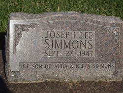
| Description | : | Ralph Edward Simmons, 49, of Rector passed from this life Sunday, July 21, 2002, after a courageous battle with cancer. He was born July 14, 1953, in Portageville, Mo., to Cleta Whitaker Simmons and the late Auda Lee Simmons. He was a lifelong farmer, an avid sportsman and a devoted father and husband. Ralph served as a board member and secretary of the St. Francis Drainage District of Clay and Greene Counties and was a member of the First United Methodist Church. He served for many years on the Woodland Heights Cemetery Commission and generously donated his time to the annual Rector Labor... Read More |
frequently asked questions (FAQ):
-
Where is Ralph Edward Simmons's memorial?
Ralph Edward Simmons's memorial is located at: Spindale Cemetery, Spindale, Rutherford County, USA.
-
When did Ralph Edward Simmons death?
Ralph Edward Simmons death on 21 Jul 2002 in USA
-
Where are the coordinates of the Ralph Edward Simmons's memorial?
Latitude: 35.3507996
Longitude: -81.9218979
Family Members:
Parent
Siblings
Flowers:
Nearby Cemetories:
1. Spindale Cemetery
Spindale, Rutherford County, USA
Coordinate: 35.3507996, -81.9218979
2. Russell Tabernacle CME Church Memorial Garden
Spindale, Rutherford County, USA
Coordinate: 35.3587510, -81.9164120
3. Whiteside Cemetery
Spindale, Rutherford County, USA
Coordinate: 35.3605400, -81.9118200
4. Adaville Baptist Church Cemetery
Spindale, Rutherford County, USA
Coordinate: 35.3356680, -81.9201110
5. Spindale Fellowship Holiness Church Cemetery
Spindale, Rutherford County, USA
Coordinate: 35.3544971, -81.9410039
6. Restoration Church Cemetery
Forest City, Rutherford County, USA
Coordinate: 35.3328200, -81.9228500
7. Wells Springs UMC Cemetery
Forest City, Rutherford County, USA
Coordinate: 35.3485413, -81.8906326
8. David Huntley Family Cemetery
Rutherfordton, Rutherford County, USA
Coordinate: 35.3255330, -81.9347790
9. Little Huntley Church Cemetery
Rutherford County, USA
Coordinate: 35.3229870, -81.9340790
10. Pleasant Grove United Methodist Church Cemetery
Forest City, Rutherford County, USA
Coordinate: 35.3490000, -81.8845000
11. Saint Paul AME Zion Cemetery
Forest City, Rutherford County, USA
Coordinate: 35.3407600, -81.8863900
12. Sunset Memorial Park
Forest City, Rutherford County, USA
Coordinate: 35.3200800, -81.9088050
13. Southern Baptist Church Cemetery
Rutherfordton, Rutherford County, USA
Coordinate: 35.3781380, -81.9436040
14. First United Methodist Church Memorial Garden
Rutherfordton, Rutherford County, USA
Coordinate: 35.3702390, -81.9560630
15. Mountain View Baptist Church Cemetery
Rutherfordton, Rutherford County, USA
Coordinate: 35.3323070, -81.9591380
16. Saint Francis Episcopal Cemetery
Rutherfordton, Rutherford County, USA
Coordinate: 35.3739100, -81.9553200
17. Rutherfordton City Cemetery
Rutherfordton, Rutherford County, USA
Coordinate: 35.3756120, -81.9557920
18. Fellowship Baptist Church
Rutherford County, USA
Coordinate: 35.3893780, -81.9336530
19. Hunt Family Cemetery
Ruth, Rutherford County, USA
Coordinate: 35.3826830, -81.9536940
20. Oak Grove Missionary Baptist Church
Forest City, Rutherford County, USA
Coordinate: 35.3296300, -81.8782300
21. Old Cool Springs Baptist Cemetery
Rutherford County, USA
Coordinate: 35.3420280, -81.8712940
22. Cool Springs Cemetery
Forest City, Rutherford County, USA
Coordinate: 35.3396988, -81.8711014
23. Saint Luke F.B.H. Church Cemetery
Forest City, Rutherford County, USA
Coordinate: 35.3405390, -81.8697340
24. New Hope Cemetery
Rutherfordton, Rutherford County, USA
Coordinate: 35.3757470, -81.9671180

