| Birth | : | 11 May 1911 Gosper County, Nebraska, USA |
| Death | : | 27 Apr 2001 Blencoe, Monona County, Iowa, USA |
| Burial | : | Graceland Cemetery, Blencoe, Monona County, USA |
| Coordinate | : | 41.9263992, -96.0994034 |
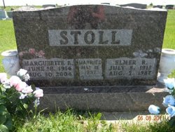
| Description | : | Stoll, Ralph E 11 May 1911 27 April 2001 Mar- 12 June 1935 ----- "Arapahoe Public Mirror" [Arapahoe, Furnas Co., NE], 22 August 2001: Ralph E. Stoll, 89, of Blencoe, Iowa, died suddenly Friday, April 27, 2001 at his home. Ralph was born May 11, 1911 at Elwood, Nebraska, the son of Harry and Edith [Carter] Stoll. He started farming at Arapahoe, Nebraska in 1930 and was married to Leta Livingston on June 12, 1935 at Lexington, Nebraska. They were life-long farmers and moved to Blencoe in 1943. The couple wintered in Mesa, Arizona for 20 years. Leta passed away on October 7, 1999 at their... Read More |
frequently asked questions (FAQ):
-
Where is Ralph Edward Stoll's memorial?
Ralph Edward Stoll's memorial is located at: Graceland Cemetery, Blencoe, Monona County, USA.
-
When did Ralph Edward Stoll death?
Ralph Edward Stoll death on 27 Apr 2001 in Blencoe, Monona County, Iowa, USA
-
Where are the coordinates of the Ralph Edward Stoll's memorial?
Latitude: 41.9263992
Longitude: -96.0994034
Family Members:
Parent
Spouse
Siblings
Children
Flowers:
Nearby Cemetories:
1. Graceland Cemetery
Blencoe, Monona County, USA
Coordinate: 41.9263992, -96.0994034
2. Onawa City Cemetery
Onawa, Monona County, USA
Coordinate: 42.0187950, -96.0894852
3. Golden Spring Cemetery
Decatur, Burt County, USA
Coordinate: 41.9410300, -96.2296300
4. Arizona Community Cemetery
Arizona, Burt County, USA
Coordinate: 41.8144800, -96.1432600
5. Fountainbleau Cemetery
Little Sioux, Harrison County, USA
Coordinate: 41.8295000, -95.9967000
6. Ingemann Danish Lutheran Church Cemetery
Moorhead, Monona County, USA
Coordinate: 41.9382000, -95.9265000
7. Cork Cemetery
Turin, Monona County, USA
Coordinate: 42.0107600, -95.9569400
8. Bethesda Cemetery
Moorhead, Monona County, USA
Coordinate: 41.9247017, -95.9158020
9. Mission Cemetery
Moorhead, Monona County, USA
Coordinate: 41.9311000, -95.9147000
10. Conyers Cemetery
Little Sioux, Harrison County, USA
Coordinate: 41.8058014, -96.0036011
11. Little Sioux Cemetery
Little Sioux, Harrison County, USA
Coordinate: 41.8025017, -96.0066986
12. Hillcrest Cemetery
Decatur, Burt County, USA
Coordinate: 42.0057983, -96.2577972
13. Advent Cemetery
Burt County, USA
Coordinate: 41.9014300, -96.2895100
14. Preparation Canyon Cemetery
Moorhead, Monona County, USA
Coordinate: 41.8810997, -95.9049988
15. Belvidere Cemetery
Turin, Monona County, USA
Coordinate: 42.0078011, -95.9255981
16. Bisbee Cemetery
Turin, Monona County, USA
Coordinate: 42.0228004, -95.9332962
17. Holy Family Cemetery
Decatur, Burt County, USA
Coordinate: 41.9953003, -96.2994003
18. Silver Creek Cemetery
Tekamah, Burt County, USA
Coordinate: 41.8400002, -96.2885971
19. South Jordan Cemetery
Moorhead, Monona County, USA
Coordinate: 41.9795000, -95.8858000
20. Tekamah Cemetery
Tekamah, Burt County, USA
Coordinate: 41.7868996, -96.2300034
21. Soldier Valley Cemetery
Pisgah, Harrison County, USA
Coordinate: 41.7916985, -95.9546967
22. Ruffcorn Cemetery
Harrison County, USA
Coordinate: 41.7571983, -96.0207977
23. Deman-Hinds Cemetery
Decatur, Burt County, USA
Coordinate: 41.9948300, -96.3288700
24. Gilpin Cemetery
Macy, Thurston County, USA
Coordinate: 42.0528100, -96.2833000


