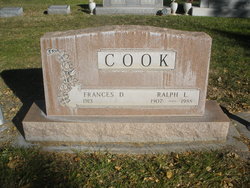
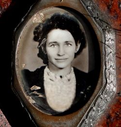
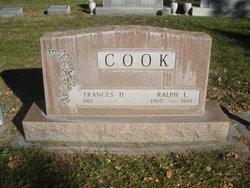
Ralph L. Cook
| Birth | : | 30 Oct 1907 Weeping Water, Cass County, Nebraska, USA |
| Death | : | 2 Feb 1988 Kearney, Buffalo County, Nebraska, USA |
| Burial | : | Graceland Cemetery, Creston, Union County, USA |
| Coordinate | : | 41.0369987, -94.3519974 |
| Description | : | Son of Adam & Ella Cook Husband of Leila Fisher Cook and Frances Wells Cook Popham |
frequently asked questions (FAQ):
-
Where is Ralph L. Cook's memorial?
Ralph L. Cook's memorial is located at: Graceland Cemetery, Creston, Union County, USA.
-
When did Ralph L. Cook death?
Ralph L. Cook death on 2 Feb 1988 in Kearney, Buffalo County, Nebraska, USA
-
Where are the coordinates of the Ralph L. Cook's memorial?
Latitude: 41.0369987
Longitude: -94.3519974
Family Members:
Parent
Spouse
Siblings
Children
Flowers:
Nearby Cemetories:
1. Graceland Cemetery
Creston, Union County, USA
Coordinate: 41.0369987, -94.3519974
2. Calvary Cemetery
Creston, Union County, USA
Coordinate: 41.0579987, -94.3899994
3. Ide Cemetery
Creston, Union County, USA
Coordinate: 40.9770012, -94.3499985
4. Lytles Grove Cemetery
Cromwell, Union County, USA
Coordinate: 41.0190010, -94.4309998
5. County Home Cemetery
Creston, Union County, USA
Coordinate: 41.0449982, -94.2590027
6. Cromwell Cemetery
Cromwell, Union County, USA
Coordinate: 41.0456543, -94.4616928
7. Old Jerusalem Cemetery
Creston, Union County, USA
Coordinate: 41.1159401, -94.3084335
8. Spaulding Center Cemetery
Union County, USA
Coordinate: 41.1139984, -94.4179993
9. Evergreen Cemetery
Creston, Union County, USA
Coordinate: 41.1139984, -94.2839966
10. McDuffie Cemetery
Kent, Union County, USA
Coordinate: 40.9500008, -94.4110031
11. Prairie Lawn Cemetery
Spaulding, Union County, USA
Coordinate: 41.1360016, -94.3759995
12. Harmony Cemetery
Shannon City, Union County, USA
Coordinate: 40.9370003, -94.3359985
13. Rollins Plot Cemetery
Afton, Union County, USA
Coordinate: 41.0040283, -94.2234802
14. Saint Edwards Catholic Cemetery
Afton, Union County, USA
Coordinate: 41.0359993, -94.2129974
15. Grove Chapel Cemetery
Kent, Union County, USA
Coordinate: 40.9350110, -94.3947670
16. Civil War Era Cemetery
Afton, Union County, USA
Coordinate: 41.0460854, -94.2025299
17. Greenlawn Cemetery
Afton, Union County, USA
Coordinate: 41.0335999, -94.1856003
18. Liberty Cemetery
Union Township, Adair County, USA
Coordinate: 41.1585620, -94.2902070
19. Cedar Grove Cemetery
Lorimor, Union County, USA
Coordinate: 41.1209984, -94.2200012
20. Summit Cemetery
Prescott, Adams County, USA
Coordinate: 41.0283012, -94.5291977
21. Bruning Cemetery
Kent, Union County, USA
Coordinate: 40.9049988, -94.4069977
22. Norris Plot Cemetery
Afton, Union County, USA
Coordinate: 41.0079994, -94.1579971
23. Morgan Cemetery
Kent, Union County, USA
Coordinate: 40.9080009, -94.4520035
24. Dodge Center Cemetery
Afton, Union County, USA
Coordinate: 41.1279984, -94.1829987


