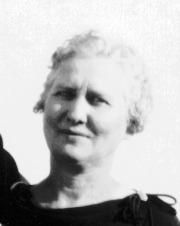
Ralph Louis Braun
| Birth | : | 10 Nov 1919 Wolsey, Beadle County, South Dakota, USA |
| Death | : | 28 Apr 2008 Sioux Falls, Minnehaha County, South Dakota, USA |
| Burial | : | Saint Johns Catholic Cemetery, Independence, Buchanan County, USA |
| Coordinate | : | 42.4822006, -91.8957977 |
| Description | : | Ralph L. Braun, age 88, of Sioux Falls and formerly of Huron, died Monday, April 28, 2008 at Dow Rummel Village at Sioux Falls. Ralph Louis Braun was born on November 10, 1919, to Louie E. and Hattie (Berndt) Braun at Wolsey, SD. He grew up in Wolsey, graduated from Wolsey High School in 1936 and South Dakota State University in 1942. After completing college, he joined the 1st Marine Division and completed 25 months of service in the South Pacific before teaching Marine infantry school at Camp Pendleton, California until 1945. On December 28, 1944, he was united in marriage... Read More |
frequently asked questions (FAQ):
-
Where is Ralph Louis Braun's memorial?
Ralph Louis Braun's memorial is located at: Saint Johns Catholic Cemetery, Independence, Buchanan County, USA.
-
When did Ralph Louis Braun death?
Ralph Louis Braun death on 28 Apr 2008 in Sioux Falls, Minnehaha County, South Dakota, USA
-
Where are the coordinates of the Ralph Louis Braun's memorial?
Latitude: 42.4822006
Longitude: -91.8957977
Family Members:
Parent
Spouse
Siblings
Flowers:
Nearby Cemetories:
1. Saint Johns Catholic Cemetery
Independence, Buchanan County, USA
Coordinate: 42.4822006, -91.8957977
2. Oakwood Cemetery
Independence, Buchanan County, USA
Coordinate: 42.4627991, -91.8927994
3. West Haven Cemetery
Independence, Buchanan County, USA
Coordinate: 42.4588678, -91.8986696
4. Buchanan County Poor Farm Cemetery
Independence, Buchanan County, USA
Coordinate: 42.4871560, -91.8647280
5. Mount Hope Cemetery
Independence, Buchanan County, USA
Coordinate: 42.4571991, -91.8914032
6. Buchanan County Home Cemetery
Independence, Buchanan County, USA
Coordinate: 42.4903050, -91.8596350
7. Wilson Cemetery
Independence, Buchanan County, USA
Coordinate: 42.4658012, -91.8516998
8. State Hospital Cemetery
Independence, Buchanan County, USA
Coordinate: 42.4455986, -91.9253006
9. Otterville Cemetery
Buchanan County, USA
Coordinate: 42.5158005, -91.9392014
10. Pine Creek Cemetery
Quasqueton, Buchanan County, USA
Coordinate: 42.4172400, -91.7867200
11. Littleton Cemetery
Littleton, Buchanan County, USA
Coordinate: 42.5338593, -92.0179520
12. Cedar Crest Cemetery
Jesup, Buchanan County, USA
Coordinate: 42.4782982, -92.0406036
13. Saint Athanasius Cemetery
Jesup, Buchanan County, USA
Coordinate: 42.4761009, -92.0421982
14. Rowley Cemetery
Rowley, Buchanan County, USA
Coordinate: 42.3716621, -91.8530655
15. Fairview Cemetery
Winthrop, Buchanan County, USA
Coordinate: 42.4692001, -91.7407990
16. Payne Cemetery
Winthrop, Buchanan County, USA
Coordinate: 42.5203018, -91.7453003
17. Saint Patricks Cemetery
Winthrop, Buchanan County, USA
Coordinate: 42.4653015, -91.7328033
18. Hickory Grove Cemetery
Quasqueton, Buchanan County, USA
Coordinate: 42.4207598, -91.7534684
19. Fontana Cemetery
Hazleton, Buchanan County, USA
Coordinate: 42.6046982, -91.9052963
20. Fremont Township Cemetery
Winthrop, Buchanan County, USA
Coordinate: 42.5046997, -91.7264023
21. Amish Cemetery
Buchanan County, USA
Coordinate: 42.5689011, -92.0224991
22. Quasqueton Cemetery
Quasqueton, Buchanan County, USA
Coordinate: 42.3994370, -91.7621231
23. Byron Township Cemetery
Buchanan County, USA
Coordinate: 42.5271988, -91.7275009
24. Saint Marys Cemetery
Hazleton, Buchanan County, USA
Coordinate: 42.6164017, -91.8983002


