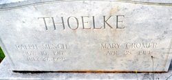
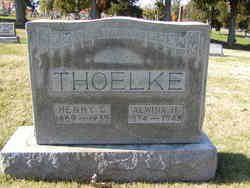
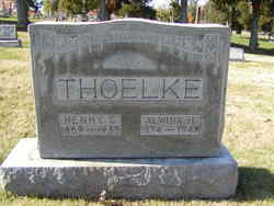
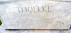
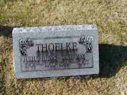
Ralph Mench Thoelke
| Birth | : | 10 Nov 1917 St. Charles County, Missouri, USA |
| Death | : | 27 Jul 1988 Anderson County, South Carolina, USA |
| Burial | : | New Silver Brook Cemetery, Anderson, Anderson County, USA |
| Coordinate | : | 34.4860992, -82.6331024 |
| Description | : | Department of Veterans Affairs BIRLS Death File, 1850-2010 Name: Ralph Thoelke Gender: Male Birth Date: 10 Nov 1917 Death Date: 27 Jul 1988 SSN: 492019732 Branch 1: ARMY Enlistment Date 1: 17 Apr 1941 Release Date 1: 13 Feb 1948 |
frequently asked questions (FAQ):
-
Where is Ralph Mench Thoelke's memorial?
Ralph Mench Thoelke's memorial is located at: New Silver Brook Cemetery, Anderson, Anderson County, USA.
-
When did Ralph Mench Thoelke death?
Ralph Mench Thoelke death on 27 Jul 1988 in Anderson County, South Carolina, USA
-
Where are the coordinates of the Ralph Mench Thoelke's memorial?
Latitude: 34.4860992
Longitude: -82.6331024
Family Members:
Parent
Spouse
Siblings
Children
Flowers:
Nearby Cemetories:
1. New Silver Brook Cemetery
Anderson, Anderson County, USA
Coordinate: 34.4860992, -82.6331024
2. Potters Field
Anderson, Anderson County, USA
Coordinate: 34.4908330, -82.6336110
3. Silver Brook Cemetery
Anderson, Anderson County, USA
Coordinate: 34.4928017, -82.6361008
4. Old Mount Tabor Baptist Church Cemetery
Anderson, Anderson County, USA
Coordinate: 34.4826590, -82.6523020
5. Grace Episcopal Church
Anderson, Anderson County, USA
Coordinate: 34.4993050, -82.6470300
6. Orr Mill Cemetery
Anderson, Anderson County, USA
Coordinate: 34.4906006, -82.6544037
7. Saint Johns United Methodist Church Columbarium
Anderson, Anderson County, USA
Coordinate: 34.5007640, -82.6475280
8. First Baptist Church Cemetery
Anderson County, USA
Coordinate: 34.5030750, -82.6464940
9. Westview Cemetery
Anderson, Anderson County, USA
Coordinate: 34.4921989, -82.6575012
10. Nevitt Family Cemetery
Anderson County, USA
Coordinate: 34.4837870, -82.6064050
11. Saint Joseph's Catholic Church Cemetery (Defunct)
Anderson County, USA
Coordinate: 34.5050354, -82.6486661
12. First Presbyterian Church Cemetery
Anderson, Anderson County, USA
Coordinate: 34.5042800, -82.6542000
13. Norris Hill Presbyterian Church Cemetery
Anderson County, USA
Coordinate: 34.4577950, -82.6303180
14. Burke Family Cemetery
Anderson, Anderson County, USA
Coordinate: 34.4859560, -82.5976550
15. Boulevard Baptist Church Columbarium
Anderson, Anderson County, USA
Coordinate: 34.5155690, -82.6449670
16. Holy Trinity Lutheran Church Columbarium
Anderson, Anderson County, USA
Coordinate: 34.5166600, -82.6519400
17. Hammond Family Cemetery
Anderson, Anderson County, USA
Coordinate: 34.5082830, -82.6010490
18. LaBoon Family Cemetery
Anderson County, USA
Coordinate: 34.4991989, -82.6735992
19. Mary Smith Family Cemetery
Anderson, Anderson County, USA
Coordinate: 34.4699140, -82.5919430
20. Eureka Baptist Church Cemetery
Anderson, Anderson County, USA
Coordinate: 34.5119019, -82.5963974
21. Bennett Family Cemetery
Anderson County, USA
Coordinate: 34.4776000, -82.5816500
22. M J Dolly Cooper Veterans Cemetery
Anderson, Anderson County, USA
Coordinate: 34.4820099, -82.5783081
23. Davenport Family Cemetery
Anderson, Anderson County, USA
Coordinate: 34.4422890, -82.6479530
24. Peter Keys Family Cemetery
Anderson, Anderson County, USA
Coordinate: 34.4878500, -82.6911500

