
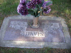
Ralph Odell Davis
| Birth | : | 21 Oct 1919 Belvidere Township, Monona County, Iowa, USA |
| Death | : | Dec 1985 |
| Burial | : | St John the Baptist Churchyard, Burslem, Stoke-on-Trent Unitary Authority, England |
| Coordinate | : | 53.0425850, -2.1962510 |
| Plot | : | Block 4, Lot 15A |
frequently asked questions (FAQ):
-
Where is Ralph Odell Davis's memorial?
Ralph Odell Davis's memorial is located at: St John the Baptist Churchyard, Burslem, Stoke-on-Trent Unitary Authority, England.
-
When did Ralph Odell Davis death?
Ralph Odell Davis death on Dec 1985 in
-
Where are the coordinates of the Ralph Odell Davis's memorial?
Latitude: 53.0425850
Longitude: -2.1962510
Family Members:
Parent

Spouse

Siblings
Children
Flowers:


Nearby Cemetories:
1. St John the Baptist Churchyard
Burslem, Stoke-on-Trent Unitary Authority, England
Coordinate: 53.0425850, -2.1962510
2. Smallthorne Cemetery
Smallthorne, Stoke-on-Trent Unitary Authority, England
Coordinate: 53.0480310, -2.1765950
3. Burslem Cemetery
Burslem, Stoke-on-Trent Unitary Authority, England
Coordinate: 53.0463020, -2.1747030
4. Parish church of st saviour smallthorne
Smallthorne, Stoke-on-Trent Unitary Authority, England
Coordinate: 53.0497445, -2.1758707
5. St Margaret Churchyard
Wolstanton, Newcastle-Under-Lyme Borough, England
Coordinate: 53.0296810, -2.2154990
6. St. John the Evangelist Churchyard
Hanley, Stoke-on-Trent Unitary Authority, England
Coordinate: 53.0280200, -2.1749590
7. Etruria Methodist Church
Stoke-on-Trent, Stoke-on-Trent Unitary Authority, England
Coordinate: 53.0209680, -2.1985840
8. Holy Trinity Churchyard
Hanley, Stoke-on-Trent Unitary Authority, England
Coordinate: 53.0297350, -2.1672050
9. Christ Church Churchyard
Tunstall, Stoke-on-Trent Unitary Authority, England
Coordinate: 53.0625400, -2.2112840
10. Tunstall Cemetery
Tunstall, Stoke-on-Trent Unitary Authority, England
Coordinate: 53.0618690, -2.2180260
11. St. Mark's Church Graveyard
Shelton, Stoke-on-Trent Unitary Authority, England
Coordinate: 53.0189000, -2.1820000
12. Sacred Heart Churchyard
Hanley, Stoke-on-Trent Unitary Authority, England
Coordinate: 53.0210590, -2.1737770
13. St Bartholomew Churchyard
Norton in the Moors, Stoke-on-Trent Unitary Authority, England
Coordinate: 53.0604630, -2.1595270
14. Hanley Cemetery
Hanley, Stoke-on-Trent Unitary Authority, England
Coordinate: 53.0143330, -2.1863120
15. St. George's Churchyard
Newcastle-under-Lyme, Newcastle-Under-Lyme Borough, England
Coordinate: 53.0141190, -2.2242070
16. Chesterton Cemetery
Newcastle-under-Lyme, Newcastle-Under-Lyme Borough, England
Coordinate: 53.0352240, -2.2500500
17. Holy Trinity Churchyard
Chesterton, Stratford-on-Avon District, England
Coordinate: 53.0418320, -2.2523770
18. Carmountside Cemetery and Crematorium
Milton, Stoke-on-Trent Unitary Authority, England
Coordinate: 53.0449570, -2.1394910
19. St. Philip and St. James Churchyard
Milton, Stoke-on-Trent Unitary Authority, England
Coordinate: 53.0503730, -2.1403780
20. St. John the Evangelist Churchyard
Goldenhill, Stoke-on-Trent Unitary Authority, England
Coordinate: 53.0749010, -2.2189830
21. St. Giles' Churchyard
Newcastle-under-Lyme, Newcastle-Under-Lyme Borough, England
Coordinate: 53.0115110, -2.2301920
22. St. Mary's Churchyard
Bucknall, Stoke-on-Trent Unitary Authority, England
Coordinate: 53.0240220, -2.1424430
23. Hartshill Cemetery
Hartshill, Stoke-on-Trent Unitary Authority, England
Coordinate: 53.0054283, -2.2035301
24. Quakers Burial Ground
Stoke-on-Trent, Stoke-on-Trent Unitary Authority, England
Coordinate: 53.0052870, -2.1881570