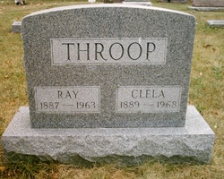
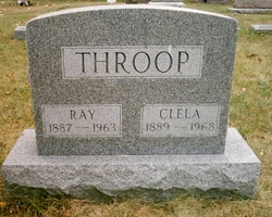
Ray Allen Throop
| Birth | : | 31 Mar 1887 |
| Death | : | Jul 1963 Michigan, USA |
| Burial | : | Candelaria Cemetery, Candelaria Junction, Mineral County, USA |
| Coordinate | : | 38.1591988, -118.0841980 |
| Plot | : | Lot 2 |
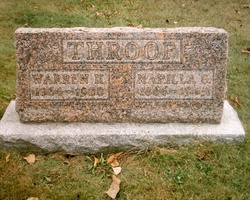
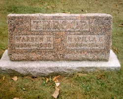
| Description | : | Son of Warren H. and Marrilla G. Kellogg Throop. Married Clela Egelkraut. |
frequently asked questions (FAQ):
-
Where is Ray Allen Throop's memorial?
Ray Allen Throop's memorial is located at: Candelaria Cemetery, Candelaria Junction, Mineral County, USA.
-
When did Ray Allen Throop death?
Ray Allen Throop death on Jul 1963 in Michigan, USA
-
Where are the coordinates of the Ray Allen Throop's memorial?
Latitude: 38.1591988
Longitude: -118.0841980
Family Members:
Parent
Spouse
Siblings
Flowers:
Nearby Cemetories:
1. Columbus Cemetery
Columbus, Esmeralda County, USA
Coordinate: 38.1128900, -118.0223700
2. Belleville Cemetery
Candelaria Junction, Mineral County, USA
Coordinate: 38.2145500, -118.1737100
3. Sodaville Cemetery
Sodaville, Mineral County, USA
Coordinate: 38.3434000, -118.1078000
4. Marietta Cemetery
Marietta, Mineral County, USA
Coordinate: 38.2447014, -118.3405991
5. Mina Cemetery
Mina, Mineral County, USA
Coordinate: 38.3961000, -118.1162000
6. New Boston Gravesite
Mina, Mineral County, USA
Coordinate: 38.4279000, -118.1440600
7. Galloway Memorial
Hawthorne, Mineral County, USA
Coordinate: 38.4049600, -118.3176000
8. Gilbert Cemetery
Millers, Esmeralda County, USA
Coordinate: 38.1960400, -117.6967700
9. Luning Cemetery
Luning, Mineral County, USA
Coordinate: 38.5017891, -118.1787796
10. Tomlin Gravesite
Luning, Mineral County, USA
Coordinate: 38.5045319, -118.1808319
11. Badger Bill Gravesite
Hawthorne, Mineral County, USA
Coordinate: 38.4546000, -118.4032800
12. Fish Lake Valley Cemetery
Dyer, Esmeralda County, USA
Coordinate: 37.7490005, -118.0404968
13. Montgomery City Burial Site
Benton, Mono County, USA
Coordinate: 37.8286110, -118.4308330
14. Chinese Gravesite
Hawthorne, Mineral County, USA
Coordinate: 38.5479813, -118.4238892
15. Millers Cemetery #1
Millers, Esmeralda County, USA
Coordinate: 38.1234300, -117.4558600
16. Millers Cemetery #2
Millers, Esmeralda County, USA
Coordinate: 38.1237500, -117.4524100
17. Benton Hot Springs Cemetery
Benton Hot Springs, Mono County, USA
Coordinate: 37.8029430, -118.5298200
18. Silver Peak Cemetery
Silver Peak, Esmeralda County, USA
Coordinate: 37.7565002, -117.6380005
19. Black Lake Cemetery
Benton Hot Springs, Mono County, USA
Coordinate: 37.7893490, -118.5897250
20. Chinese Cemetery
Hawthorne, Mineral County, USA
Coordinate: 38.5334300, -118.6144800
21. Hawthorne Cemetery
Hawthorne, Mineral County, USA
Coordinate: 38.5340004, -118.6253967
22. Poinsettia Burial Ground
Hawthorne, Mineral County, USA
Coordinate: 38.7787400, -118.2624100
23. Aurora Cemetery
Mineral County, USA
Coordinate: 38.2913300, -118.9014300
24. Kirchen Gravesite
Tonopah, Nye County, USA
Coordinate: 38.0776700, -117.2505500

