


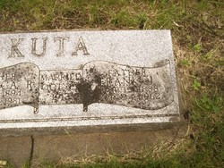
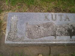
Raymond J. “Ray” Kuta
| Birth | : | 10 Jun 1917 Osceola, Polk County, Nebraska, USA |
| Death | : | 13 Nov 1980 Lincoln, Lancaster County, Nebraska, USA |
| Burial | : | Callender Cemetery, Callender, Webster County, USA |
| Coordinate | : | 42.3693237, -94.2793427 |
| Inscription | : | WW II - US Army |
| Description | : | http://www.rootsweb.ancestry.com/~neplatte/vitals/vitals1980.html The Columbus Telegram, November 14, 1980 KUTA--Ray J. Kuta Ray J. Kuta, 63, 1509 8th St., Columbus, died Thursday at Lincoln Veterans Hospital. Funeral services will be 10:30 a.m. Monday at St. Anthony Catholic Church, with the Rev. Bruno Savage officiating. Burial, with military services, will be in St. Bonaventure Cemetery. Visitation will be after 1 p.m. Sunday at McKown Funeral Home. Rosary will be recited at 7:30 p.m. Sunday at the funeral home. Kuta, son of Frank J. Kuta Sr. and Veronica R. (Kush) Kuta, was born... Read More |
frequently asked questions (FAQ):
-
Where is Raymond J. “Ray” Kuta's memorial?
Raymond J. “Ray” Kuta's memorial is located at: Callender Cemetery, Callender, Webster County, USA.
-
When did Raymond J. “Ray” Kuta death?
Raymond J. “Ray” Kuta death on 13 Nov 1980 in Lincoln, Lancaster County, Nebraska, USA
-
Where are the coordinates of the Raymond J. “Ray” Kuta's memorial?
Latitude: 42.3693237
Longitude: -94.2793427
Family Members:
Parent
Spouse
Siblings

Flowers:


Nearby Cemetories:
1. Callender Cemetery
Callender, Webster County, USA
Coordinate: 42.3693237, -94.2793427
2. Vinje Cemetery
Callender, Webster County, USA
Coordinate: 42.3693237, -94.2797775
3. Saron Lutheran Cemetery
Callender, Webster County, USA
Coordinate: 42.3690720, -94.2780609
4. Our Saviour Cemetery
Callender, Webster County, USA
Coordinate: 42.3396988, -94.3153000
5. Fulton Township Cemetery
Moorland, Webster County, USA
Coordinate: 42.4272000, -94.3159000
6. Roland Township Cemetery
Slifer, Webster County, USA
Coordinate: 42.3685989, -94.3685989
7. Elkhorn Township Cemetery
Fort Dodge, Webster County, USA
Coordinate: 42.4276120, -94.2329690
8. Elkhorn Cemetery
Webster County, USA
Coordinate: 42.4277992, -94.2328033
9. Mizpah Cemetery
Webster County, USA
Coordinate: 42.3835983, -94.3707962
10. Our Lady of Good Counsel Cemetery
Moorland, Webster County, USA
Coordinate: 42.4427986, -94.3043976
11. Graceland Cemetery
Elkhorn Township, Webster County, USA
Coordinate: 42.4275017, -94.2127991
12. Fulton Lutheran Cemetery
Roelyn, Webster County, USA
Coordinate: 42.4263992, -94.3688965
13. Gowrie Township Cemetery
Gowrie, Webster County, USA
Coordinate: 42.2813988, -94.3043976
14. Webster County Home Cemetery
Fort Dodge, Webster County, USA
Coordinate: 42.4563710, -94.2181420
15. Lost Grove Cemetery
Harcourt, Webster County, USA
Coordinate: 42.2583008, -94.2331009
16. Otho Cemetery
Otho, Webster County, USA
Coordinate: 42.4025002, -94.1153030
17. Calvary Presbyterian Cemetery
Barnum, Webster County, USA
Coordinate: 42.4742810, -94.3835020
18. Cedar Cemetery
Rinard, Calhoun County, USA
Coordinate: 42.3456001, -94.4644012
19. Carpenter Cemetery
Webster County, USA
Coordinate: 42.5015907, -94.2166061
20. Saint Olafs Cemetery
Fort Dodge, Webster County, USA
Coordinate: 42.5017014, -94.2153015
21. Greenfield Cemetery
Knierim, Calhoun County, USA
Coordinate: 42.4495000, -94.4565000
22. Burns Cemetery
Webster County, USA
Coordinate: 42.5249970, -94.2759880
23. West Lawn Cemetery
Lehigh, Webster County, USA
Coordinate: 42.3616982, -94.0678024
24. Old Lizard Cemetery
Webster County, USA
Coordinate: 42.5249720, -94.3141340