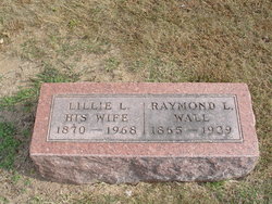
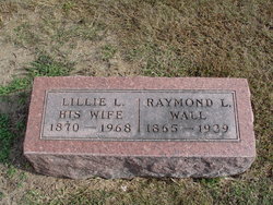
Raymond Lee “Ray” Wall
| Birth | : | 21 Jul 1865 Hardin, Ray County, Missouri, USA |
| Death | : | 6 May 1939 Millville, Ray County, Missouri, USA |
| Burial | : | Forest Lawn Memorial Park, Cypress, Orange County, USA |
| Coordinate | : | 33.8339005, -118.0560989 |
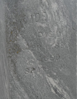
| Description | : | MO Death Cert # 19584 Father = Wade Wall/Kentucky Mother = Unknown Spouse = Lillie Leona Wall Informant = Stone Wall Occupation = Farmer COD = Arteriosclerosis |
frequently asked questions (FAQ):
-
Where is Raymond Lee “Ray” Wall's memorial?
Raymond Lee “Ray” Wall's memorial is located at: Forest Lawn Memorial Park, Cypress, Orange County, USA.
-
When did Raymond Lee “Ray” Wall death?
Raymond Lee “Ray” Wall death on 6 May 1939 in Millville, Ray County, Missouri, USA
-
Where are the coordinates of the Raymond Lee “Ray” Wall's memorial?
Latitude: 33.8339005
Longitude: -118.0560989
Family Members:
Parent
Spouse
Siblings
Children
Flowers:
Nearby Cemetories:
1. Forest Lawn Memorial Park
Cypress, Orange County, USA
Coordinate: 33.8339005, -118.0560989
2. Saint Josephs Episcopal Church Columbarium
Buena Park, Orange County, USA
Coordinate: 33.8415590, -118.0280360
3. Long Beach Police Academy K-9 Cemetery
Long Beach, Los Angeles County, USA
Coordinate: 33.8274000, -118.0895300
4. Artesia Cemetery
Cerritos, Los Angeles County, USA
Coordinate: 33.8717003, -118.0958023
5. Saint Gregory Episcopal Church Columbarium
Long Beach, Los Angeles County, USA
Coordinate: 33.8036100, -118.1105600
6. Christ Lutheran Church Columbarium
Long Beach, Los Angeles County, USA
Coordinate: 33.7952500, -118.1044100
7. Olive Lawn Memorial Park
La Mirada, Los Angeles County, USA
Coordinate: 33.9038700, -118.0114400
8. Magnolia Memorial Park
Garden Grove, Orange County, USA
Coordinate: 33.7843895, -117.9755478
9. Young Israel Cemetery
Norwalk, Los Angeles County, USA
Coordinate: 33.9071000, -118.1081300
10. United States Naval Weapons Station Grounds
Seal Beach, Orange County, USA
Coordinate: 33.7505850, -118.0882970
11. All Souls Cemetery
Long Beach, Los Angeles County, USA
Coordinate: 33.8405991, -118.1647034
12. Palm Cemetery
Long Beach, Los Angeles County, USA
Coordinate: 33.8447200, -118.1682500
13. Cinco Camp Burial Grounds
Cantil, Kern County, USA
Coordinate: 33.9277710, -118.0649960
14. Norwalk State Hospital Cemetery
Norwalk, Los Angeles County, USA
Coordinate: 33.9277710, -118.0649960
15. Forest Lawn Memorial Park
Long Beach, Los Angeles County, USA
Coordinate: 33.8436012, -118.1691971
16. Holy Cross Cemetery
Anaheim, Orange County, USA
Coordinate: 33.8236885, -117.9422226
17. All Saints Anglican Church Columbarium
Long Beach, Los Angeles County, USA
Coordinate: 33.7696600, -118.1461300
18. Little Lake Cemetery
Santa Fe Springs, Los Angeles County, USA
Coordinate: 33.9317900, -118.0779100
19. Westminster Memorial Park
Westminster, Orange County, USA
Coordinate: 33.7489014, -117.9931030
20. Downey District Cemetery
Downey, Los Angeles County, USA
Coordinate: 33.9102783, -118.1399994
21. Long Beach Municipal Cemetery
Long Beach, Los Angeles County, USA
Coordinate: 33.8044700, -118.1769200
22. Paradise Memorial Park
Santa Fe Springs, Los Angeles County, USA
Coordinate: 33.9354540, -118.0869900
23. First Presbyterian Church Memorial Gardens
Fullerton, Orange County, USA
Coordinate: 33.8788600, -117.9417400
24. Sunnyside Cemetery
Long Beach, Los Angeles County, USA
Coordinate: 33.8044700, -118.1789100

