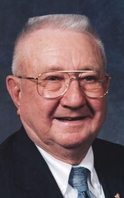
Reuben Henry Brei
| Birth | : | 24 Apr 1923 Todd County, South Dakota, USA |
| Death | : | 15 Sep 2015 Kearney, Buffalo County, Nebraska, USA |
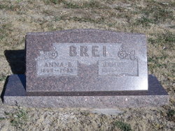
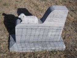
| Burial | : | Zions Lutheran Cemetery, Mission, Todd County, USA |
| Coordinate | : | 43.3052760, -100.6528920 |
| Description | : | KEARNEY — Reuben H. Brei, 92, of Kearney died Tuesday, Sept. 15, 2015, at CHI Health Good Samaritan. Services will be at 11 a.m. Saturday at Trinity Evangelical Lutheran Church in Winner, S.D. Burial will be at 2 p.m. at Zion Lutheran Cemetery in Mission, S.D. O’Brien Straatmann Redinger Funeral Home in Kearney is in charge of the arrangements. Reuben Henry Brei was born on April 24, 1923, at the family home near Mission in Todd County to Henry and Anna Brei, nee Kasat. He was baptized and confirmed at Zion Evangelical Lutheran Church in Mission. He was a faithful... Read More |
frequently asked questions (FAQ):
-
Where is Reuben Henry Brei's memorial?
Reuben Henry Brei's memorial is located at: Zions Lutheran Cemetery, Mission, Todd County, USA.
-
When did Reuben Henry Brei death?
Reuben Henry Brei death on 15 Sep 2015 in Kearney, Buffalo County, Nebraska, USA
-
Where are the coordinates of the Reuben Henry Brei's memorial?
Latitude: 43.3052760
Longitude: -100.6528920
Family Members:
Parent
Spouse
Siblings
Children
Flowers:
Nearby Cemetories:
1. Zions Lutheran Cemetery
Mission, Todd County, USA
Coordinate: 43.3052760, -100.6528920
2. Trinity Cemetery
Mission, Todd County, USA
Coordinate: 43.3025017, -100.6442032
3. Saint Thomas Catholic Cemetery
Antelope, Todd County, USA
Coordinate: 43.3045500, -100.6430400
4. Peace Cemetery
Mission, Todd County, USA
Coordinate: 43.2746200, -100.6502800
5. Rosebud Cemetery
Rosebud, Todd County, USA
Coordinate: 43.3454720, -100.7110170
6. Spotted Elk Cemetery
White River, Mellette County, USA
Coordinate: 43.4066400, -100.6386800
7. Holy Family Cemetery
Mellette County, USA
Coordinate: 43.4045100, -100.7208400
8. Sicangu Akicita Owicahe Tribal Veterans Cemetery
White River, Mellette County, USA
Coordinate: 43.4299200, -100.7398600
9. Ring Thunder Sacred Heart Cemetery
Mellette County, USA
Coordinate: 43.4143982, -100.7947006
10. Saint John Cemetery
Norris, Mellette County, USA
Coordinate: 43.3960991, -100.8181000
11. Saint John Episcopal Cemetery
Mellette County, USA
Coordinate: 43.3957000, -100.8190000
12. Bronco Bill Cemetery
White River, Mellette County, USA
Coordinate: 43.4461800, -100.7417400
13. Body of Christ Cemetery
White River, Mellette County, USA
Coordinate: 43.4461900, -100.7417300
14. Spotted Tail Cemetery
Rosebud, Todd County, USA
Coordinate: 43.2416992, -100.8518982
15. Grace Chapel Cemetery
Soldier Creek, Todd County, USA
Coordinate: 43.3166070, -100.8790610
16. Carroll Cemetery
Olsonville, Todd County, USA
Coordinate: 43.1371300, -100.6085100
17. Bear Looks Behind Cemetery
White River, Mellette County, USA
Coordinate: 43.4823700, -100.7369900
18. Saints Philip and James Cemetery
White River, Mellette County, USA
Coordinate: 43.4910700, -100.7400400
19. Calvary Cemetery
Okreek, Todd County, USA
Coordinate: 43.3592020, -100.3830890
20. Salt Camp Cemetery
Todd County, USA
Coordinate: 43.2771988, -100.9393997
21. See Red Family Cemetery
Saint Francis, Todd County, USA
Coordinate: 43.2021000, -100.9049500
22. Mediator Cemetery
Wood, Mellette County, USA
Coordinate: 43.4919014, -100.4841995
23. Evergreen Cemetery
Wood, Mellette County, USA
Coordinate: 43.4928017, -100.4852982
24. Saint Marys Garden Cemetery
Wood, Mellette County, USA
Coordinate: 43.5083008, -100.5218964

