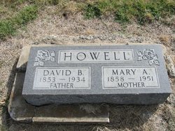
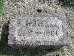
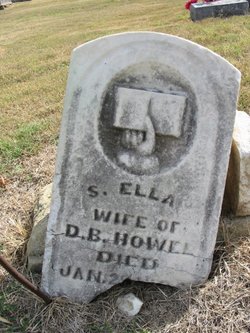
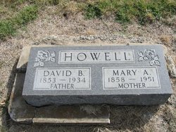
Rev David Burman Howell
| Birth | : | 19 Sep 1853 Floyd County, Virginia, USA |
| Death | : | 29 Apr 1934 Chanute, Neosho County, Kansas, USA |
| Burial | : | Coal Ridge Church Cemetery, Knoxville, Marion County, USA |
| Coordinate | : | 41.3781013, -93.0231018 |
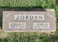
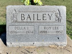
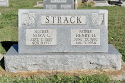
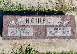
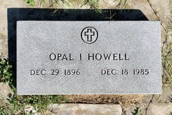
| Description | : | Son of Beaufort Howell and Susanna Link The Rev. David B Howell, 80, former United Brethren circuit rider died Sunday in the home of his daughter, Mrs. Henry Strack, west of Humboldt. He came to Kansas from Indiana fifty-five years ago, and was in the ministry forty years. He leaves his wife, to whom he was married in Elk county in 1884; four daughters, Mrs. John Jordan and Miss Opal Howell, Chanute, Mrs. Roy Bailey of Earlton, and Mrs. Henry Strack, Humboldt; two sons, Burel Howell, Chanute, and Ira Howell, Yates Center; and one brother, Lemuel Howell, Chanute. Clyde... Read More |
frequently asked questions (FAQ):
-
Where is Rev David Burman Howell's memorial?
Rev David Burman Howell's memorial is located at: Coal Ridge Church Cemetery, Knoxville, Marion County, USA.
-
When did Rev David Burman Howell death?
Rev David Burman Howell death on 29 Apr 1934 in Chanute, Neosho County, Kansas, USA
-
Where are the coordinates of the Rev David Burman Howell's memorial?
Latitude: 41.3781013
Longitude: -93.0231018
Family Members:
Parent
Spouse
Children
Flowers:
Nearby Cemetories:
1. Coal Ridge Church Cemetery
Knoxville, Marion County, USA
Coordinate: 41.3781013, -93.0231018
2. Monster Cemetery
Knoxville, Marion County, USA
Coordinate: 41.3689995, -93.0169983
3. Coffman Cemetery
Knoxville, Marion County, USA
Coordinate: 41.3549000, -93.0238000
4. t'Lam Cemetery
Pella, Marion County, USA
Coordinate: 41.3849983, -92.9816971
5. Asbury Cemetery
Marion County, USA
Coordinate: 41.3457985, -93.0049973
6. Timber Ridge Cemetery
Pella, Marion County, USA
Coordinate: 41.3781400, -92.9672340
7. Klein Cemetery
Pella, Marion County, USA
Coordinate: 41.4199000, -92.9907000
8. Karr Family Cemetery
Marion County, USA
Coordinate: 41.4252000, -93.0737000
9. Price Cemetery
Marion County, USA
Coordinate: 41.4389000, -93.0369034
10. Greenwood Cemetery
Knoxville, Marion County, USA
Coordinate: 41.3466988, -93.0952988
11. Funk Cemetery
Marion County, USA
Coordinate: 41.3139992, -93.0329971
12. Welle Farm Cemetery
Pella, Marion County, USA
Coordinate: 41.4258000, -92.9644500
13. Fisher Cemetery
Summit Township, Marion County, USA
Coordinate: 41.4487745, -93.0225801
14. Teter Cemetery
Otley, Marion County, USA
Coordinate: 41.4039001, -93.1128006
15. Competine Cemetery
Knoxville, Marion County, USA
Coordinate: 41.3177000, -93.0781000
16. Eureka Cemetery
Durham, Marion County, USA
Coordinate: 41.3274994, -92.9480972
17. Oak Wood Cemetery
Pella, Marion County, USA
Coordinate: 41.4096870, -92.9282000
18. Vierson Cemetery
Pella, Marion County, USA
Coordinate: 41.4235090, -92.9387260
19. Breckenridge Cemetery
Harvey, Marion County, USA
Coordinate: 41.3024000, -92.9944000
20. Ruckman Cemetery
Knoxville, Marion County, USA
Coordinate: 41.4124985, -93.1188965
21. Ridlen Cemetery
Knoxville, Marion County, USA
Coordinate: 41.2994003, -93.0569000
22. Loynachan Farm Cemetery
Tracy, Marion County, USA
Coordinate: 41.2970000, -92.9920000
23. Mikesell Cemetery
Knoxville, Marion County, USA
Coordinate: 41.4424370, -93.0975420
24. Buwalda Cemetery
Pella, Marion County, USA
Coordinate: 41.4450000, -92.9485500

