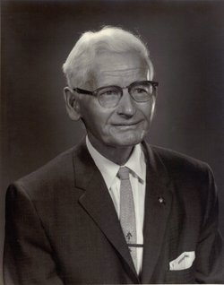
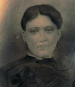
Rev Ephriam Jackson Pauley
| Birth | : | 27 Apr 1882 Turtle Creek, Boone County, West Virginia, USA |
| Death | : | 19 Oct 1967 Prescott, Yavapai County, Arizona, USA |
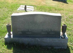
| Burial | : | Boone Memorial Park, Madison, Boone County, USA |
| Coordinate | : | 38.0484630, -81.8312900 |
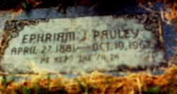
| Inscription | : | HE KEPT THE FAITH |
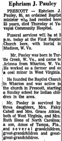
| Description | : | Rev. Ephriam Jackson Pauley was the founder of the Wharton Missionary Baptist Church and the leader of the first Boy Scout Troop in Boone County, West Virginia. He was the son of James Iverson and Rozenna (Miller) Pauley. On November 5, 1900 he married Emmaline Miller, daughter of Zatto and Minerva (Bell) Miller. Their marriage ceremony was officiated by Rev. Jacob Ball. The were members of the Olive Branch Missionary Baptist Church from childhood and young adulthood. ---------------------------------------------------- Ephriam J. Pauley, a resident of Prescott for over 20 years, died Thursday. October 19, in the Yavaapai Community Hospital. Services... Read More |
frequently asked questions (FAQ):
-
Where is Rev Ephriam Jackson Pauley's memorial?
Rev Ephriam Jackson Pauley's memorial is located at: Boone Memorial Park, Madison, Boone County, USA.
-
When did Rev Ephriam Jackson Pauley death?
Rev Ephriam Jackson Pauley death on 19 Oct 1967 in Prescott, Yavapai County, Arizona, USA
-
Where are the coordinates of the Rev Ephriam Jackson Pauley's memorial?
Latitude: 38.0484630
Longitude: -81.8312900
Family Members:
Parent
Spouse
Siblings
Children
Flowers:
Nearby Cemetories:
1. Boone Memorial Park
Madison, Boone County, USA
Coordinate: 38.0484630, -81.8312900
2. Allen Cemetery
Madison, Boone County, USA
Coordinate: 38.0569800, -81.8271800
3. Stollings Cemetery
Madison, Boone County, USA
Coordinate: 38.0586300, -81.8225200
4. Smoot Cemetery
Madison, Boone County, USA
Coordinate: 38.0594501, -81.8204875
5. South Madison Cemetery
Madison, Boone County, USA
Coordinate: 38.0583649, -81.8172455
6. Allen Cemetery
Low Gap, Boone County, USA
Coordinate: 38.0307190, -81.8331730
7. Hager Cemetery
Danville, Boone County, USA
Coordinate: 38.0644890, -81.8450120
8. Memory Gardens
Madison, Boone County, USA
Coordinate: 38.0281200, -81.8340700
9. Burwell Ballard Cemetery
Low Gap, Boone County, USA
Coordinate: 38.0280310, -81.8344330
10. Family Gardens Cemetery
Low Gap, Boone County, USA
Coordinate: 38.0272700, -81.8311300
11. Ira Price Cemetery
Madison, Boone County, USA
Coordinate: 38.0694450, -81.8247840
12. W. H. Turley Family Cemetery
Madison, Boone County, USA
Coordinate: 38.0699196, -81.8258286
13. Price Cemetery
Madison, Boone County, USA
Coordinate: 38.0703250, -81.8261080
14. Caldwell Cemetery
Madison, Boone County, USA
Coordinate: 38.0261490, -81.8324140
15. Price Cemetery
Danville, Boone County, USA
Coordinate: 38.0402985, -81.8022003
16. George Price Cemetery
Foch, Boone County, USA
Coordinate: 38.0404820, -81.8018790
17. Green Family Cemetery
Bandytown, Boone County, USA
Coordinate: 38.0581017, -81.8653030
18. Price Branch Graveyard
Danville, Boone County, USA
Coordinate: 38.0770400, -81.8303500
19. Miller Cemetery
Low Gap, Boone County, USA
Coordinate: 38.0193700, -81.8519700
20. Poor Farm Cemetery
Danville, Boone County, USA
Coordinate: 38.0814400, -81.8404630
21. Kimbler Cemetery
Boone County, USA
Coordinate: 38.0825960, -81.8466430
22. Danville Memorial Park
Danville, Boone County, USA
Coordinate: 38.0313750, -81.8721900
23. Smoot Branch Cemetery
Danville, Boone County, USA
Coordinate: 38.0844800, -81.8447010
24. Mullins Cemetery
Danville, Boone County, USA
Coordinate: 38.0856018, -81.8182983

