
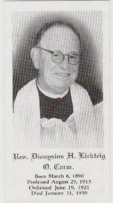
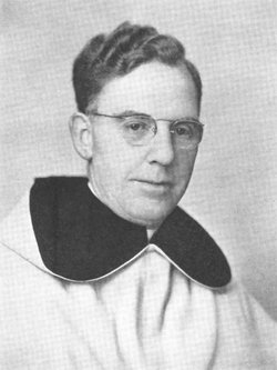
Rev Fr Dionysius Henry Gerard “Fr Dion” Lickteig
| Birth | : | 6 Mar 1890 |
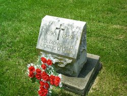
| Death | : | 31 Jan 1959 |
| Burial | : | Saint Boniface Catholic Cemetery, Scipio, Anderson County, USA |
| Coordinate | : | 38.3650017, -95.2109985 |
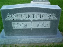
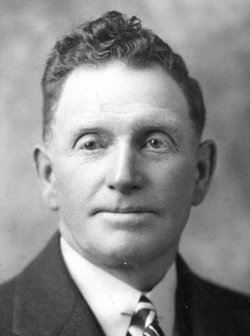
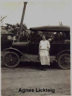
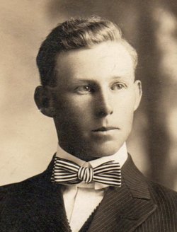
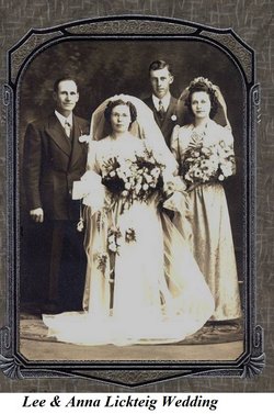
| Description | : | Brother of: George Herman Lickteig (Born: 1881) John Jacob Lickteig (Born: 1883) Mary Catherine "Sister Florentine" Lickteig (Born: 1886) Anna Adelaide "Sister Anastasia" Lickteig (Born: 1887) Mary Agnes Lickteig (Born: 1891) Louis Bernard Lickteig (Born: 1894) Dominic "Edward Jacob" Lickteig (Born: 1896) Leo "Lee" Joseph Lickteig (Born: 1899) Claude Amandus Lickteig (Born: 1905) RELIGION: Henry Gerard Lickteig was born on a farm near Scipio, KS on March 6, 1890. With his sisters and family he traveled to various places before returning to Scipio, KS in 1905. In September of 1911, Henry, who was now 21 years of age, joined his brother... Read More |
frequently asked questions (FAQ):
-
Where is Rev Fr Dionysius Henry Gerard “Fr Dion” Lickteig's memorial?
Rev Fr Dionysius Henry Gerard “Fr Dion” Lickteig's memorial is located at: Saint Boniface Catholic Cemetery, Scipio, Anderson County, USA.
-
When did Rev Fr Dionysius Henry Gerard “Fr Dion” Lickteig death?
Rev Fr Dionysius Henry Gerard “Fr Dion” Lickteig death on 31 Jan 1959 in
-
Where are the coordinates of the Rev Fr Dionysius Henry Gerard “Fr Dion” Lickteig's memorial?
Latitude: 38.3650017
Longitude: -95.2109985
Family Members:
Parent

Siblings
Flowers:


Nearby Cemetories:
1. Saint Boniface Catholic Cemetery
Scipio, Anderson County, USA
Coordinate: 38.3650017, -95.2109985
2. Beacon of Truth Cemetery
Richmond, Franklin County, USA
Coordinate: 38.3895300, -95.2470200
3. Berea Cemetery
Franklin County, USA
Coordinate: 38.3981018, -95.1849976
4. West Scipio Cemetery
Anderson County, USA
Coordinate: 38.3685989, -95.2660980
5. Richmond Cemetery
Richmond, Franklin County, USA
Coordinate: 38.4040500, -95.2670700
6. Judy Cemetery
Garnett, Anderson County, USA
Coordinate: 38.3093987, -95.1753006
7. Smith Cemetery
Richmond, Franklin County, USA
Coordinate: 38.4253700, -95.1785950
8. Greeley City Cemetery
Greeley, Anderson County, USA
Coordinate: 38.3752327, -95.1258011
9. Saint Johns Cemetery
Greeley, Anderson County, USA
Coordinate: 38.3546982, -95.1256027
10. Holy Angels Cemetery
Garnett, Anderson County, USA
Coordinate: 38.2974100, -95.2312200
11. Garnett Cemetery
Garnett, Anderson County, USA
Coordinate: 38.2961006, -95.2249985
12. Lanter Family Cemetery
Anderson County, USA
Coordinate: 38.3827100, -95.1059000
13. Sutton Valley Cemetery
Greeley, Anderson County, USA
Coordinate: 38.3311005, -95.1044006
14. Pottawatomie Baptist Mission Cemetery
Lane, Franklin County, USA
Coordinate: 38.4049500, -95.1028200
15. Baker Cemetery
Lane, Franklin County, USA
Coordinate: 38.4371986, -95.1333008
16. Sturgeon Cemetery
Lane, Franklin County, USA
Coordinate: 38.4376100, -95.1254100
17. Ashburn Family Cemetery
Garnett, Anderson County, USA
Coordinate: 38.2629600, -95.1872900
18. Morris Family Cemetery
Garnett, Anderson County, USA
Coordinate: 38.2434600, -95.1842400
19. Pleasantview Cemetery
Glenlock, Anderson County, USA
Coordinate: 38.3036003, -95.3503036
20. Needham Cemetery
Lane, Franklin County, USA
Coordinate: 38.4700012, -95.1231003
21. South Sugar Valley Cemetery
Garnett, Anderson County, USA
Coordinate: 38.2697890, -95.1021450
22. Ray Cemetery
Franklin County, USA
Coordinate: 38.4927140, -95.1754620
23. Myers Cemetery
Lane, Franklin County, USA
Coordinate: 38.4578820, -95.0935150
24. Baptist Cemetery
Anderson County, USA
Coordinate: 38.2592010, -95.3135986