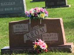
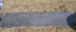
Rhea L. Denney Krom
| Birth | : | 22 Jun 1915 Huntington County, Indiana, USA |
| Death | : | 26 Sep 1962 Wabash County, Indiana, USA |
| Burial | : | Boughton Cemetery, Riley, Clinton County, USA |
| Coordinate | : | 42.9221992, -84.7052994 |
| Plot | : | Sec E, lot 328, sp 1 |
frequently asked questions (FAQ):
-
Where is Rhea L. Denney Krom's memorial?
Rhea L. Denney Krom's memorial is located at: Boughton Cemetery, Riley, Clinton County, USA.
-
When did Rhea L. Denney Krom death?
Rhea L. Denney Krom death on 26 Sep 1962 in Wabash County, Indiana, USA
-
Where are the coordinates of the Rhea L. Denney Krom's memorial?
Latitude: 42.9221992
Longitude: -84.7052994
Family Members:
Parent
Spouse
Siblings
Children
Flowers:
Nearby Cemetories:
1. Boughton Cemetery
Riley, Clinton County, USA
Coordinate: 42.9221992, -84.7052994
2. Saint Peter Lutheran Cemetery
Saint Johns, Clinton County, USA
Coordinate: 42.9230995, -84.7014008
3. Oak Ridge Cemetery
Saint Johns, Clinton County, USA
Coordinate: 42.9583015, -84.7043991
4. Saint Pauls Lutheran Cemetery
Westphalia, Clinton County, USA
Coordinate: 42.9505997, -84.7388992
5. Georgia Cemetery
Saint Johns, Clinton County, USA
Coordinate: 42.9439011, -84.6367035
6. Bray Cemetery
Saint Johns, Clinton County, USA
Coordinate: 42.9594002, -84.6414032
7. South Riley Township Cemetery
South Riley, Clinton County, USA
Coordinate: 42.8633003, -84.6414032
8. Saint Marys Cemetery
Westphalia, Clinton County, USA
Coordinate: 42.9277992, -84.8116989
9. Wacousta Cemetery
Wacousta, Clinton County, USA
Coordinate: 42.8206980, -84.6963820
10. Merrihew Cemetery
Olive Township, Clinton County, USA
Coordinate: 42.9294014, -84.5663986
11. Alward Cemetery
Olive Township, Clinton County, USA
Coordinate: 42.8925018, -84.5717010
12. Eddy Family Cemetery
Eagle, Clinton County, USA
Coordinate: 42.8287100, -84.7691800
13. North Eagle Cemetery
Eagle Township, Clinton County, USA
Coordinate: 42.8396988, -84.7956009
14. Frink Cemetery
Saint Johns, Clinton County, USA
Coordinate: 43.0162970, -84.6313980
15. Wager Cemetery
Fowler, Clinton County, USA
Coordinate: 43.0321999, -84.7343979
16. Niles Cemetery
Eagle, Clinton County, USA
Coordinate: 42.8121986, -84.7497025
17. Most Holy Trinity Cemetery
Fowler, Clinton County, USA
Coordinate: 43.0158005, -84.7975006
18. Saint Michael the Archangel Cemetery
DeWitt, Clinton County, USA
Coordinate: 42.8415490, -84.5880960
19. South Bingham Cemetery
Saint Johns, Clinton County, USA
Coordinate: 42.9580994, -84.5516968
20. Spaulding Cemetery
Pewamo, Ionia County, USA
Coordinate: 42.9693930, -84.8551150
21. Mount Calvary Cemetery
Pewamo, Ionia County, USA
Coordinate: 42.9893990, -84.8480988
22. DeWitt City Cemetery
DeWitt, Clinton County, USA
Coordinate: 42.8476219, -84.5676498
23. Pioneer Cemetery
Portland, Ionia County, USA
Coordinate: 42.9431000, -84.8769400
24. Gardner Cemetery
Bingham Township, Clinton County, USA
Coordinate: 43.0307999, -84.6003036


