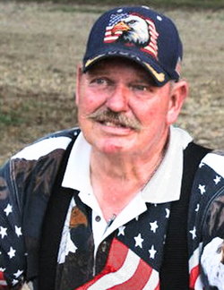
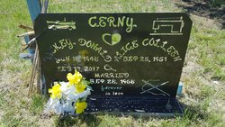
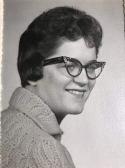
Rickey Donald “Rick” Cerny
| Birth | : | 18 Jun 1948 Gordon, Sheridan County, Nebraska, USA |
| Death | : | 17 Feb 2017 Sheridan County, Nebraska, USA |
| Burial | : | Amity Cemetery, Sheridan County, USA |
| Coordinate | : | 42.8036003, -102.4389038 |
| Description | : | Rickey Donald Cerny, 68, of Gordon died Friday, February 17, 2017 at his home surrounded by his loving family. He was born June 18, 1948, in Gordon Nebraska to Fred and Alma Cerny. He was raised in Rushville and graduated from Rushville High School. He went on to school at Milford, Nebraska and received his Associates of Applied Arts Degree in Auto Body Technology from Nebraska Vocational Technical School in 1969. On September 28th, 1968, he married the love of his life, Colleen Spencer in Lewellen, Nebraska. The couple made their home in Clinton Nebraska. He worked as a fabricator at Scott Manufacturers for... Read More |
frequently asked questions (FAQ):
-
Where is Rickey Donald “Rick” Cerny's memorial?
Rickey Donald “Rick” Cerny's memorial is located at: Amity Cemetery, Sheridan County, USA.
-
When did Rickey Donald “Rick” Cerny death?
Rickey Donald “Rick” Cerny death on 17 Feb 2017 in Sheridan County, Nebraska, USA
-
Where are the coordinates of the Rickey Donald “Rick” Cerny's memorial?
Latitude: 42.8036003
Longitude: -102.4389038
Family Members:
Parent
Siblings
Flowers:
Nearby Cemetories:
1. Amity Cemetery
Sheridan County, USA
Coordinate: 42.8036003, -102.4389038
2. Saint Marys Cemetery
Rushville, Sheridan County, USA
Coordinate: 42.7174988, -102.4436035
3. Fair View Cemetery
Rushville, Sheridan County, USA
Coordinate: 42.7155991, -102.4325027
4. Holly Cemetery
Rushville, Sheridan County, USA
Coordinate: 42.8575120, -102.5370990
5. Saint Aloysius Cemetery
Sheridan County, USA
Coordinate: 42.9015500, -102.4025500
6. Novotny Cemetery
Hay Springs, Sheridan County, USA
Coordinate: 42.7742004, -102.5963974
7. Bethel Cemetery
Sheridan County, USA
Coordinate: 42.9011002, -102.3208008
8. Bomar Cemetery
Hay Springs, Sheridan County, USA
Coordinate: 42.8062000, -102.6459600
9. Abold Family Cemetery
Rushville, Sheridan County, USA
Coordinate: 42.8863500, -102.6158000
10. Gordon Cemetery
Gordon, Sheridan County, USA
Coordinate: 42.7858009, -102.2102966
11. Mount Hope Cemetery
Gordon, Sheridan County, USA
Coordinate: 42.7113991, -102.2241974
12. Preble Cemetery
Sheridan County, USA
Coordinate: 42.6504000, -102.5765000
13. White Clay Cemetery
Rushville, Sheridan County, USA
Coordinate: 42.9732820, -102.5667230
14. Holy Cross Cemetery
Pine Ridge, Oglala Lakota County, USA
Coordinate: 43.0194016, -102.5503006
15. Pine Ridge Presbyterian Cemetery
Pine Ridge, Oglala Lakota County, USA
Coordinate: 43.0235200, -102.5506200
16. St. Mary's Cemetery
Hay Springs, Sheridan County, USA
Coordinate: 42.6721992, -102.7035980
17. Hay Springs Cemetery
Hay Springs, Sheridan County, USA
Coordinate: 42.6702995, -102.7033005
18. Wolf Creek Community Cemetery
Oglala Lakota County, USA
Coordinate: 43.0405750, -102.3966490
19. Beaver Valley Cemetery
Sheridan County, USA
Coordinate: 42.8880997, -102.7517014
20. Highland Cemetery
Hay Springs, Sheridan County, USA
Coordinate: 42.7145500, -102.7727500
21. Antelope Cemetery
Hay Springs, Sheridan County, USA
Coordinate: 42.7144970, -102.7727290
22. Dane Cemetery
Cherry County, USA
Coordinate: 42.7924300, -102.0824700
23. Davis Cemetery
Rushville, Sheridan County, USA
Coordinate: 42.5421000, -102.4118800
24. Spotted Bear Family Cemetery
Denby, Oglala Lakota County, USA
Coordinate: 43.0608200, -102.3376600

