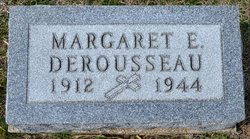
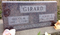
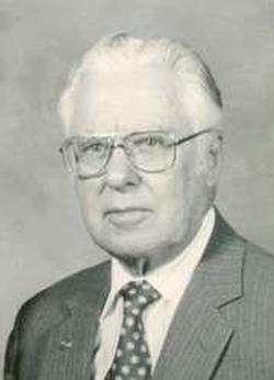
Rita E Derousseau Sorell
| Birth | : | 9 Feb 1923 Cloud County, Kansas, USA |
| Death | : | 17 Sep 2003 Wichita, Sedgwick County, Kansas, USA |
| Burial | : | Saint Concordia Cemetery, Concordia, Cloud County, USA |
| Coordinate | : | 39.5593800, -97.6503100 |
| Plot | : | Block 219.01 |
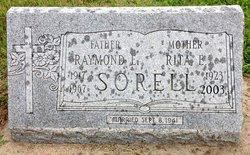
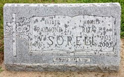
| Inscription | : | Mother Married Sep 8, 1941 |
| Description | : | Salina Journal Sept. 19, 2003 WICHITA — Rita E. Sorell, 80, Wichita, formerly of Clyde, died Wednesday Sept. 17, 2003. Mrs. Sorell was born Rita Derousseau on Feb. 9, 1923, in rural Cloud County. She was a homemaker. She was preceded in death by her husband, Raymond; a grandchild; and a great-grandchild. Survivors include a son, Richard of Wichita; a daughter, Carolyn Desilet of Wichita; a sister, Helen Girard of Concordia; a brother, Alphonse Derousseau of Clyde; six grandchildren; and 11 great-grandchildren. The funeral will be at 10 a.m. Saturday at St. John the Baptist Catholic Church, Clyde. Burial will be in St.... Read More |
frequently asked questions (FAQ):
-
Where is Rita E Derousseau Sorell's memorial?
Rita E Derousseau Sorell's memorial is located at: Saint Concordia Cemetery, Concordia, Cloud County, USA.
-
When did Rita E Derousseau Sorell death?
Rita E Derousseau Sorell death on 17 Sep 2003 in Wichita, Sedgwick County, Kansas, USA
-
Where are the coordinates of the Rita E Derousseau Sorell's memorial?
Latitude: 39.5593800
Longitude: -97.6503100
Family Members:
Parent
Spouse
Siblings
Flowers:
Nearby Cemetories:
1. Saint Concordia Cemetery
Concordia, Cloud County, USA
Coordinate: 39.5593800, -97.6503100
2. Nazareth Convent Cemetery
Concordia, Cloud County, USA
Coordinate: 39.5614000, -97.6612000
3. Pleasant Hill Cemetery
Concordia, Cloud County, USA
Coordinate: 39.5583000, -97.6639023
4. Pleasant Hill Cemetery
Huscher, Cloud County, USA
Coordinate: 39.5093994, -97.6292038
5. Gotland Cemetery
Sibley Township, Cloud County, USA
Coordinate: 39.6091995, -97.6125031
6. Hefner Cemetery
Cloud County, USA
Coordinate: 39.5393400, -97.7218400
7. Sibley Cemetery
Sibley Township, Cloud County, USA
Coordinate: 39.6096992, -97.6908035
8. Rice Cemetery
Rice, Cloud County, USA
Coordinate: 39.5614014, -97.5552979
9. West Branch Cemetery
Buffalo Township, Cloud County, USA
Coordinate: 39.5391998, -97.7457962
10. Saron Lutheran Cemetery
Sibley Township, Cloud County, USA
Coordinate: 39.6385994, -97.6511002
11. Murdock Family Cemetery
Cloud County, USA
Coordinate: 39.6386400, -97.6504800
12. Nelson Family Cemetery
Sibley Township, Cloud County, USA
Coordinate: 39.6366600, -97.7010600
13. Nelson Cemetery
Rice, Cloud County, USA
Coordinate: 39.5257988, -97.5410995
14. Wilcox Cemetery
Cloud County, USA
Coordinate: 39.4925003, -97.7313995
15. Ezra Adkins Gravesite
Cloud County, USA
Coordinate: 39.6234500, -97.7372900
16. Fairview Cemetery
Buffalo Township, Cloud County, USA
Coordinate: 39.5889015, -97.7724991
17. Minersville Cemetery
Talmo, Republic County, USA
Coordinate: 39.6568330, -97.6229250
18. Kindel Cemetery
Center Township, Cloud County, USA
Coordinate: 39.4519005, -97.6464005
19. Dutton Family Cemetery
Sibley Township, Cloud County, USA
Coordinate: 39.6419440, -97.7430560
20. Green Mound Cemetery
Rice, Cloud County, USA
Coordinate: 39.5248450, -97.5081630
21. Walnut Grove Cemetery
Cloud County, USA
Coordinate: 39.5699997, -97.4993973
22. Hollis Cemetery
Cloud County, USA
Coordinate: 39.6383018, -97.5361023
23. Hall Cemetery
Cloud County, USA
Coordinate: 39.4455986, -97.7033005
24. Zion Cemetery
Agenda, Republic County, USA
Coordinate: 39.6749992, -97.5939026

