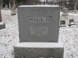
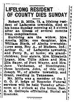
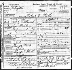
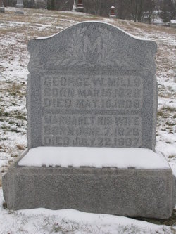
Robert B Mills
| Birth | : | 3 May 1851 Roanoke, Huntington County, Indiana, USA |
| Death | : | 22 Aug 1926 Allen County, Indiana, USA |
| Burial | : | Oaklawn Memorial Park, Oakdale, Stanislaus County, USA |
| Coordinate | : | 37.7711945, -120.8486862 |
| Plot | : | J 40 |
| Description | : | cause of death: myocarditis source: Allen County, IN Death Records |
frequently asked questions (FAQ):
-
Where is Robert B Mills's memorial?
Robert B Mills's memorial is located at: Oaklawn Memorial Park, Oakdale, Stanislaus County, USA.
-
When did Robert B Mills death?
Robert B Mills death on 22 Aug 1926 in Allen County, Indiana, USA
-
Where are the coordinates of the Robert B Mills's memorial?
Latitude: 37.7711945
Longitude: -120.8486862
Family Members:
Parent
Spouse
Siblings
Children
Flowers:
Nearby Cemetories:
1. Oaklawn Memorial Park
Oakdale, Stanislaus County, USA
Coordinate: 37.7711945, -120.8486862
2. Oakdale Citizens Cemetery
Oakdale, Stanislaus County, USA
Coordinate: 37.7624600, -120.8388800
3. Langworth Cemetery
Oakdale, Stanislaus County, USA
Coordinate: 37.7580986, -120.8957977
4. Valley Home Memorial Park
Oakdale, Stanislaus County, USA
Coordinate: 37.8275528, -120.9333267
5. Burwood Cemetery
Escalon, San Joaquin County, USA
Coordinate: 37.7616997, -120.9593964
6. Saint Joseph Cemetery
Eugene, Stanislaus County, USA
Coordinate: 37.8941994, -120.8696976
7. Martin Cemetery
Waterford, Stanislaus County, USA
Coordinate: 37.6684360, -120.7582160
8. Knights Ferry Cemetery
Stanislaus County, USA
Coordinate: 37.8224907, -120.6830750
9. William Knight Burial Site
Knights Ferry, Stanislaus County, USA
Coordinate: 37.8189200, -120.6729500
10. Lakewood Memorial Park
Hughson, Stanislaus County, USA
Coordinate: 37.6199760, -120.8975983
11. Modesto County Cemetery
Modesto, Stanislaus County, USA
Coordinate: 37.6492400, -120.9813800
12. Saint Stanislaus Catholic Cemetery
Modesto, Stanislaus County, USA
Coordinate: 37.6473610, -120.9808440
13. Acacia Memorial Park
Modesto, Stanislaus County, USA
Coordinate: 37.6481080, -120.9836610
14. Modesto Pioneer Cemetery
Modesto, Stanislaus County, USA
Coordinate: 37.6473350, -120.9829040
15. Modesto Citizens Cemetery
Modesto, Stanislaus County, USA
Coordinate: 37.6472930, -120.9845570
16. Old Brooks Farm Cemetery
Farmington, San Joaquin County, USA
Coordinate: 37.9175800, -120.9440300
17. Saint John's Catholic Cemetery
Escalon, San Joaquin County, USA
Coordinate: 37.7994537, -121.0705185
18. Telegraph City Cemetery
Telegraph City, Calaveras County, USA
Coordinate: 37.9290460, -120.7302490
19. Wood Colony Cemetery
Salida, Stanislaus County, USA
Coordinate: 37.6893730, -121.0682144
20. Good Shepherd Catholic Cemetery
Modesto, Stanislaus County, USA
Coordinate: 37.6853130, -121.0672890
21. Highland View Memorial Gardens
Farmington, San Joaquin County, USA
Coordinate: 37.9242935, -121.0008621
22. Beardslee Family Cemetery
Telegraph City, Calaveras County, USA
Coordinate: 37.9423190, -120.7265960
23. Ceres Memorial Park
Ceres, Stanislaus County, USA
Coordinate: 37.5958214, -120.9634399
24. Maxwell Cemetery
Stanislaus County, USA
Coordinate: 37.7360000, -120.5923000

