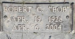
Robert C. “Bob” Connet
| Birth | : | 19 Apr 1928 Illinois, USA |
| Death | : | 6 Apr 2004 Denver, Denver County, Colorado, USA |
| Burial | : | Springdale Cemetery, Springdale, Cedar County, USA |
| Coordinate | : | 41.6786003, -91.2581024 |
| Description | : | R.C. "Bob" Connet, 75, of Littleton, Colo., formerly of Cedar Rapids, died of kidney failure Tuesday, April 6, 2004, in Porter Hospice, Denver, Colo. The family will gather and greet friends at the Presidential Suites of the Crown Center on Friday from 6 to 8 p.m. Survivors include his wife, Ellen; and children, Mike Connet of Vienna, Va., Dawn Connet of West Des Moines, Marye McLaud of Davenport, Jodi James of Parker, Colo., and Jeff McLaud of Cedar Rapids. Also surviving are grandchildren, Paul, Evan, Grace, Ryan, Mallory, Kera and Krissy; and his favorite companion, Cassie. He was preceded in death by his... Read More |
frequently asked questions (FAQ):
-
Where is Robert C. “Bob” Connet's memorial?
Robert C. “Bob” Connet's memorial is located at: Springdale Cemetery, Springdale, Cedar County, USA.
-
When did Robert C. “Bob” Connet death?
Robert C. “Bob” Connet death on 6 Apr 2004 in Denver, Denver County, Colorado, USA
-
Where are the coordinates of the Robert C. “Bob” Connet's memorial?
Latitude: 41.6786003
Longitude: -91.2581024
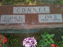
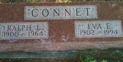
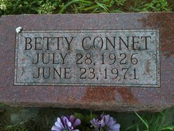
Family Members:
Parent
Spouse
Flowers:
Nearby Cemetories:
1. Springdale Cemetery
Springdale, Cedar County, USA
Coordinate: 41.6786003, -91.2581024
2. North Liberty Cemetery
Springdale, Cedar County, USA
Coordinate: 41.6852989, -91.2292023
3. Pee Dee Cemetery
Cedar County, USA
Coordinate: 41.6699982, -91.2142029
4. Hickory Grove Cemetery
Cedar County, USA
Coordinate: 41.6637000, -91.3073000
5. Chamness Burial Plot
Springdale, Cedar County, USA
Coordinate: 41.6597351, -91.3182108
6. Saint Joseph Cemetery
Cedar Valley, Cedar County, USA
Coordinate: 41.7295000, -91.2667000
7. Burnett Burial Site
Rochester, Cedar County, USA
Coordinate: 41.6680782, -91.1834911
8. Saint Bernadette Catholic Church
West Branch, Cedar County, USA
Coordinate: 41.6755750, -91.3396070
9. Honey Grove Cemetery
Cedar County, USA
Coordinate: 41.7158012, -91.3266983
10. Friends Village Cemetery
West Branch, Cedar County, USA
Coordinate: 41.6732000, -91.3470000
11. West Branch Cemetery
West Branch, Cedar County, USA
Coordinate: 41.6765000, -91.3515000
12. Herbert Hoover National Historic Site
West Branch, Cedar County, USA
Coordinate: 41.6681500, -91.3519900
13. Howard Cemetery
Plato, Cedar County, USA
Coordinate: 41.7486303, -91.2918299
14. Dunfee Burial Site
Rochester, Cedar County, USA
Coordinate: 41.6266900, -91.1834904
15. Downey Cemetery
Downey, Cedar County, USA
Coordinate: 41.6119003, -91.3182983
16. Mount Zion Church Cemetery
Cedar County, USA
Coordinate: 41.7343000, -91.1790000
17. West Bethel Cemetery
Cedar County, USA
Coordinate: 41.6502991, -91.1556015
18. United Brethren Cemetery
Cedar County, USA
Coordinate: 41.7445000, -91.3285000
19. North Prairie Cemetery
West Liberty, Muscatine County, USA
Coordinate: 41.5924988, -91.2694016
20. Goodale Cemetery
Tipton, Cedar County, USA
Coordinate: 41.7219380, -91.1567400
21. Woodbridge Cemetery
Buchanan, Cedar County, USA
Coordinate: 41.7644005, -91.2294006
22. Rochester Cemetery
Rochester, Cedar County, USA
Coordinate: 41.6656200, -91.1395800
23. Kizer-Burns Cemetery
Tipton, Cedar County, USA
Coordinate: 41.7559130, -91.1854800
24. Oasis Cemetery
Oasis, Johnson County, USA
Coordinate: 41.7005997, -91.3858032


