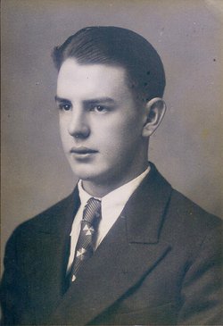
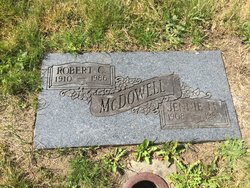
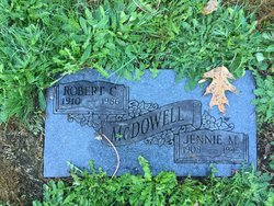
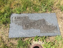
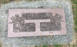
Robert C “Rab” McDowell
| Birth | : | 6 Apr 1910 Mineral, Cherokee County, Kansas, USA |
| Death | : | 16 Oct 1986 Buckley, Pierce County, Washington, USA |
| Burial | : | St. John The Baptist Churchyard, Garboldisham, Breckland Borough, England |
| Coordinate | : | 52.3961130, 0.9444950 |
| Description | : | Ashes on the grave of his father |
frequently asked questions (FAQ):
-
Where is Robert C “Rab” McDowell's memorial?
Robert C “Rab” McDowell's memorial is located at: St. John The Baptist Churchyard, Garboldisham, Breckland Borough, England.
-
When did Robert C “Rab” McDowell death?
Robert C “Rab” McDowell death on 16 Oct 1986 in Buckley, Pierce County, Washington, USA
-
Where are the coordinates of the Robert C “Rab” McDowell's memorial?
Latitude: 52.3961130
Longitude: 0.9444950
Family Members:
Parent
Spouse
Siblings
Flowers:
Nearby Cemetories:
1. St. John The Baptist Churchyard
Garboldisham, Breckland Borough, England
Coordinate: 52.3961130, 0.9444950
2. St Andrew's Churchyard
Blo' Norton, Breckland Borough, England
Coordinate: 52.3784830, 0.9549700
3. Hopton Methodist Churchyard
Hopton, St Edmundsbury Borough, England
Coordinate: 52.3737430, 0.9253540
4. All Saints Churchyard
Hopton, St Edmundsbury Borough, England
Coordinate: 52.3730420, 0.9275760
5. St Nicholas Churchyard
North Lopham, Breckland Borough, England
Coordinate: 52.4029430, 0.9920510
6. Methodist Churchyard
North Lopham, Breckland Borough, England
Coordinate: 52.4053630, 0.9920680
7. All Saints Churchyard
Knettishall, St Edmundsbury Borough, England
Coordinate: 52.3849000, 0.8974000
8. St Andrew Churchyard
South Lopham, Breckland Borough, England
Coordinate: 52.3957830, 0.9969650
9. St Nicholas Church
Thelnetham, St Edmundsbury Borough, England
Coordinate: 52.3656000, 0.9635000
10. St Mary Churchyard
Market Weston, St Edmundsbury Borough, England
Coordinate: 52.3649970, 0.9223330
11. St Peter's Churchyard
Riddlesworth, Breckland Borough, England
Coordinate: 52.3941990, 0.8888780
12. Market Weston War Memorial
Market Weston, St Edmundsbury Borough, England
Coordinate: 52.3648470, 0.9225730
13. East Harling Cemetery
East Harling, Breckland Borough, England
Coordinate: 52.4336498, 0.9346589
14. St Mary Churchyard
Coney Weston, St Edmundsbury Borough, England
Coordinate: 52.3681000, 0.8946000
15. St Peter and St Paul Churchyard
East Harling, Breckland Borough, England
Coordinate: 52.4373860, 0.9304050
16. St Peter & St Paul Church
Norwich, City of Norwich, England
Coordinate: 52.4408990, 0.9299175
17. St. Mary's Churchyard
Hinderclay, Mid Suffolk District, England
Coordinate: 52.3521190, 0.9749790
18. The Chapel Graveyard
Kenninghall, Breckland Borough, England
Coordinate: 52.4359530, 0.9961130
19. Saint Mary Churchyard
Kenninghall, Breckland Borough, England
Coordinate: 52.4336980, 1.0010730
20. Barningham Cemetery
Barningham, St Edmundsbury Borough, England
Coordinate: 52.3553880, 0.8888050
21. St Andrews Barningham
Barningham, St Edmundsbury Borough, England
Coordinate: 52.3547760, 0.8879500
22. St Andrew Churchyard
Fersfield, South Norfolk District, England
Coordinate: 52.4043450, 1.0351310
23. St. Mary The Virgin Churchyard
Bridgham, Breckland Borough, England
Coordinate: 52.4355480, 0.8783780
24. St. Mary the Virgin Churchyard
Redgrave, Mid Suffolk District, England
Coordinate: 52.3632900, 1.0196800

