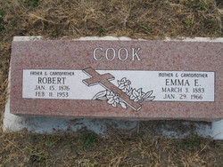
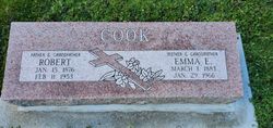
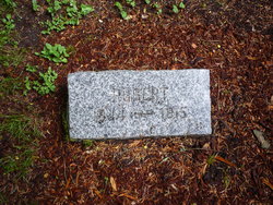
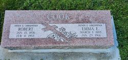
Robert Cook
| Birth | : | 15 Jan 1876 Arthur, Wellington County, Ontario, Canada |
| Death | : | 11 Feb 1953 Port Townsend, Jefferson County, Washington, USA |
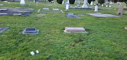
| Burial | : | Maple Grove Cemetery, Dundalk, Grey County, Canada |
| Coordinate | : | 44.1599000, -80.4026800 |
| Description | : | Cook Robert - also 2/11/1953 2/19/1953 Obit C-21 Cook Robert - also 2/11/1953 2/20/1953 Obit-jch C-184 obit - Jefferson Co., Hist. Soc. |
frequently asked questions (FAQ):
-
Where is Robert Cook's memorial?
Robert Cook's memorial is located at: Maple Grove Cemetery, Dundalk, Grey County, Canada.
-
When did Robert Cook death?
Robert Cook death on 11 Feb 1953 in Port Townsend, Jefferson County, Washington, USA
-
Where are the coordinates of the Robert Cook's memorial?
Latitude: 44.1599000
Longitude: -80.4026800
Family Members:
Parent
Spouse
Siblings
Children
Flowers:
Nearby Cemetories:
1. Maple Grove Cemetery
Dundalk, Grey County, Canada
Coordinate: 44.1599000, -80.4026800
2. Bethel United Church Cemetery
Southgate Township, Grey County, Canada
Coordinate: 44.1736200, -80.4623800
3. Ventry Cemetery
Ventry, Grey County, Canada
Coordinate: 44.1187000, -80.4503000
4. Inistioge Cemetery
Proton Township, Grey County, Canada
Coordinate: 44.2106275, -80.4503259
5. Salem Cemetery
Proton Township, Grey County, Canada
Coordinate: 44.1554600, -80.5472200
6. Esplin Cemetery
Grey County, Canada
Coordinate: 44.0992580, -80.5435410
7. Saint Paul's Anglican Cemetery
Melancthon, Dufferin County, Canada
Coordinate: 44.1028300, -80.2559300
8. Melancthon United Church Cemetery
Melancthon, Dufferin County, Canada
Coordinate: 44.1026710, -80.2557530
9. Walker's Cemetery
Southgate Township, Grey County, Canada
Coordinate: 44.0539180, -80.4873860
10. Evergreen Cemetery
Priceville, Grey County, Canada
Coordinate: 44.1979470, -80.5646170
11. South Line Union Cemetery
Badjeros, Grey County, Canada
Coordinate: 44.2562700, -80.2834900
12. Amos Presbyterian Cemetery
Dromore, Grey County, Canada
Coordinate: 44.1492600, -80.5817900
13. Swinton Park Cemetery
Swinton Park, Grey County, Canada
Coordinate: 44.1492600, -80.5817900
14. Saint Patrick's Cemetery
Southgate Township, Grey County, Canada
Coordinate: 44.0381750, -80.4721830
15. Old Durham Road Pioneer Cemetery
Priceville, Grey County, Canada
Coordinate: 44.2142800, -80.5784900
16. Hornings Mills Cemetery
Horning's Mills, Dufferin County, Canada
Coordinate: 44.1574010, -80.2063900
17. Flesherton Cemetery
Flesherton, Grey County, Canada
Coordinate: 44.2577700, -80.5448900
18. Spring Valley Cemetery
Horning's Mills, Dufferin County, Canada
Coordinate: 44.1466460, -80.2026950
19. Maxwell Pioneer Cemetery
Maxwell, Grey County, Canada
Coordinate: 44.3052300, -80.4163500
20. Maxwell Presbyterian Cemetery
Osprey Township, Grey County, Canada
Coordinate: 44.3062890, -80.3964530
21. Saint Mary's Anglican Cemetery
Maxwell, Grey County, Canada
Coordinate: 44.3090720, -80.3986110
22. Maxwell Union Cemetery
Maxwell, Grey County, Canada
Coordinate: 44.3108400, -80.3926500
23. Osprey Independent Old Order Mennonite Cemetery
Osprey Township, Grey County, Canada
Coordinate: 44.2880780, -80.2888780
24. Shelburne Cemetery
Shelburne, Dufferin County, Canada
Coordinate: 44.0927010, -80.2090378

