
| Birth | : | 25 Feb 1822 Augusta County, Virginia, USA |
| Death | : | 12 Apr 1899 Independence, Montgomery County, Kansas, USA |
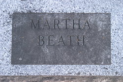
| Burial | : | Le Hunt Cemetery, Montgomery County, USA |
| Coordinate | : | 37.2744300, -95.7586200 |
| Description | : | ROBERT CRAWFORD BEATHE IS MY GREAT GRANDFATHER -- R. A. PARKER FATALLY HURT -- ROBERT BEATH Dr. Thornton of Radical City was in town today and informs us that Mr. Robert Beath, who lived one mile west of Radical, was probably fatally injured by a fall Sunday night. Mr. Beath is upwards of seventy years of age and was one of the early settlers of the county. His family, at home, consists of his wife and two sons. Mr. Beath was sleeping alone in an upstairs room to which there was a front door without... Read More |
frequently asked questions (FAQ):
-
Where is Robert Crawford “Bob” Beathe's memorial?
Robert Crawford “Bob” Beathe's memorial is located at: Le Hunt Cemetery, Montgomery County, USA.
-
When did Robert Crawford “Bob” Beathe death?
Robert Crawford “Bob” Beathe death on 12 Apr 1899 in Independence, Montgomery County, Kansas, USA
-
Where are the coordinates of the Robert Crawford “Bob” Beathe's memorial?
Latitude: 37.2744300
Longitude: -95.7586200
Family Members:
Parent

Spouse
Siblings
Children
Flowers:


Nearby Cemetories:
1. Le Hunt Cemetery
Montgomery County, USA
Coordinate: 37.2744300, -95.7586200
2. Radical Cemetery
Montgomery County, USA
Coordinate: 37.2882996, -95.7416992
3. Calvary Cemetery
Independence, Montgomery County, USA
Coordinate: 37.2486000, -95.7043991
4. Mount Hope Cemetery
Independence, Montgomery County, USA
Coordinate: 37.2413300, -95.7060050
5. Krone Cemetery
Montgomery County, USA
Coordinate: 37.3302400, -95.7494600
6. Quaker Cemetery
Elk City, Montgomery County, USA
Coordinate: 37.2395900, -95.8243400
7. Simpson Cemetery
Elk City, Montgomery County, USA
Coordinate: 37.3269005, -95.8186035
8. Saint Andrews Cemetery
Independence, Montgomery County, USA
Coordinate: 37.2566986, -95.6658020
9. Parker Cemetery
Montgomery County, USA
Coordinate: 37.2630997, -95.8572006
10. Choteau Cemetery
Independence, Montgomery County, USA
Coordinate: 37.3194700, -95.6746700
11. Highland Cemetery
Montgomery County, USA
Coordinate: 37.2092018, -95.8283005
12. Farm Ridge Cemetery
Elk City, Montgomery County, USA
Coordinate: 37.3560982, -95.8019028
13. Bethel Cemetery
Independence, Montgomery County, USA
Coordinate: 37.2761002, -95.6457977
14. Pratt Cemetery
Montgomery County, USA
Coordinate: 37.2324982, -95.6557999
15. Callahan Cemetery
Elk City, Montgomery County, USA
Coordinate: 37.3626400, -95.8113200
16. Oak Hill Cemetery
Elk City, Montgomery County, USA
Coordinate: 37.2907982, -95.8930969
17. Woodring Cemetery
Elk City, Montgomery County, USA
Coordinate: 37.2696991, -95.9011002
18. Carson Cemetery
Elk City, Montgomery County, USA
Coordinate: 37.2843500, -95.9099000
19. Montgomery County Poor Farm Cemetery
Liberty, Montgomery County, USA
Coordinate: 37.1888590, -95.6493690
20. White Cemetery
Montgomery County, USA
Coordinate: 37.3671989, -95.8641968
21. Brock Cemetery
Elk City, Montgomery County, USA
Coordinate: 37.2657500, -95.9188800
22. Harmony Cemetery
Cherryvale, Montgomery County, USA
Coordinate: 37.2324982, -95.5950012
23. Rutland Cemetery
Independence, Montgomery County, USA
Coordinate: 37.1963997, -95.9008026
24. Pleasant Dale Cemetery
Cherryvale, Montgomery County, USA
Coordinate: 37.3139700, -95.5860700