| Birth | : | 10 Aug 1924 Cuming County, Nebraska, USA |
| Death | : | 14 May 2008 West Point, Cuming County, Nebraska, USA |
| Burial | : | Pyrmont Cemetery, Pyrmont, Montgomery County, USA |
| Coordinate | : | 39.8157997, -84.4618988 |
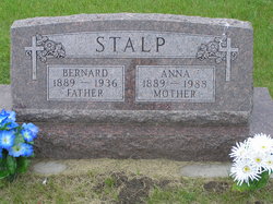
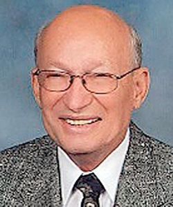
| Description | : | Son of Bernard and Anna Uhing Stalp. He attended elementary and high school at Guardian Angels Catholic School in West Point. He served in the US Army during the occupation of Japan during WWII. After his discharge, Bob returned to West Point where he engaged in farming and cattle feeding. On February 18, 1950, he married Illa Tillman at St. Rose of Lima Catholic Church in Hooper. Following marriage, he was worked in construction with his brother, Hank, later founding Nebraska Sand and Gravel, which their son, Tim, now manages. Robert was a member of Emmanuel Fellowship Church in Omaha, the Gideons,... Read More |
frequently asked questions (FAQ):
-
Where is Robert John “Bob” Stalp's memorial?
Robert John “Bob” Stalp's memorial is located at: Pyrmont Cemetery, Pyrmont, Montgomery County, USA.
-
When did Robert John “Bob” Stalp death?
Robert John “Bob” Stalp death on 14 May 2008 in West Point, Cuming County, Nebraska, USA
-
Where are the coordinates of the Robert John “Bob” Stalp's memorial?
Latitude: 39.8157997
Longitude: -84.4618988
Family Members:
Parent
Spouse
Siblings
Flowers:
Nearby Cemetories:
1. Pyrmont Cemetery
Pyrmont, Montgomery County, USA
Coordinate: 39.8157997, -84.4618988
2. Hansbarger Family Cemetery
Pyrmont, Montgomery County, USA
Coordinate: 39.8085360, -84.4427630
3. Shiloh Lutheran Cemetery
Twin Township, Preble County, USA
Coordinate: 39.8096230, -84.4839370
4. Hook Family Cemetery
Pyrmont, Montgomery County, USA
Coordinate: 39.8066420, -84.4398770
5. Saint Johns Evangelical Lutheran Cemetery
Lewisburg, Preble County, USA
Coordinate: 39.8385620, -84.4880680
6. Bachman Cemetery
Bachman, Montgomery County, USA
Coordinate: 39.8613620, -84.4602300
7. Landis Cemetery
Brookville, Montgomery County, USA
Coordinate: 39.8180540, -84.3987510
8. Providence Lutheran Cemetery
Montgomery County, USA
Coordinate: 39.8041760, -84.3953630
9. Arlington Cemetery
Brookville, Montgomery County, USA
Coordinate: 39.8652992, -84.4297028
10. Parish Cemetery
Arlington, Montgomery County, USA
Coordinate: 39.8660660, -84.4297028
11. Kreider Cemetery
Montgomery County, USA
Coordinate: 39.8414400, -84.3871700
12. Pleasant Hill Cemetery
Brookville, Montgomery County, USA
Coordinate: 39.8031006, -84.3807983
13. Lower Lewisburg Cemetery
Lewisburg, Preble County, USA
Coordinate: 39.8453331, -84.5369339
14. McNelly Cemetery
Hays Corner, Montgomery County, USA
Coordinate: 39.7962860, -84.3791570
15. Warvel Cemetery
New Lebanon, Montgomery County, USA
Coordinate: 39.7494010, -84.4492440
16. Pfoutz Cemetery
New Lebanon, Montgomery County, USA
Coordinate: 39.7658330, -84.4003330
17. Roselawn Cemetery
Lewisburg, Preble County, USA
Coordinate: 39.8518982, -84.5428009
18. Arnold Cemetery
Brookville, Montgomery County, USA
Coordinate: 39.8317216, -84.3705022
19. Sugar Grove Cemetery
West Alexandria, Preble County, USA
Coordinate: 39.7668991, -84.5318985
20. Old Presbyterian Cemetery
New Lexington, Preble County, USA
Coordinate: 39.7619971, -84.5307839
21. Hart Family Cemetery
New Lexington, Preble County, USA
Coordinate: 39.7851050, -84.5518290
22. Royal Oak Memorial Gardens
Brookville, Montgomery County, USA
Coordinate: 39.8698349, -84.3897476
23. Hay Cemetery
Trotwood, Montgomery County, USA
Coordinate: 39.7916220, -84.3653440
24. Miller Cemetery
Johnsville, Montgomery County, USA
Coordinate: 39.7370580, -84.4524160


