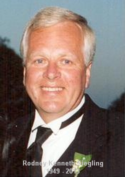
Rodney Kenneth “Rod” Siegling
| Birth | : | 1 Dec 1949 Redfield, Spink County, South Dakota, USA |
| Death | : | 3 Jun 2013 Omaha, Douglas County, Nebraska, USA |
| Burial | : | Greenlawn Cemetery, Redfield, Spink County, USA |
| Coordinate | : | 44.8857994, -98.5164032 |
| Plot | : | Division I, Block 005, Grave 093 |
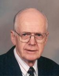
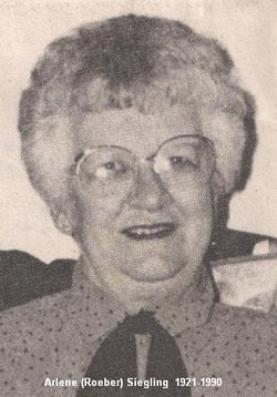
| Description | : | Rodney Kenneth Siegling December 1, 1949 - June 3, 2013 Rod Siegling, 63, of Redfield, SD died Monday June 3, 2013 at the University of Nebraska Medical Center in Omaha, NE. He was born December 1, 1949 to Kenneth and Arlene (Roeber) Siegling in Redfield. Rod lived in Burdette, SD and attended Burdette Country School until the 4th grade, when his family moved to Redfield. He graduated from Redfield High School, attended Northern State University, and graduated from the Brown Institute of Broadcasting in Minneapolis, MN. Rod married Robbi Robertson on September 25, 1982. To this union of over 30 years... Read More |
frequently asked questions (FAQ):
-
Where is Rodney Kenneth “Rod” Siegling's memorial?
Rodney Kenneth “Rod” Siegling's memorial is located at: Greenlawn Cemetery, Redfield, Spink County, USA.
-
When did Rodney Kenneth “Rod” Siegling death?
Rodney Kenneth “Rod” Siegling death on 3 Jun 2013 in Omaha, Douglas County, Nebraska, USA
-
Where are the coordinates of the Rodney Kenneth “Rod” Siegling's memorial?
Latitude: 44.8857994
Longitude: -98.5164032
Family Members:
Parent
Flowers:
Nearby Cemetories:
1. Greenlawn Cemetery
Redfield, Spink County, USA
Coordinate: 44.8857994, -98.5164032
2. Saint Bernard Cemetery
Redfield, Spink County, USA
Coordinate: 44.8857994, -98.5139008
3. South Dakota Developmental Center Cemetery
Spink County, USA
Coordinate: 44.8880120, -98.5234880
4. Ashton Cemetery
Ashton, Spink County, USA
Coordinate: 44.9914017, -98.5224991
5. Poor Farm Cemetery
Frankfort, Spink County, USA
Coordinate: 44.8836350, -98.3591071
6. Crandon Cemetery
Spink County, USA
Coordinate: 44.7825012, -98.4436035
7. Cottonwood Cemetery
Redfield, Spink County, USA
Coordinate: 44.8078800, -98.6579600
8. Tulare Cemetery
Tulare, Spink County, USA
Coordinate: 44.7486000, -98.4922028
9. Athol Cemetery
Athol, Spink County, USA
Coordinate: 45.0140800, -98.5948500
10. Saint Marys Catholic Cemetery
Zell, Faulk County, USA
Coordinate: 44.8943340, -98.7283210
11. Saint Ann Cemetery
Frankfort, Spink County, USA
Coordinate: 44.8821983, -98.3028030
12. Saint Marys Cemetery
Athol, Spink County, USA
Coordinate: 45.0283012, -98.5935974
13. Frankfort Cemetery
Frankfort, Spink County, USA
Coordinate: 44.8784800, -98.2965200
14. Graceland Cemetery
Tulare, Spink County, USA
Coordinate: 44.7481003, -98.3861008
15. Guttenberg Cemetery
Spink County, USA
Coordinate: 44.8205986, -98.2972031
16. Glendale Colony Cemetery
Spink County, USA
Coordinate: 44.7999900, -98.2856600
17. Clifton Cemetery
Clifton Township, Spink County, USA
Coordinate: 45.0106010, -98.3197021
18. Saint Johns Cemetery
Tulare, Spink County, USA
Coordinate: 44.7202988, -98.6600037
19. Spink Colony Cemetery
Spink Colony, Spink County, USA
Coordinate: 44.7440800, -98.2923800
20. Garfield Cemetery
Spink County, USA
Coordinate: 44.6622009, -98.5535965
21. Buffalo Cemetery
Spink County, USA
Coordinate: 44.6918983, -98.6853027
22. Rockham Cemetery
Rockham, Faulk County, USA
Coordinate: 44.9118996, -98.8375015
23. Irving Cemetery
Doland, Spink County, USA
Coordinate: 44.7751500, -98.2203600
24. Baldwin Cemetery
Brentford, Spink County, USA
Coordinate: 45.1130981, -98.3392029


