
| Birth | : | 1 Feb 1936 Keystone, Benton County, Iowa, USA |
| Death | : | 11 Oct 2020 Cedar Rapids, Linn County, Iowa, USA |
| Burial | : | Keystone Cemetery, Keystone, Benton County, USA |
| Coordinate | : | 41.9939003, -92.2172012 |
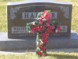
| Description | : | Walter and Mabel (Meyer) Harder marriage Darlene Karpisek September 28, 1963 U.S. Army family farm and worked at Feuerbach Oil. IDS selling investments until 1971 when he began working for the Benton Community School System. In 1981 he was appointed to Maintenance Director for the school and retired in 1998. After retirement, Roger worked for Grinnell Mutual Insurance providing insurance adjustment inspections. He was preceded in death by his parents, sister Janice Swick and grandson Wesley Teneyck. |
frequently asked questions (FAQ):
-
Where is Roger Lee Harder's memorial?
Roger Lee Harder's memorial is located at: Keystone Cemetery, Keystone, Benton County, USA.
-
When did Roger Lee Harder death?
Roger Lee Harder death on 11 Oct 2020 in Cedar Rapids, Linn County, Iowa, USA
-
Where are the coordinates of the Roger Lee Harder's memorial?
Latitude: 41.9939003
Longitude: -92.2172012
Family Members:
Parent
Siblings
Flowers:


Nearby Cemetories:
1. Keystone Cemetery
Keystone, Benton County, USA
Coordinate: 41.9939003, -92.2172012
2. Holy Cross Cemetery
Keystone, Benton County, USA
Coordinate: 41.9961014, -92.1825027
3. Van Metre Cemetery
Keystone, Benton County, USA
Coordinate: 41.9614983, -92.1514969
4. Redman Cemetery
Benton County, USA
Coordinate: 41.9710999, -92.2917023
5. Irving Cemetery
Irving, Benton County, USA
Coordinate: 41.9505997, -92.2797012
6. Bender Cemetery
Keystone, Benton County, USA
Coordinate: 42.0363998, -92.1536026
7. Twogood Cemetery
Benton County, USA
Coordinate: 42.0499992, -92.2799988
8. Kirchner Cemetery
Benton County, USA
Coordinate: 42.0727300, -92.2027400
9. Arbuthnot Cemetery
Chelsea, Tama County, USA
Coordinate: 41.9416550, -92.3001787
10. Calvary Cemetery
Van Horne, Benton County, USA
Coordinate: 41.9641991, -92.1138992
11. LaRue Cemetery
Benton County, USA
Coordinate: 42.0574989, -92.1438980
12. Ranstead Cemetery
Luzerne, Benton County, USA
Coordinate: 41.9201622, -92.1613846
13. Wright Cemetery
Belle Plaine, Benton County, USA
Coordinate: 41.9136009, -92.2643967
14. Dvorak Cemetery
Elberon, Tama County, USA
Coordinate: 41.9713000, -92.3417000
15. Waltham Cemetery
Elberon, Tama County, USA
Coordinate: 42.0355988, -92.3328018
16. Big Grove-Homer Cemetery
Benton County, USA
Coordinate: 42.0867004, -92.1821976
17. Lutheran Cemetery
Luzerne, Benton County, USA
Coordinate: 41.8991950, -92.1852390
18. International Cemetery
Luzerne, Benton County, USA
Coordinate: 41.8981018, -92.1800003
19. Oak Hill Cemetery
Belle Plaine, Benton County, USA
Coordinate: 41.8987007, -92.2571030
20. Saint Marys Cemetery
Vining, Tama County, USA
Coordinate: 41.9906000, -92.3556000
21. Beal Pioneer Cemetery
Belle Plaine, Benton County, USA
Coordinate: 41.8903008, -92.2538986
22. Lone Pine Cemetery
Tama County, USA
Coordinate: 42.0797005, -92.3082962
23. National Cemetery
Vining, Tama County, USA
Coordinate: 41.9702988, -92.3705978
24. Roadside Cemetery
Clutier, Tama County, USA
Coordinate: 42.0574800, -92.3548800