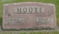
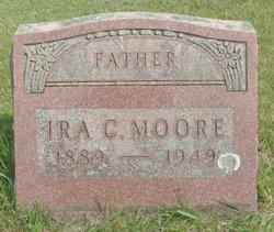
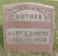
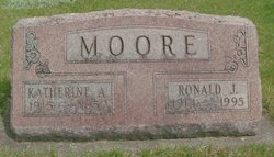
Ronald James “Red” Moore
| Birth | : | 27 Apr 1914 Wadena, Fayette County, Iowa, USA |
| Death | : | 4 Oct 1995 Elkader, Clayton County, Iowa, USA |
| Burial | : | Pine Ridge Cemetery, Ain, Grant County, USA |
| Coordinate | : | 34.1797800, -92.3170800 |
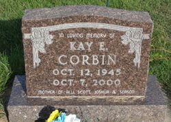
| Description | : | Ronald J. "Red" Moore, 81, died Wednesday, Oct. 4, 1995, in the Elkader Care Center after a long illness. Services: 11 a.m. Saturday, United Methodist Church, by the Rev. Laurie Riley. Burial: Hillcrest Cemetery. Friends may call from 4 to 8 p.m. Friday at Leonard Funeral Home, Elkader, and after 10 a.m. Saturday at the church. Survivors include four sons, John and Bruce, both of Volga, Ronald Eugene of Cedar Rapids and Paul of Colleyville, Texas; three daughters, Mary Shettler of Columbus Junction, Carol Harris of Elgin and Kay Corbin of Wadena; two brothers, William and Ira, both of Cedar Rapids;... Read More |
frequently asked questions (FAQ):
-
Where is Ronald James “Red” Moore's memorial?
Ronald James “Red” Moore's memorial is located at: Pine Ridge Cemetery, Ain, Grant County, USA.
-
When did Ronald James “Red” Moore death?
Ronald James “Red” Moore death on 4 Oct 1995 in Elkader, Clayton County, Iowa, USA
-
Where are the coordinates of the Ronald James “Red” Moore's memorial?
Latitude: 34.1797800
Longitude: -92.3170800
Family Members:
Parent
Spouse
Siblings
Children
Flowers:
Nearby Cemetories:
1. Hedden Chapel Cemetery
Grant County, USA
Coordinate: 34.1742180, -92.3369480
2. White Cemetery
Grant County, USA
Coordinate: 34.1917000, -92.2853012
3. Ain Cemetery
Ain, Grant County, USA
Coordinate: 34.2087110, -92.3373940
4. Grapevine Cemetery
Grapevine, Grant County, USA
Coordinate: 34.1454700, -92.3148700
5. Saint John Cemetery
Grapevine, Grant County, USA
Coordinate: 34.2221985, -92.3367004
6. Mount Zion Cemetery
Grant County, USA
Coordinate: 34.2285995, -92.2981033
7. Saint Paul AME Church Cemetery
Grapevine, Grant County, USA
Coordinate: 34.2311200, -92.2748700
8. Ramick Cemetery
Grant County, USA
Coordinate: 34.1436005, -92.2549973
9. Rhodes Cemetery
Sheridan, Grant County, USA
Coordinate: 34.1749992, -92.3953018
10. Clement Cemetery
Grapevine, Grant County, USA
Coordinate: 34.1114006, -92.2964020
11. Camp Creek Cemetery
Grant County, USA
Coordinate: 34.2510986, -92.3422012
12. Morris Cemetery #1
Grapevine, Grant County, USA
Coordinate: 34.1050900, -92.3368000
13. New Hope Cemetery
Cross Roads, Grant County, USA
Coordinate: 34.2189970, -92.3986500
14. Macedonia Cemetery
Grapevine, Grant County, USA
Coordinate: 34.1237330, -92.2501830
15. Cedar Branch Cemetery
Ain, Grant County, USA
Coordinate: 34.2283750, -92.2418610
16. Lee Cemetery
Sulphur Springs, Jefferson County, USA
Coordinate: 34.1506004, -92.2228012
17. Davis Cemetery
Grapevine, Grant County, USA
Coordinate: 34.0956001, -92.3439026
18. Sarah and Buddie Shell
Grapevine, Grant County, USA
Coordinate: 34.0914178, -92.3081192
19. Old Shiloh Cemetery
Cross Roads, Grant County, USA
Coordinate: 34.2210999, -92.4132996
20. Providence Cemetery
Jefferson County, USA
Coordinate: 34.2042380, -92.2081750
21. Bethel South Cemetery
Sheridan, Grant County, USA
Coordinate: 34.1702995, -92.4383011
22. Phillips Cemetery
Jefferson County, USA
Coordinate: 34.2057991, -92.1960983
23. Shell Cemetery
Grapevine, Grant County, USA
Coordinate: 34.0750008, -92.3191986
24. Branch Cemetery
Jefferson County, USA
Coordinate: 34.1897011, -92.1903000

