Rosetta Amrein Ensor
| Birth | : | 30 Jul 1921 Jarrettsville, Harford County, Maryland, USA |
| Death | : | 3 Jan 2005 Towson, Baltimore County, Maryland, USA |
| Burial | : | Bel Air Memorial Gardens, Bel Air, Harford County, USA |
| Coordinate | : | 39.5468000, -76.3617900 |
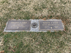
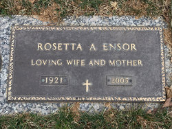
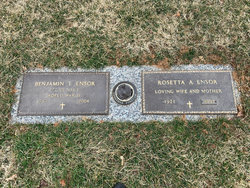
| Inscription | : | CFC US NAVY WORLD WAR II TOGETHER FOREVER LOVING WIFE AND MOTHER |
| Description | : | Rosetta Amrein Ensor (July 30 1921 ~ January 03, 2005) 30 July 1921 - 3 January 2005 *** ROSETTA A. ENSOR, 83, of Bel Air, died January 3, 2005 at St. Josephs Medical Center in Towson, following surgery. Born in Jarrettsville, July 30, 1921, she was the daughter of the late J. [Justice] Henry and Callie (nee Jones) Amrein. Married 59 years to her late husband, Benjamin T. Ensor, she was a homemaker. Actively involved in her children's lives, she was "scouting mom", "little league mom", "majorette mom", "theater mom", and... Read More |
frequently asked questions (FAQ):
-
Where is Rosetta Amrein Ensor's memorial?
Rosetta Amrein Ensor's memorial is located at: Bel Air Memorial Gardens, Bel Air, Harford County, USA.
-
When did Rosetta Amrein Ensor death?
Rosetta Amrein Ensor death on 3 Jan 2005 in Towson, Baltimore County, Maryland, USA
-
Where are the coordinates of the Rosetta Amrein Ensor's memorial?
Latitude: 39.5468000
Longitude: -76.3617900
Family Members:
Parent
Spouse
Siblings
Children
Flowers:
Nearby Cemetories:
1. Bel Air Memorial Gardens
Bel Air, Harford County, USA
Coordinate: 39.5468000, -76.3617900
2. Emmanuel Episcopal Church Columbarium
Bel Air, Harford County, USA
Coordinate: 39.5396020, -76.3546890
3. Heavenly Waters Cemetery
Harford County, USA
Coordinate: 39.5293999, -76.3747025
4. Southampton Farm Cemetery
Southampton, Harford County, USA
Coordinate: 39.5486600, -76.3344700
5. David Lee Family Cemetery
Bel Air, Harford County, USA
Coordinate: 39.5319958, -76.3866033
6. Saint Matthews Lutheran Church Columbarium
Bel Air, Harford County, USA
Coordinate: 39.5440430, -76.3268720
7. Saint Ignatius Cemetery
Hickory, Harford County, USA
Coordinate: 39.5736008, -76.3550034
8. Dallam-Webster Family Cemetery
Bel Air, Harford County, USA
Coordinate: 39.5722400, -76.3339100
9. Hickory Baptist Church Cemetery
Forest Hill, Harford County, USA
Coordinate: 39.5779600, -76.3452000
10. Christ Church Cemetery
Forest Hill, Harford County, USA
Coordinate: 39.5744019, -76.3874969
11. Welcome Home Freewill Baptist Church Cemetery
Bel Air, Harford County, USA
Coordinate: 39.5689000, -76.3244800
12. Christ Our King Presbyterian Church
Bel Air, Harford County, USA
Coordinate: 39.5165851, -76.3313539
13. Forest Friends Meeting Cemetery
Forest Hill, Harford County, USA
Coordinate: 39.5837212, -76.3816452
14. Mount Zion United Methodist Church Cemetery
Bel Air, Harford County, USA
Coordinate: 39.5475006, -76.3086014
15. Mount Tabor United Methodist Church Cemetery
Bel Air, Harford County, USA
Coordinate: 39.5863991, -76.3308029
16. Tabernacle Mount Zion United Methodist Cemetery
Fallston, Harford County, USA
Coordinate: 39.5057983, -76.3899994
17. Friends Cemetery
Fallston, Harford County, USA
Coordinate: 39.5094000, -76.4058000
18. Centre Cemetery
Forest Hill, Harford County, USA
Coordinate: 39.5963700, -76.3899500
19. Fallston United Methodist Church Cemetery
Fallston, Harford County, USA
Coordinate: 39.5256004, -76.4281006
20. Fairview Cemetery
Harford County, USA
Coordinate: 39.5805900, -76.4212600
21. Oak Grove Baptist Church Cemetery
Bel Air, Harford County, USA
Coordinate: 39.5548300, -76.2880200
22. Baptist View Regular Baptist Church Cemetery
Forest Hill, Harford County, USA
Coordinate: 39.6012900, -76.3964900
23. Mount Carmel Cemetery
Emmorton, Harford County, USA
Coordinate: 39.4937200, -76.3224600
24. Deer Creek United Methodist Church Cemetery
Forest Hill, Harford County, USA
Coordinate: 39.6130981, -76.3522034

