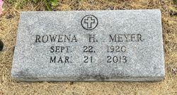
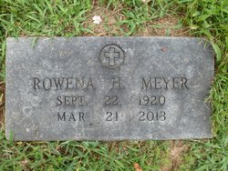
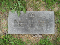
Rowena Helen Ponder Meyer
| Birth | : | 22 Sep 1920 Perry County, Missouri, USA |
| Death | : | 21 Mar 2013 Uniontown, Perry County, Missouri, USA |
| Burial | : | R.D. Dean Memorial I.O.O.F. Cemetery, Elk Garden, Mineral County, USA |
| Coordinate | : | 39.3767580, -79.1584820 |
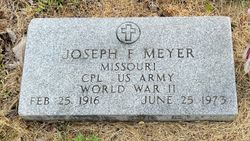
| Description | : | Born Sept. 22, 1920 in Perry County, the daughter of Joseph H. Ponder and Theresia B. (Buchheit) Ponder. She was married on June 11, 1946 at Apple Creek to Joseph Frederick Meyer, who preceded her in death on June 25, 1973. Survivors include six children, Bernice Baldwin of Jackson; Leo (Rose Diane) Meyer of Uniontown; Pat (Chris) Lambrecht of Westminster, Colo.; Ellen Meyer of Perryville; Dorothy (Don) Hemmann of Uniontown; and Rose (Rob) Huff of Cape Girardeau; two sisters, Geraldine Farrar of Cape Girardeau; and Eugenia Crump of Ste. Genevieve; 15 grandchildren; 19 great-grandchildren; and four great-great-grandchildren. Rowena was... Read More |
frequently asked questions (FAQ):
-
Where is Rowena Helen Ponder Meyer's memorial?
Rowena Helen Ponder Meyer's memorial is located at: R.D. Dean Memorial I.O.O.F. Cemetery, Elk Garden, Mineral County, USA.
-
When did Rowena Helen Ponder Meyer death?
Rowena Helen Ponder Meyer death on 21 Mar 2013 in Uniontown, Perry County, Missouri, USA
-
Where are the coordinates of the Rowena Helen Ponder Meyer's memorial?
Latitude: 39.3767580
Longitude: -79.1584820
Family Members:
Spouse
Flowers:
Nearby Cemetories:
1. R.D. Dean Memorial I.O.O.F. Cemetery
Elk Garden, Mineral County, USA
Coordinate: 39.3767580, -79.1584820
2. Nethken Hill Cemetery
Elk Garden, Mineral County, USA
Coordinate: 39.3755989, -79.1592026
3. Kalbaugh Cemetery
Elk Garden, Mineral County, USA
Coordinate: 39.3744011, -79.1583023
4. Elk Garden Cemetery Old
Elk Garden, Mineral County, USA
Coordinate: 39.3850670, -79.1588600
5. Dixon Cemetery
Elk Garden, Mineral County, USA
Coordinate: 39.3922005, -79.1568985
6. Kitzmiller Cemetery
Kitzmiller, Garrett County, USA
Coordinate: 39.3922005, -79.1817017
7. Hamill Cemetery
Kitzmiller, Garrett County, USA
Coordinate: 39.3973500, -79.1889100
8. Bray Cemetery
Kitzmiller, Garrett County, USA
Coordinate: 39.3983002, -79.1999969
9. Dixon Cemetery
Sulphur City, Mineral County, USA
Coordinate: 39.3424988, -79.1350021
10. Kitzmiller Cemetery
Mineral County, USA
Coordinate: 39.4174995, -79.1350021
11. Manor Cemetery
Garrett County, USA
Coordinate: 39.4286003, -79.1505966
12. Short Run Cemetery
Kitzmiller, Garrett County, USA
Coordinate: 39.3910100, -79.2278100
13. Hartmansville United Methodist Church Cemetery
Hartmansville, Mineral County, USA
Coordinate: 39.3194000, -79.1659100
14. Mount Zion Cemetery
Garrett County, USA
Coordinate: 39.4393997, -79.1710968
15. Evans Cemetery
Kitzmiller, Garrett County, USA
Coordinate: 39.4273500, -79.2201100
16. Evans Cemetery
Hartmansville, Mineral County, USA
Coordinate: 39.3046490, -79.1535100
17. Old Cross Dunkard Church Cemetery
Barnum, Mineral County, USA
Coordinate: 39.4300957, -79.0940933
18. Union Chapel Cemetery
Mineral County, USA
Coordinate: 39.4300150, -79.0926170
19. Burgess Cemetery
Laurel Dale, Mineral County, USA
Coordinate: 39.3126360, -79.1093620
20. Brown-Tephabock Cemetery
Laurel Dale, Mineral County, USA
Coordinate: 39.3120230, -79.1104240
21. Tasker Cemetery
Cross, Mineral County, USA
Coordinate: 39.4290657, -79.0853119
22. Claysville United Methodist Church Cemetery
New Creek, Mineral County, USA
Coordinate: 39.3425250, -79.0680940
23. Virts Cemetery
Bethel, Garrett County, USA
Coordinate: 39.4474140, -79.1156660
24. Paughs Cemetery
Garrett County, USA
Coordinate: 39.3869019, -79.2593994


