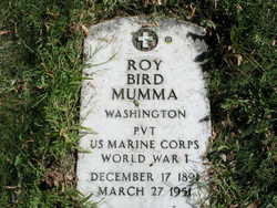
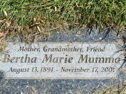
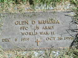
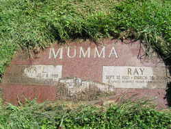
Roy Bird Mumma
| Birth | : | 17 Dec 1891 Blythedale, Harrison County, Missouri, USA |
| Death | : | 27 Mar 1951 Brewster, Okanogan County, Washington, USA |
| Burial | : | Havelock Cemetery, Havelock, Marlborough District, New Zealand |
| Coordinate | : | -41.2826300, 173.7684800 |
| Description | : | Washington Death Certificate Name: Roy Bird Mumma Death Date: 27 Mar 1951 Death Place: Brewster, Okanogan, Washington Gender: Male Age at Death: 60 years Estimated Birth Year: 1891 Father's Name: Albert M Mumma Mother's Name: Martha Hobbs Film Number: 2032980 Digital GS Number: 4224160 Image Number: 841 Volume/Page/Certificate Number: rn 5043 |
frequently asked questions (FAQ):
-
Where is Roy Bird Mumma's memorial?
Roy Bird Mumma's memorial is located at: Havelock Cemetery, Havelock, Marlborough District, New Zealand.
-
When did Roy Bird Mumma death?
Roy Bird Mumma death on 27 Mar 1951 in Brewster, Okanogan County, Washington, USA
-
Where are the coordinates of the Roy Bird Mumma's memorial?
Latitude: -41.2826300
Longitude: 173.7684800
Family Members:
Spouse
Children
Flowers:
Nearby Cemetories:
1. Havelock Cemetery
Havelock, Marlborough District, New Zealand
Coordinate: -41.2826300, 173.7684800
2. Kaiuma Bay Graves
Kaiuma, Marlborough District, New Zealand
Coordinate: -41.2362962, 173.7875701
3. Ruapeka Cemetery
Canvastown, Marlborough District, New Zealand
Coordinate: -41.2883780, 173.6901440
4. Mahakipawa
Linkwater, Marlborough District, New Zealand
Coordinate: -41.2892290, 173.8474970
5. Te Horo Cemetery
Canvastown, Marlborough District, New Zealand
Coordinate: -41.2887942, 173.6652268
6. Deep Creek Cemetery
Deep Creek, Marlborough District, New Zealand
Coordinate: -41.3556480, 173.6320210
7. Rai Valley Cemetery
Rai Valley, Marlborough District, New Zealand
Coordinate: -41.2127080, 173.5802470
8. Picton Cemetery
Picton, Marlborough District, New Zealand
Coordinate: -41.2902300, 173.9976500
9. Picton Gaolyard
Picton, Marlborough District, New Zealand
Coordinate: -41.2933357, 174.0046601
10. Ruakanakana Urupā
Kaituna, Marlborough District, New Zealand
Coordinate: -41.4463616, 173.8779400
11. Maher Family Cemetery
Kaituna, Marlborough District, New Zealand
Coordinate: -41.4682494, 173.7958289
12. Kaituna Cemetery
Kaituna, Marlborough District, New Zealand
Coordinate: -41.4694650, 173.8036590
13. Wairau Affray Graves
Tuamarina, Marlborough District, New Zealand
Coordinate: -41.4285146, 173.9597007
14. Waikawa Urupā
Waikawa, Marlborough District, New Zealand
Coordinate: -41.2739670, 174.0411840
15. Tuamarina Cemetery
Tuamarina, Marlborough District, New Zealand
Coordinate: -41.4280969, 173.9623665
16. Rapaura Community Churchyard
Rapaura, Marlborough District, New Zealand
Coordinate: -41.4724800, 173.8995800
17. Rapaura Anglican Cemetery
Rapaura, Marlborough District, New Zealand
Coordinate: -41.4719700, 173.9014700
18. McLaren's Grave
Nelson City, New Zealand
Coordinate: -41.0722901, 173.6998022
19. Langley Dale Cemetery
Marlborough District, New Zealand
Coordinate: -41.5076952, 173.7025647
20. Pioneers Church Cemetery
Renwick, Marlborough District, New Zealand
Coordinate: -41.5091139, 173.8364765
21. Upper Wairau Valley Cemetery
Blenheim, Marlborough District, New Zealand
Coordinate: -41.5171130, 173.7974110
22. Old Renwick Cemetery
Marlborough District, New Zealand
Coordinate: -41.5014030, 173.8909900
23. Robin Hood Bay Urupā
Marlborough District, New Zealand
Coordinate: -41.3541665, 174.0768701
24. Māori Island Urupā Otamawahu
Grovetown, Marlborough District, New Zealand
Coordinate: -41.4729310, 173.9778908

