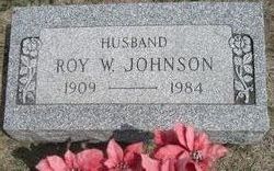
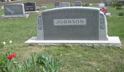
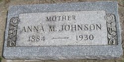
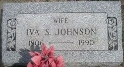
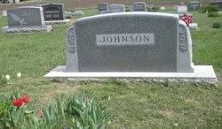
Roy W Johnson
| Birth | : | 22 Jun 1909 Diamond Springs, Morris County, Kansas, USA |
| Death | : | 30 Nov 1984 Junction City, Geary County, Kansas, USA |
| Burial | : | Mount Pleasant Cemetery, Clearbranch, Unicoi County, USA |
| Coordinate | : | 36.0531900, -82.5169500 |
| Inscription | : | Husband |
frequently asked questions (FAQ):
-
Where is Roy W Johnson's memorial?
Roy W Johnson's memorial is located at: Mount Pleasant Cemetery, Clearbranch, Unicoi County, USA.
-
When did Roy W Johnson death?
Roy W Johnson death on 30 Nov 1984 in Junction City, Geary County, Kansas, USA
-
Where are the coordinates of the Roy W Johnson's memorial?
Latitude: 36.0531900
Longitude: -82.5169500
Family Members:
Parent
Spouse
Siblings
Flowers:
Nearby Cemetories:
1. Mount Pleasant Cemetery
Clearbranch, Unicoi County, USA
Coordinate: 36.0531900, -82.5169500
2. Clear Branch Cemetery
Clearbranch, Unicoi County, USA
Coordinate: 36.0546300, -82.5156600
3. Kan Foster Cemetery
Coffee Ridge, Unicoi County, USA
Coordinate: 36.0450400, -82.5068400
4. Gillis Cemetery
Coffee Ridge, Unicoi County, USA
Coordinate: 36.0405200, -82.5151400
5. Hensley Cemetery #2
Unicoi County, USA
Coordinate: 36.0468800, -82.5017700
6. Clouse Cemetery
Flag Pond, Unicoi County, USA
Coordinate: 36.0485500, -82.5339500
7. Holcomb Cemetery
Clearbranch, Unicoi County, USA
Coordinate: 36.0614600, -82.5021900
8. Riddle Cemetery
Rocky Fork, Unicoi County, USA
Coordinate: 36.0674500, -82.5207100
9. Gillis Cemetery #2
Ernestville, Unicoi County, USA
Coordinate: 36.0665500, -82.5054100
10. Edwards Branch Cemetery
Flag Pond, Unicoi County, USA
Coordinate: 36.0677400, -82.5277100
11. Foster Cemetery #1
Erwin, Unicoi County, USA
Coordinate: 36.0446600, -82.4986000
12. Sams Cemetery
Unicoi County, USA
Coordinate: 36.0327988, -82.5105972
13. Willis Cemetery #1
Coffee Ridge, Unicoi County, USA
Coordinate: 36.0313390, -82.5069890
14. Tilson Cemetery
Clearbranch, Unicoi County, USA
Coordinate: 36.0299988, -82.5255966
15. Foster Cemetery
Unicoi County, USA
Coordinate: 36.0387800, -82.4926700
16. Sams Cemetery #1
Coffee Ridge, Unicoi County, USA
Coordinate: 36.0265700, -82.5107500
17. Tumbling Hill Cemetery
Coffee Ridge, Unicoi County, USA
Coordinate: 36.0385300, -82.4885800
18. Big Branch Cemetery
Rocky Fork, Unicoi County, USA
Coordinate: 36.0589700, -82.5506500
19. Foster Cemetery
Unicoi County, USA
Coordinate: 36.0429500, -82.4847100
20. Tinker Cemetery #2
Ernestville, Unicoi County, USA
Coordinate: 36.0798000, -82.5048900
21. Low Gap Cemetery
Unicoi County, USA
Coordinate: 36.0654800, -82.4846900
22. Willis Cemetery #3
Chestoa, Unicoi County, USA
Coordinate: 36.0319100, -82.4917500
23. Higgins Cemetery
Rocky Fork, Unicoi County, USA
Coordinate: 36.0553700, -82.5540200
24. Donna Sue Shelton Cemetery
Flag Pond, Unicoi County, USA
Coordinate: 36.0350200, -82.5476500

