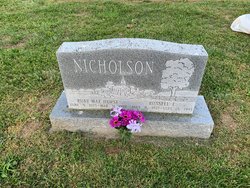
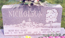
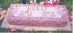
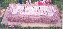
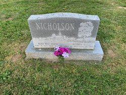
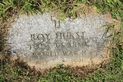
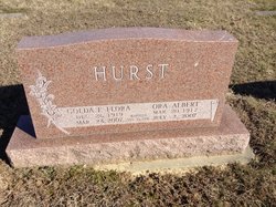
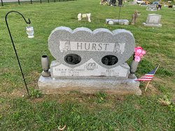
Ruby Mae Hurst Nicholson
| Birth | : | 9 Jun 1923 Washington County, Indiana, USA |
| Death | : | 31 Mar 1992 Salem, Washington County, Indiana, USA |
| Burial | : | Casey Cemetery, Roane County, USA |
| Coordinate | : | 38.5414009, -81.3486023 |
| Description | : | Obituary: Salem Democrat. Salem, Ind. Thurs April 2, 1992. A-17. Ruby M. Nicholson, 68, of Salem, died Tuesday, March 31, 1992, at Washington County Memorial Hospital. She was a member of the Salem Assembly of God, the Indiana Retired Teachers Association, and the Washington county Extension Homakers Club. She was a retired teacher of the Franklin Township and East Washington elementary Schools for 31 years. She was born June 9, 1923, in Pekin to Denis H. and Pearl J. Hall Hurst. She married Russel E. Nicholson in 1957 who survives. Other survivors are one son, Michael E. Nicholson of... Read More |
frequently asked questions (FAQ):
-
Where is Ruby Mae Hurst Nicholson's memorial?
Ruby Mae Hurst Nicholson's memorial is located at: Casey Cemetery, Roane County, USA.
-
When did Ruby Mae Hurst Nicholson death?
Ruby Mae Hurst Nicholson death on 31 Mar 1992 in Salem, Washington County, Indiana, USA
-
Where are the coordinates of the Ruby Mae Hurst Nicholson's memorial?
Latitude: 38.5414009
Longitude: -81.3486023
Family Members:
Parent
Spouse
Siblings
Flowers:
Nearby Cemetories:
1. Casey Cemetery
Roane County, USA
Coordinate: 38.5414009, -81.3486023
2. Board Cemetery
Clendenin, Kanawha County, USA
Coordinate: 38.5358290, -81.3447250
3. Hayes Cemetery
Cotton, Roane County, USA
Coordinate: 38.5480800, -81.3473250
4. Franklin Taylor Cemetery
Roane County, USA
Coordinate: 38.5494003, -81.3403015
5. Smith Cemetery
Cotton, Roane County, USA
Coordinate: 38.5483017, -81.3653030
6. Canterbury Cemetery
Kanawha County, USA
Coordinate: 38.5391998, -81.3688965
7. Jackson Cemetery
Roane County, USA
Coordinate: 38.5541992, -81.3242035
8. Staats Cemetery
Clendenin, Kanawha County, USA
Coordinate: 38.5349998, -81.3824997
9. Harper Family Cemetery
Cotton, Roane County, USA
Coordinate: 38.5689316, -81.3494580
10. Cummings Cemetery
Procious, Clay County, USA
Coordinate: 38.5136110, -81.3550030
11. Cummings Cemetery
Clendenin, Kanawha County, USA
Coordinate: 38.5135994, -81.3550034
12. Harper Cemetery
Cotton, Roane County, USA
Coordinate: 38.5703600, -81.3441800
13. Taylor Cemetery
Clendenin, Kanawha County, USA
Coordinate: 38.5083200, -81.3398800
14. Statts Cemetery
Clendenin, Kanawha County, USA
Coordinate: 38.5106100, -81.3304200
15. Deverick Cemetery
Clendenin, Kanawha County, USA
Coordinate: 38.5119019, -81.3272018
16. Robertson Family Cemetery
Clendenin, Kanawha County, USA
Coordinate: 38.5079500, -81.3384400
17. Bird Cemetery
Clendenin, Kanawha County, USA
Coordinate: 38.5071900, -81.3404300
18. Armstead Cemetery
Clio, Roane County, USA
Coordinate: 38.5671997, -81.3114014
19. White Cemetery
Clendenin, Kanawha County, USA
Coordinate: 38.5022011, -81.3467026
20. Taylor Cemetery
Clendenin, Kanawha County, USA
Coordinate: 38.5061800, -81.3245800
21. Armstead Cemetery #3
Clio, Roane County, USA
Coordinate: 38.5694800, -81.3097500
22. Mary Osborne Cemetery
Clendenin, Kanawha County, USA
Coordinate: 38.4984490, -81.3507860
23. Barnhouse Cemetery
Roane County, USA
Coordinate: 38.5842018, -81.3375015
24. Bird Cemetery
Roane County, USA
Coordinate: 38.5868988, -81.3644028

