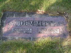
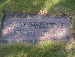
Ruth Estella Morrill Demmitt
| Birth | : | 27 Jun 1877 Buckman, Morrison County, Minnesota, USA |
| Death | : | 18 Jun 1953 Twisp, Okanogan County, Washington, USA |
| Burial | : | Graceland Park Cemetery, Sioux City, Woodbury County, USA |
| Coordinate | : | 42.4589005, -96.3486023 |
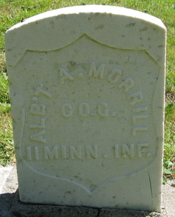
| Description | : | Washington Death Certificate Name: Ruth Estell Demmitt Death Date: 18 Jun 1953 Death Place: Twisp, Okanogan, Washington Gender: Female Age at Death: 74 years Estimated Birth Year: 1879 Father's Name: Albert A. Morrill Film Number: 2033291 Digital GS Number: 4224225 Image Number: 626 Volume/Page/Certificate Number: 10973 children:Lottie M Demmitt Yates b: 17 Aug 1897 d: 30 Jan 1973, Cathern Elizabeth Demmitt b: 18 Sep 1904 d: 31 Jul 1947 m: Herbert Peck Grover m: Ralph N Peterson, Esther Adeline Demmitt Holman b: 19 Feb 1916 d: May 1986 |
frequently asked questions (FAQ):
-
Where is Ruth Estella Morrill Demmitt's memorial?
Ruth Estella Morrill Demmitt's memorial is located at: Graceland Park Cemetery, Sioux City, Woodbury County, USA.
-
When did Ruth Estella Morrill Demmitt death?
Ruth Estella Morrill Demmitt death on 18 Jun 1953 in Twisp, Okanogan County, Washington, USA
-
Where are the coordinates of the Ruth Estella Morrill Demmitt's memorial?
Latitude: 42.4589005
Longitude: -96.3486023
Family Members:
Parent
Spouse
Siblings
Children
Flowers:
Nearby Cemetories:
1. Independent Farane Cemetery
Sioux City, Woodbury County, USA
Coordinate: 42.4552600, -96.3500170
2. Carmelite Monastery
Sioux City, Woodbury County, USA
Coordinate: 42.4579000, -96.3675000
3. Memorial Park Cemetery
Sioux City, Woodbury County, USA
Coordinate: 42.4528008, -96.3261032
4. First Brides Grave
Sioux City, Woodbury County, USA
Coordinate: 42.4579500, -96.3756500
5. Charles Floyd Monument
Sioux City, Woodbury County, USA
Coordinate: 42.4626480, -96.3779330
6. Mount Sinai Cemetery
Sioux City, Woodbury County, USA
Coordinate: 42.4943810, -96.3711700
7. Mount Carmel Cemetery
Sioux City, Woodbury County, USA
Coordinate: 42.4956017, -96.3685989
8. Floyd Cemetery
Sioux City, Woodbury County, USA
Coordinate: 42.4968987, -96.3756027
9. Woodbury Township Cemetery
Sergeant Bluff, Woodbury County, USA
Coordinate: 42.4083800, -96.3570480
10. Dakota City Cemetery
Dakota City, Dakota County, USA
Coordinate: 42.4216500, -96.4143100
11. Saint Thomas Episcopal Church Columbarium
Woodbury County, USA
Coordinate: 42.5031000, -96.4063000
12. Saint Michaels Calvary Cemetery
South Sioux City, Dakota County, USA
Coordinate: 42.4552994, -96.4503021
13. Eberly Cemetery
Woodbury County, USA
Coordinate: 42.4822006, -96.2453003
14. Chief War Eagle Memorial
Sioux City, Woodbury County, USA
Coordinate: 42.4939003, -96.4543991
15. Calvary Cemetery
Sioux City, Woodbury County, USA
Coordinate: 42.5205994, -96.4424973
16. Concordia Cemetery
Woodbury County, USA
Coordinate: 42.5186005, -96.2438965
17. First Congregational Church of Christ Memorial Ga
Sioux City, Woodbury County, USA
Coordinate: 42.5492800, -96.4035900
18. United Church of Christ Cemetery
Sioux City, Woodbury County, USA
Coordinate: 42.5491900, -96.4041300
19. Logan Park Cemetery
Sioux City, Woodbury County, USA
Coordinate: 42.5377693, -96.4304810
20. Liberty Township Cemetery
Salix, Woodbury County, USA
Coordinate: 42.3560982, -96.3116989
21. Roost Cemetery
Dakota County, USA
Coordinate: 42.4466900, -96.5023200
22. Floyd Township Cemetery
Bronson, Woodbury County, USA
Coordinate: 42.4021988, -96.2125015
23. Banner Cemetery
Lawton, Woodbury County, USA
Coordinate: 42.4855995, -96.1844025
24. Boals Family Plot
Dakota City, Dakota County, USA
Coordinate: 42.4345000, -96.5151000


