
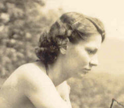
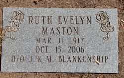
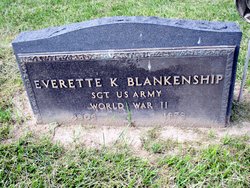
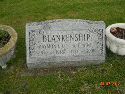
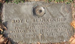
Ruth Evelyn Blankenship Maston
| Birth | : | 11 Mar 1917 Jasper County, Indiana, USA |
| Death | : | 13 Oct 2006 Spencer, Owen County, Indiana, USA |
| Burial | : | Saint Helen’s Churchyard, Longhorsley, Northumberland Unitary Authority, England |
| Coordinate | : | 55.2432500, -1.7588200 |
| Plot | : | Section T, Lot 116 |
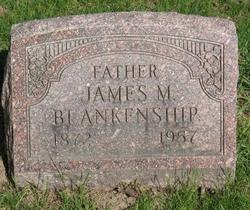
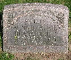
| Description | : | Ruth Evelyn (Blankenship) Maston was born March 11, 1917, in Jasper County, Indiana, to James M and Minnie Alice (Huber) Blankenship. She was the youngest of eleven children who survived to adulthood, all of whom are now deceased. In 1943she married Charles H. Maston who died in 2000. She is survived by four children: Randi Richardson, of Spencer, Indiana, Maryanne Wilcox of Harris Minnesota: Rosie Erskine Lamrhari of Greenville, North Carolina, and Jeremiah MacLaren of Murfreesboro, Tennessee. Two addiional children, Robert Kenton and Kimberly Eileen did not survive infancy. In her younger days, and well into her 70's Ruth was... Read More |
frequently asked questions (FAQ):
-
Where is Ruth Evelyn Blankenship Maston's memorial?
Ruth Evelyn Blankenship Maston's memorial is located at: Saint Helen’s Churchyard, Longhorsley, Northumberland Unitary Authority, England.
-
When did Ruth Evelyn Blankenship Maston death?
Ruth Evelyn Blankenship Maston death on 13 Oct 2006 in Spencer, Owen County, Indiana, USA
-
Where are the coordinates of the Ruth Evelyn Blankenship Maston's memorial?
Latitude: 55.2432500
Longitude: -1.7588200
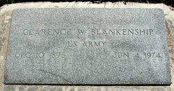
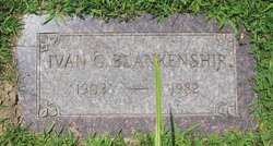
Family Members:
Parent
Siblings

Children
Flowers:


Nearby Cemetories:
1. Saint Helen’s Churchyard
Longhorsley, Northumberland Unitary Authority, England
Coordinate: 55.2432500, -1.7588200
2. Brinkburn Priory
Brinkburn, Northumberland Unitary Authority, England
Coordinate: 55.2788120, -1.8191170
3. Brinkburn Priory and Manor House
Longframlington, Northumberland Unitary Authority, England
Coordinate: 55.2789620, -1.8194090
4. St Cuthbert Churchyard
Hebron, Northumberland Unitary Authority, England
Coordinate: 55.2023450, -1.6963700
5. Longframlington Church Cemetery Extension
Longframlington, Northumberland Unitary Authority, England
Coordinate: 55.3014700, -1.7950600
6. Fairmoor Cemetery
Morpeth, Northumberland Unitary Authority, England
Coordinate: 55.1861980, -1.7163260
7. St Mary the Virgin Churchyard
Longframlington, Northumberland Unitary Authority, England
Coordinate: 55.3028950, -1.7952920
8. Felton Cemetery
Felton, Northumberland Unitary Authority, England
Coordinate: 55.3020920, -1.7118410
9. Longframlington Cemetery
Longframlington, Northumberland Unitary Authority, England
Coordinate: 55.3085440, -1.8003926
10. Saint Mary Magdalene Churchyard
Mitford, Northumberland Unitary Authority, England
Coordinate: 55.1645410, -1.7363020
11. Saint John's Churchyard
Longhirst, Northumberland Unitary Authority, England
Coordinate: 55.1936200, -1.6474840
12. Newminster Abbey
Morpeth, Northumberland Unitary Authority, England
Coordinate: 55.1664000, -1.7044070
13. St. Mary the Virgin Church
Morpeth, Northumberland Unitary Authority, England
Coordinate: 55.1598990, -1.6917760
14. St. Mary the Virgin Churchyard
Morpeth, Northumberland Unitary Authority, England
Coordinate: 55.1597110, -1.6921530
15. St. John the Divine Churchyard
Acklington, Northumberland Unitary Authority, England
Coordinate: 55.3106000, -1.6435000
16. Saint Andrews Churchyard
Hartburn, Northumberland Unitary Authority, England
Coordinate: 55.1683350, -1.8596667
17. Chevington Cemetery
Alnwick, Northumberland Unitary Authority, England
Coordinate: 55.2905270, -1.6148670
18. St. John Churchyard
Meldon, Northumberland Unitary Authority, England
Coordinate: 55.1489650, -1.8144770
19. St Andrew's Churchyard
Bothal, Northumberland Unitary Authority, England
Coordinate: 55.1731340, -1.6205890
20. St Andrew Churchyard
Bolam, Northumberland Unitary Authority, England
Coordinate: 55.1376680, -1.8565600
21. Saint Aidens Churchyard
Ashington, Northumberland Unitary Authority, England
Coordinate: 55.1826900, -1.5781400
22. Saint Bartholomew’s Churchyard
Cresswell, Northumberland Unitary Authority, England
Coordinate: 55.2331200, -1.5444900
23. Amble West Cemetery
Amble, Northumberland Unitary Authority, England
Coordinate: 55.3311820, -1.5922950
24. St. Paul's Churchyard
Choppington, Northumberland Unitary Authority, England
Coordinate: 55.1494290, -1.6009780