
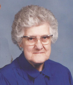
| Birth | : | 8 Mar 1908 Holland, Lancaster County, Nebraska, USA |
| Death | : | 7 Sep 1985 Lincoln, Lancaster County, Nebraska, USA |
| Burial | : | Immanuel Cemetery, Sterling, Johnson County, USA |
| Coordinate | : | 40.4692001, -96.4253006 |
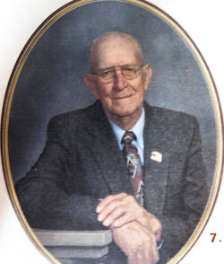
| Description | : | Ruth Evelyn Vanderbeek was born on March 8, 1908 on the family farm in rural Holland, Hickman, Lancaster County, Nebraska area. She received her elementary education at Solon Country School in Otoe County Nebraska. Ruth Evelyn Vanderbeek and Norman Christian Rathe were married in August, 1931 in Marysville, Marshal County, Kansas. They started married life on the Rathe family farm near Sterling, Johnson County, Nebraska and lived there until their retirement. They lived in Sterling, Nebraska in retirement. They were members of the Immanuel Lutheran Church located on Highway 41 between Adams and Sterling, Nebraska. Norman Christian Rathe,... Read More |
frequently asked questions (FAQ):
-
Where is Ruth Evelyn Vanderbeek Rathe's memorial?
Ruth Evelyn Vanderbeek Rathe's memorial is located at: Immanuel Cemetery, Sterling, Johnson County, USA.
-
When did Ruth Evelyn Vanderbeek Rathe death?
Ruth Evelyn Vanderbeek Rathe death on 7 Sep 1985 in Lincoln, Lancaster County, Nebraska, USA
-
Where are the coordinates of the Ruth Evelyn Vanderbeek Rathe's memorial?
Latitude: 40.4692001
Longitude: -96.4253006
Family Members:
Parent

Spouse

Siblings
Children

Flowers:


Nearby Cemetories:
1. Immanuel Cemetery
Sterling, Johnson County, USA
Coordinate: 40.4692001, -96.4253006
2. Weber Cemetery
Sterling, Johnson County, USA
Coordinate: 40.4581000, -96.4177000
3. Saint John North Lutheran Cemetery
Sterling, Johnson County, USA
Coordinate: 40.4689500, -96.3878500
4. South Saint John Lutheran Cemetery
Sterling, Johnson County, USA
Coordinate: 40.4355500, -96.3858000
5. Latrobe Cemetery
Sterling, Johnson County, USA
Coordinate: 40.5151000, -96.4557000
6. Sterling Cemetery
Sterling, Johnson County, USA
Coordinate: 40.4585991, -96.3582993
7. Granite Hill Cemetery
Johnson County, USA
Coordinate: 40.4180984, -96.4417038
8. Hooker Cemetery
Adams, Gage County, USA
Coordinate: 40.4207993, -96.4732971
9. Highland Cemetery
Adams, Gage County, USA
Coordinate: 40.4580994, -96.5196991
10. Pella Cemetery
Panama, Lancaster County, USA
Coordinate: 40.5555992, -96.5014038
11. Holy Rosary Catholic Cemetery
Saint Mary, Johnson County, USA
Coordinate: 40.4280000, -96.2905000
12. Dughman Cemetery
Douglas, Otoe County, USA
Coordinate: 40.5705986, -96.3452988
13. Saint Martins Cemetery
Douglas, Otoe County, USA
Coordinate: 40.5844002, -96.3861008
14. Rosehill Cemetery
Douglas, Otoe County, USA
Coordinate: 40.5845940, -96.3867900
15. Solon Cemetery
Otoe County, USA
Coordinate: 40.5917015, -96.4436035
16. Vesta Cemetery
Johnson County, USA
Coordinate: 40.3630981, -96.3414001
17. Hope Lutheran Cemetery
Burr, Otoe County, USA
Coordinate: 40.5525017, -96.2938995
18. Wilcox Cemetery
Burr, Otoe County, USA
Coordinate: 40.5254478, -96.2708740
19. Panama Cemetery
Panama, Lancaster County, USA
Coordinate: 40.5821991, -96.5255966
20. Grandview Cemetery
Gage County, USA
Coordinate: 40.4617004, -96.6091995
21. Crab Orchard Cemetery
Crab Orchard, Johnson County, USA
Coordinate: 40.3274994, -96.4366989
22. Helena Cemetery
Johnson County, USA
Coordinate: 40.5085983, -96.2457962
23. Firth Cemetery
Firth, Lancaster County, USA
Coordinate: 40.5250015, -96.6085968
24. Mount Zion Cemetery
Otoe County, USA
Coordinate: 40.6250000, -96.4449997