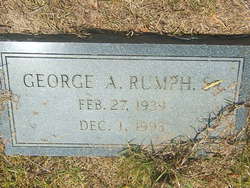
| Birth | : | 22 Jul 1915 |
| Death | : | 30 Apr 1991 |
| Burial | : | Hillcrest Cemetery, Bessemer, Gogebic County, USA |
| Coordinate | : | 46.4855995, -90.0456009 |
| Description | : | Ruth C Rumph United States Social Security Death Index Age 76 Given Name Ruth Middle Name C Surname Rumph Birth Date 22 Jul 1915 State South Carolina Last Place of Residence Enoree, Spartanburg, South Carolina Previous Residence Postal Code 29335 Event Date Apr 1991 Original obituary appears in the Spartanburg Herald Journal Obituary Section on, Wednesday, May 1, 1991, on page B4. Cross Anchor, SC - Ruth Irene Cogdill Rumph died on Tuesday, April 30, 1991 at her residence, follow declining health. Native of Spartanburg County, SC and widow of Ben T. Rumph. Daughter of the... Read More |
frequently asked questions (FAQ):
-
Where is Ruth Irene Cogdill Rumph's memorial?
Ruth Irene Cogdill Rumph's memorial is located at: Hillcrest Cemetery, Bessemer, Gogebic County, USA.
-
When did Ruth Irene Cogdill Rumph death?
Ruth Irene Cogdill Rumph death on 30 Apr 1991 in
-
Where are the coordinates of the Ruth Irene Cogdill Rumph's memorial?
Latitude: 46.4855995
Longitude: -90.0456009
Family Members:
Parent
Spouse
Siblings
Children
Flowers:
Nearby Cemetories:
1. Hillcrest Cemetery
Bessemer, Gogebic County, USA
Coordinate: 46.4855995, -90.0456009
2. Lakeside Cemetery
Wakefield, Gogebic County, USA
Coordinate: 46.4674988, -89.9456024
3. Sunset Acres Cemetery
Ironwood, Gogebic County, USA
Coordinate: 46.5189490, -90.1660820
4. Riverside Cemetery
Ironwood, Gogebic County, USA
Coordinate: 46.4599476, -90.1829530
5. Saint Mary's Cemetery
Hurley, Iron County, USA
Coordinate: 46.4443200, -90.1812600
6. Hurley Cemetery
Hurley, Iron County, USA
Coordinate: 46.4429800, -90.1813800
7. Sharey Zedek Cemetery
Hurley, Iron County, USA
Coordinate: 46.4433280, -90.1824760
8. Hillside Cemetery
Iron Belt, Iron County, USA
Coordinate: 46.4000015, -90.3377991
9. Indian Cemetery
Ironwood, Gogebic County, USA
Coordinate: 46.6058330, -90.3305560
10. Lake View Cemetery
Saxon, Iron County, USA
Coordinate: 46.5010986, -90.4227982
11. Marenisco Township Cemetery
Marenisco, Gogebic County, USA
Coordinate: 46.3847220, -89.6969440
12. Calvary Cemetery
Upson, Iron County, USA
Coordinate: 46.3774986, -90.4080963
13. Greenwood Cemetery
Upson, Iron County, USA
Coordinate: 46.3778000, -90.4094009
14. Winchester Memorial Cemetery
Winchester, Vilas County, USA
Coordinate: 46.2452300, -89.8359900
15. Presque Isle Cemetery
Presque Isle, Vilas County, USA
Coordinate: 46.2442017, -89.7624969
16. Edgewood Cemetery
Gurney, Iron County, USA
Coordinate: 46.4972000, -90.5077972
17. Shanty Boy Hill Cemetery
Presque Isle, Vilas County, USA
Coordinate: 46.2473520, -89.7279540
18. Mercer Cemetery
Mercer, Iron County, USA
Coordinate: 46.1575012, -90.0539017
19. Lakeview Cemetery
Bergland, Ontonagon County, USA
Coordinate: 46.5924644, -89.5733185
20. Bergland Cemetery
Bergland, Ontonagon County, USA
Coordinate: 46.6016998, -89.5766983
21. Saint Johns Lutheran Cemetery
Mellen, Ashland County, USA
Coordinate: 46.3923800, -90.5690100
22. Pine Lawn Cemetery
Manitowish Waters, Vilas County, USA
Coordinate: 46.1241250, -89.8659110
23. Mellen Union Cemetery
Mellen, Ashland County, USA
Coordinate: 46.3294800, -90.6621800
24. Cemetery of the Pines
Boulder Junction, Vilas County, USA
Coordinate: 46.1110600, -89.6682100


