
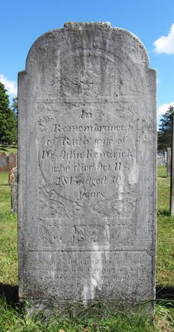


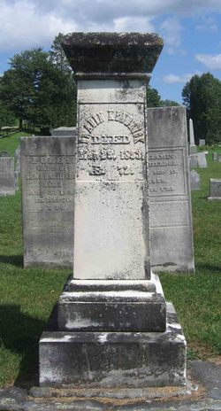
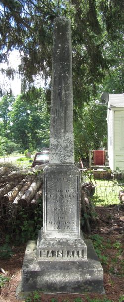
Ruth Marshall Kendrick
| Birth | : | 16 Oct 1783 Poultney, Rutland County, Vermont, USA |
| Death | : | 11 Oct 1813 Poultney, Rutland County, Vermont, USA |
| Burial | : | Sucker Creek Cemetery, Sucker Creek, Manitoulin District, Canada |
| Coordinate | : | 45.9604060, -81.9764140 |
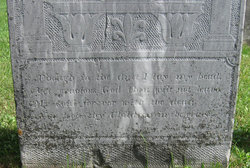
| Inscription | : | In Remembrance of Ruth wife of Dr. Adin Kendrick who died Oct. 11th 1813. Aged 30 years. ----- Though in the dust I lay my head, Yet gracious God thou wilt not leave My sould |
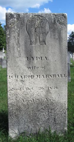
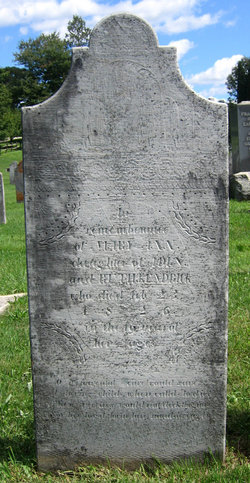
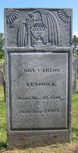
| Description | : | Daughter of Ichabod Marshall and Lydia Stearns. . First wife of Dr. Adin Kendrick, whom she married in 1806, and with whom she had 5 known children: Mary Ann Kendrick Elizabeth A. "Betsey" Kendrick Don Carlos Kendrick Samuel Kendrick Albert Kendrick . |
frequently asked questions (FAQ):
-
Where is Ruth Marshall Kendrick's memorial?
Ruth Marshall Kendrick's memorial is located at: Sucker Creek Cemetery, Sucker Creek, Manitoulin District, Canada.
-
When did Ruth Marshall Kendrick death?
Ruth Marshall Kendrick death on 11 Oct 1813 in Poultney, Rutland County, Vermont, USA
-
Where are the coordinates of the Ruth Marshall Kendrick's memorial?
Latitude: 45.9604060
Longitude: -81.9764140
Family Members:
Parent
Spouse
Siblings
Children
Flowers:


Nearby Cemetories:
1. Sucker Creek Cemetery
Sucker Creek, Manitoulin District, Canada
Coordinate: 45.9604060, -81.9764140
2. Mountain View Cemetery
Little Current, Manitoulin District, Canada
Coordinate: 45.9604400, -81.9523100
3. St. Bernard's Catholic Cemetery
Little Current, Manitoulin District, Canada
Coordinate: 45.9789170, -81.9596700
4. Holy Trinity Anglican Cemetery
Little Current, Manitoulin District, Canada
Coordinate: 45.9677590, -81.9439240
5. Elm View Cemetery
Howland, Manitoulin District, Canada
Coordinate: 45.9045270, -81.9204550
6. Sheguiandah Reserve Cemetery
Sheguiandah, Manitoulin District, Canada
Coordinate: 45.8809640, -81.9049780
7. Green Bay United Church Cemetery
Manitoulin, Manitoulin District, Canada
Coordinate: 45.8603520, -82.0223110
8. Cold Springs Cemetery
Cold Springs, Manitoulin District, Canada
Coordinate: 45.8595060, -82.1087820
9. Birch Island Cemetery
Birch Island, Manitoulin District, Canada
Coordinate: 46.0676300, -81.7714000
10. Whitefish River First Nation Cemetery
Birch Island, Manitoulin District, Canada
Coordinate: 46.0676300, -81.7714000
11. M'Chigeeng Cemetery
West Bay, Manitoulin District, Canada
Coordinate: 45.8163400, -82.1601200
12. Kagawong Cedars Cemetery
Kagawong, Manitoulin District, Canada
Coordinate: 45.9089600, -82.2568300
13. Sagamok New Cemetery
Sagamok, Algoma District, Canada
Coordinate: 46.1582040, -82.1007238
14. Big Lake Cemetery
Manitoulin, Manitoulin District, Canada
Coordinate: 45.7457500, -82.0575900
15. Spanish River First Nations Cemetery
Massey, Sudbury District, Canada
Coordinate: 46.1701900, -82.1068600
16. Whitefish Falls St. Augustine Anglican Cemetery
Whitefish Falls, Sudbury District, Canada
Coordinate: 46.1142070, -81.7313145
17. Old River Road Cemetery
Massey, Sudbury District, Canada
Coordinate: 46.1742260, -82.1342000
18. Lee Valley Cemetery
Lee Valley, Sudbury District, Canada
Coordinate: 46.2015500, -81.9442670
19. Zion Lutheran Cemetery
Massey, Sudbury District, Canada
Coordinate: 46.1968900, -82.0623000
20. Buzwah Cemetery
Buzwah, Manitoulin District, Canada
Coordinate: 45.7660100, -81.7644500
21. St. Paul's Anglican Cemetery
Manitowaning, Manitoulin District, Canada
Coordinate: 45.7447912, -81.8061589
22. Mindemoya Cemetery
Mindemoya, Manitoulin District, Canada
Coordinate: 45.7473100, -82.1928000
23. Sagamok Old Cemetery
Massey, Sudbury District, Canada
Coordinate: 46.2115590, -82.0793450
24. St. Christopher's Anglican Cemetery
McGregor Bay, Manitoulin District, Canada
Coordinate: 46.0842340, -81.6429140