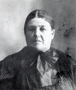
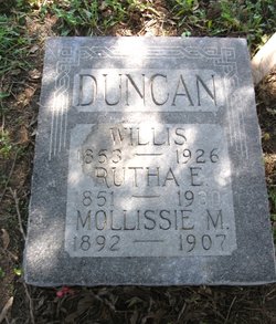
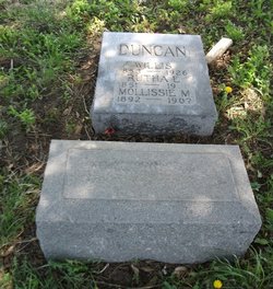
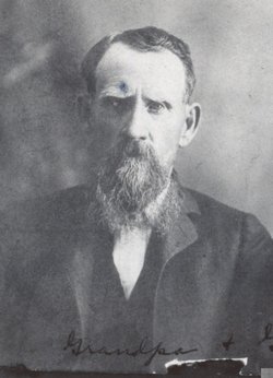
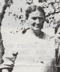
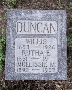
Rutha Elizabeth Smith Duncan
| Birth | : | 17 Jan 1851 Ray County, Missouri, USA |
| Death | : | 19 May 1930 Excelsior Springs, Clay County, Missouri, USA |
| Burial | : | Christian Church Cemetery, Danbury, Fairfield County, USA |
| Coordinate | : | 41.4311218, -73.5077133 |
frequently asked questions (FAQ):
-
Where is Rutha Elizabeth Smith Duncan's memorial?
Rutha Elizabeth Smith Duncan's memorial is located at: Christian Church Cemetery, Danbury, Fairfield County, USA.
-
When did Rutha Elizabeth Smith Duncan death?
Rutha Elizabeth Smith Duncan death on 19 May 1930 in Excelsior Springs, Clay County, Missouri, USA
-
Where are the coordinates of the Rutha Elizabeth Smith Duncan's memorial?
Latitude: 41.4311218
Longitude: -73.5077133
Family Members:
Parent
Spouse
Siblings
Children
Flowers:
Nearby Cemetories:
1. Christian Church Cemetery
Danbury, Fairfield County, USA
Coordinate: 41.4311218, -73.5077133
2. Cemetery of the First Baptist Church
Danbury, Fairfield County, USA
Coordinate: 41.4379005, -73.4989624
3. Pembroke Cemetery
Danbury, Fairfield County, USA
Coordinate: 41.4333000, -73.4772034
4. Westville Cemetery
Danbury, Fairfield County, USA
Coordinate: 41.4082910, -73.4996830
5. Union Cemetery
New Fairfield, Fairfield County, USA
Coordinate: 41.4524970, -73.5235870
6. Comes Cemetery
Danbury, Fairfield County, USA
Coordinate: 41.4068604, -73.4876099
7. Congregational Church of New Fairfield Mem Garden
Fairfield County, USA
Coordinate: 41.4627780, -73.4963410
8. Congregational Church Memorial Garden
New Fairfield, Fairfield County, USA
Coordinate: 41.4628000, -73.4963000
9. New Fairfield Cemetery
New Fairfield, Fairfield County, USA
Coordinate: 41.4651604, -73.4870224
10. Mill Plain Cemetery
Danbury, Fairfield County, USA
Coordinate: 41.3933600, -73.5197000
11. Barnum Family Cemetery
Brewster, Putnam County, USA
Coordinate: 41.4469109, -73.5576630
12. Old North Main Street Cemetery
Danbury, Fairfield County, USA
Coordinate: 41.4044000, -73.4600000
13. New Saint Peter Cemetery
Danbury, Fairfield County, USA
Coordinate: 41.3859700, -73.4962280
14. Kenosia Cemetery
Danbury, Fairfield County, USA
Coordinate: 41.3857994, -73.4974136
15. Immanuel Lutheran Cemetery
Danbury, Fairfield County, USA
Coordinate: 41.4110489, -73.4499207
16. Milltown Cemetery
Brewster, Putnam County, USA
Coordinate: 41.4108400, -73.5659300
17. Mountain View Cemetery
New Fairfield, Fairfield County, USA
Coordinate: 41.4803009, -73.4961014
18. Sherwood-Minor Cemetery
Brewster, Putnam County, USA
Coordinate: 41.4247300, -73.5750300
19. Wooster Cemetery
Danbury, Fairfield County, USA
Coordinate: 41.4035988, -73.4503021
20. Old Southeast Church Cemetery
Brewster Hill, Putnam County, USA
Coordinate: 41.4273900, -73.5781500
21. Haines Cemetery
Brewster, Putnam County, USA
Coordinate: 41.3880880, -73.5512260
22. Beaver Bog Cemetery
New Fairfield, Fairfield County, USA
Coordinate: 41.4859848, -73.5051727
23. Saint Platons Russian Orthodox Cemetery
Danbury, Fairfield County, USA
Coordinate: 41.4129500, -73.4382900
24. Saint James Episcopal Church Memorial Garden
Danbury, Fairfield County, USA
Coordinate: 41.3932750, -73.4528310

