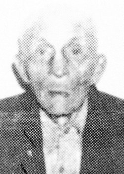
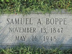
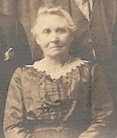
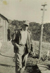
Samuel Andrew Boppe
| Birth | : | 13 Nov 1847 Halfway, Washington County, Maryland, USA |
| Death | : | 16 May 1948 Security, Washington County, Maryland, USA |
| Burial | : | Town of Black Creek Cemetery, Binghamton, Outagamie County, USA |
| Coordinate | : | 44.4441986, -88.4700012 |
| Description | : | Samuel H. Boppe, believed to be the oldest person in Washington county, died at the home of his daughter, Mrs. John Lewis, Security, yesterday morning at 9:30. Mr. Boppe, who was still able to get around but had faulty vision and hearing, was six months and three days past the one hundred year mark. He made his home at the place of his death. The subject of several newspaper features in the past year, the deceased man worked for a time on the old C & O canal and could recall vividly the soldiers passing through this section... Read More |
frequently asked questions (FAQ):
-
Where is Samuel Andrew Boppe's memorial?
Samuel Andrew Boppe's memorial is located at: Town of Black Creek Cemetery, Binghamton, Outagamie County, USA.
-
When did Samuel Andrew Boppe death?
Samuel Andrew Boppe death on 16 May 1948 in Security, Washington County, Maryland, USA
-
Where are the coordinates of the Samuel Andrew Boppe's memorial?
Latitude: 44.4441986
Longitude: -88.4700012
Family Members:
Parent
Spouse
Siblings
Children
Flowers:
Nearby Cemetories:
1. Town of Black Creek Cemetery
Binghamton, Outagamie County, USA
Coordinate: 44.4441986, -88.4700012
2. Immanuel Lutheran Cemetery
Binghamton, Outagamie County, USA
Coordinate: 44.4446983, -88.4700012
3. Black Creek Evangelical Cemetery
Black Creek, Outagamie County, USA
Coordinate: 44.4594002, -88.4505997
4. Saint Petri Cemetery
Black Creek, Outagamie County, USA
Coordinate: 44.4375000, -88.4313965
5. Saint Marys Cemetery
Black Creek, Outagamie County, USA
Coordinate: 44.4668920, -88.4460300
6. Twelve Corners Cemetery
Twelve Corners, Outagamie County, USA
Coordinate: 44.4016170, -88.4352740
7. Immanuel Lutheran Church Cemetery
Black Creek, Outagamie County, USA
Coordinate: 44.5024986, -88.4522018
8. Emmanuel United Methodist Cemetery
Black Creek, Outagamie County, USA
Coordinate: 44.3792980, -88.4742740
9. Rexford Cemetery
Shiocton, Outagamie County, USA
Coordinate: 44.4160995, -88.5603027
10. Shiocton-Bovina Saint Denis Cemetery
Shiocton, Outagamie County, USA
Coordinate: 44.4235992, -88.5671997
11. Freedom Cemetery
Freedom, Outagamie County, USA
Coordinate: 44.4110985, -88.3722000
12. Cicero United Methodist Cemetery
Cicero, Outagamie County, USA
Coordinate: 44.5229470, -88.4241490
13. Saint John Evangelical Lutheran Church Cemetery
Center, Outagamie County, USA
Coordinate: 44.3658752, -88.4155426
14. South Cicero Cemetery
Black Creek, Outagamie County, USA
Coordinate: 44.5231018, -88.4052963
15. Trinity Lutheran Cemetery
Stephensville, Outagamie County, USA
Coordinate: 44.3516273, -88.5110550
16. East Ellington Cemetery
Ellington, Outagamie County, USA
Coordinate: 44.3524200, -88.5172400
17. South Maine Cemetery
Shiocton, Outagamie County, USA
Coordinate: 44.5330400, -88.5517700
18. Saint Edward Cemetery
Mackville, Outagamie County, USA
Coordinate: 44.3443760, -88.4143210
19. Ellington Union Cemetery
Stephensville, Outagamie County, USA
Coordinate: 44.3661003, -88.5736008
20. Saint Patricks Cemetery
Stephensville, Outagamie County, USA
Coordinate: 44.3661003, -88.5744019
21. Freedom Moravian Cemetery
Freedom, Outagamie County, USA
Coordinate: 44.3959236, -88.3342056
22. Zion Lutheran Church Cemetery
Seymour, Outagamie County, USA
Coordinate: 44.5115013, -88.3480148
23. Saint John Catholic Cemetery
Seymour, Outagamie County, USA
Coordinate: 44.4991989, -88.3292007
24. Miller Family Cemetery
Seymour, Outagamie County, USA
Coordinate: 44.5081400, -88.3329800

