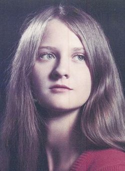
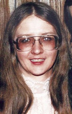
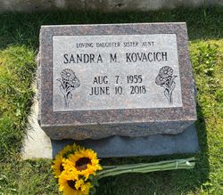
Sandra M “Sandy” Kovacich Kovacich (Rubendal)
| Birth | : | 7 Aug 1955 Anaconda, Deer Lodge County, Montana, USA |
| Death | : | 10 Jun 2018 Deer Lodge, Powell County, Montana, USA |
| Burial | : | Mount Olivet Cemetery, Anaconda, Deer Lodge County, USA |
| Coordinate | : | 46.1300011, -112.9739990 |
| Plot | : | Sec N, Row 1, 23 down |
| Inscription | : | Loving daughter sister aunt |
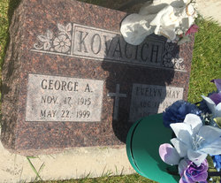
| Description | : | Aug. 7, 1955-June 10, 2018 Sandra passed away at the Deer Lodge Care and Rehabilitation Center on June 10, 2018. She was born in Anaconda to George Tug Kovacich and Evelyn Brown Kovacich on Aug. 7, 1955. She attended St. Peters Grade School and graduated from Anaconda High School in 1973. After graduation, she went to work as a laborer on the Smelter. Some of her favorite pastimes were walking, photography, music, archery, prospecting and spending time with friends, family and her pets. Sandra graduated from Montana Tech in 1980 with a Bachelor of Science in Society and Technology with High Honors. Next, she... Read More |
frequently asked questions (FAQ):
-
Where is Sandra M “Sandy” Kovacich Kovacich (Rubendal)'s memorial?
Sandra M “Sandy” Kovacich Kovacich (Rubendal)'s memorial is located at: Mount Olivet Cemetery, Anaconda, Deer Lodge County, USA.
-
When did Sandra M “Sandy” Kovacich Kovacich (Rubendal) death?
Sandra M “Sandy” Kovacich Kovacich (Rubendal) death on 10 Jun 2018 in Deer Lodge, Powell County, Montana, USA
-
Where are the coordinates of the Sandra M “Sandy” Kovacich Kovacich (Rubendal)'s memorial?
Latitude: 46.1300011
Longitude: -112.9739990
Family Members:
Parent
Siblings
Flowers:
Nearby Cemetories:
1. Mount Olivet Cemetery
Anaconda, Deer Lodge County, USA
Coordinate: 46.1300011, -112.9739990
2. Mount Carmel Cemetery
Anaconda, Deer Lodge County, USA
Coordinate: 46.1237068, -112.9619827
3. Upper Hill Cemetery
Anaconda, Deer Lodge County, USA
Coordinate: 46.1224440, -112.9588340
4. Lower Hill Cemetery
Anaconda, Deer Lodge County, USA
Coordinate: 46.1213440, -112.9572510
5. New Hill Cemetery
Anaconda, Deer Lodge County, USA
Coordinate: 46.1380770, -112.9917530
6. Staffanson Family Cemetery
Anaconda, Deer Lodge County, USA
Coordinate: 46.1780556, -112.9610000
7. Anaconda Catholic Cemetery
Anaconda, Deer Lodge County, USA
Coordinate: 46.1165858, -112.8653042
8. Norton Cemetery
Anaconda, Deer Lodge County, USA
Coordinate: 46.0619000, -112.8333000
9. Warm Springs State Hospital Cemetery
Warm Springs, Deer Lodge County, USA
Coordinate: 46.1916580, -112.8032913
10. Sunset Memorial Park
Gregson, Silver Bow County, USA
Coordinate: 46.0596000, -112.7754500
11. Montana State Prison Cemetery
Deer Lodge, Powell County, USA
Coordinate: 46.3959999, -112.7590027
12. Hillcrest Cemetery
Deer Lodge, Powell County, USA
Coordinate: 46.3958015, -112.7556000
13. Philipsburg Cemetery
Philipsburg, Granite County, USA
Coordinate: 46.3408990, -113.2961010
14. Mount Moriah Cemetery
Butte, Silver Bow County, USA
Coordinate: 45.9885500, -112.5423400
15. BNai Israel Cemetery
Butte, Silver Bow County, USA
Coordinate: 45.9865700, -112.5409000
16. Saint Patrick's Cemetery
Butte, Silver Bow County, USA
Coordinate: 45.9844017, -112.5406036
17. Saint Johns Columbarium
Butte, Silver Bow County, USA
Coordinate: 45.9923000, -112.5178000
18. Mountain View Cemetery
Butte, Silver Bow County, USA
Coordinate: 45.9622720, -112.5077200
19. Dewey Cemetery
Beaverhead County, USA
Coordinate: 45.7700005, -112.8613968
20. Potters Field
Butte, Silver Bow County, USA
Coordinate: 45.9894470, -112.4773280
21. Holy Cross Cemetery
Butte, Silver Bow County, USA
Coordinate: 45.9510994, -112.5036011
22. Christiansen Ranch Cemetery
Jackson, Beaverhead County, USA
Coordinate: 45.7742700, -113.3571300
23. Highland Cemetery
Nine-mile, Silver Bow County, USA
Coordinate: 45.7992300, -112.4865100
24. Valley Cemetery
Drummond, Granite County, USA
Coordinate: 46.6286011, -113.1361008

